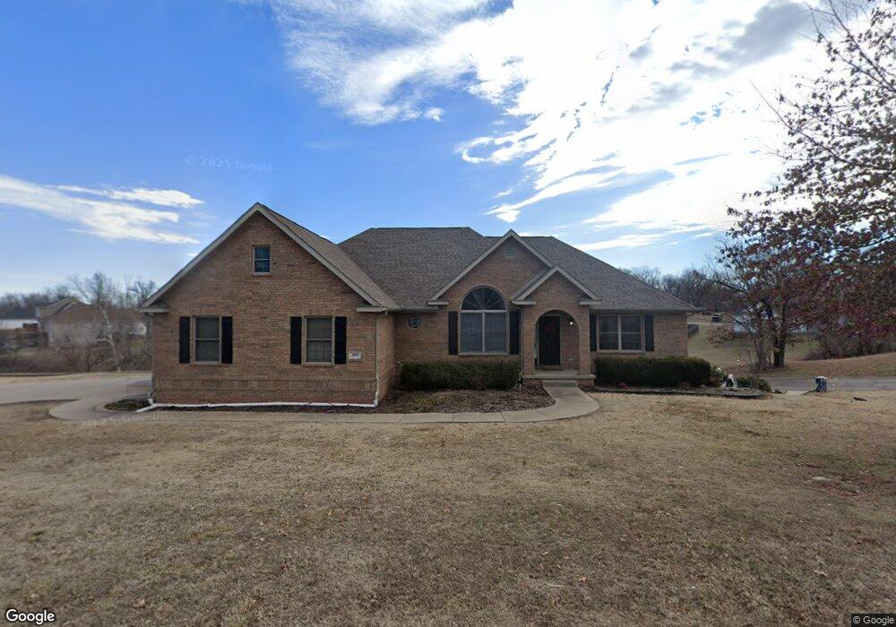
305 Tee Ln Carl Junction, MO 64834
Briarbrook NeighborhoodEstimated Value: $583,876 - $619,000
4
Beds
4
Baths
4,152
Sq Ft
$143/Sq Ft
Est. Value
About This Home
This home is located at 305 Tee Ln, Carl Junction, MO 64834 and is currently estimated at $595,719, approximately $143 per square foot. 305 Tee Ln is a home located in Jasper County with nearby schools including Carl Junction Primary School (K-1), Carl Junction Intermediate School, and Carl Junction Primary School (2-3).
Ownership History
Date
Name
Owned For
Owner Type
Purchase Details
Closed on
Nov 30, 2023
Sold by
Fc & Rj Noah Living Trust
Bought by
Robbins Jeremy R and Robbins Joshua S
Current Estimated Value
Home Financials for this Owner
Home Financials are based on the most recent Mortgage that was taken out on this home.
Original Mortgage
$370,500
Outstanding Balance
$363,888
Interest Rate
7.63%
Mortgage Type
New Conventional
Estimated Equity
$231,831
Purchase Details
Closed on
Jul 7, 2020
Sold by
Noah Forrest C and Noah Rita J
Bought by
F C & R J North Lt
Purchase Details
Closed on
May 20, 2011
Sold by
Grady John E and Grady Cynthia R
Bought by
Noah Forrest C and Noah Rita J
Home Financials for this Owner
Home Financials are based on the most recent Mortgage that was taken out on this home.
Original Mortgage
$200,000
Interest Rate
4.95%
Mortgage Type
New Conventional
Create a Home Valuation Report for This Property
The Home Valuation Report is an in-depth analysis detailing your home's value as well as a comparison with similar homes in the area
Home Values in the Area
Average Home Value in this Area
Purchase History
| Date | Buyer | Sale Price | Title Company |
|---|---|---|---|
| Robbins Jeremy R | -- | None Listed On Document | |
| F C & R J North Lt | -- | None Available | |
| Noah Forrest C | -- | Abbey |
Source: Public Records
Mortgage History
| Date | Status | Borrower | Loan Amount |
|---|---|---|---|
| Open | Robbins Jeremy R | $370,500 | |
| Previous Owner | Noah Forrest C | $200,000 |
Source: Public Records
Tax History
| Year | Tax Paid | Tax Assessment Tax Assessment Total Assessment is a certain percentage of the fair market value that is determined by local assessors to be the total taxable value of land and additions on the property. | Land | Improvement |
|---|---|---|---|---|
| 2025 | $3,575 | $64,660 | $7,070 | $57,590 |
| 2024 | $3,586 | $55,760 | $7,070 | $48,690 |
| 2023 | $3,586 | $55,760 | $7,070 | $48,690 |
| 2022 | $3,788 | $58,900 | $7,070 | $51,830 |
| 2021 | $3,285 | $58,900 | $7,070 | $51,830 |
| 2020 | $3,083 | $54,490 | $7,070 | $47,420 |
| 2019 | $2,934 | $54,490 | $7,070 | $47,420 |
| 2018 | $3,070 | $57,330 | $0 | $0 |
| 2017 | $3,077 | $57,330 | $0 | $0 |
| 2016 | $3,055 | $57,410 | $0 | $0 |
| 2015 | -- | $57,410 | $0 | $0 |
| 2014 | -- | $57,410 | $0 | $0 |
Source: Public Records
Map
Nearby Homes
- 328 Briarbrook Dr
- 201 Tee Ln
- 107 Foursome Ln
- 126 Briarbrook Dr
- 306 Lakeview Ln
- 128 Par Ln
- 111 Briarbrook Dr
- 126 N Windwood
- 9130 Missouri 171
- 804 Summerlyn Ln
- 710 Briarbrook Dr
- 1308 York St
- 908 Silver Oaks Dr
- 120 Concord St
- 104 Cambridge Dr
- 708 Danica Jo Ln
- 403 Ashmore Dr
- 307 Ashmore St
- 807 Copper Oaks Dr
- 909 Silver Oaks Dr
Your Personal Tour Guide
Ask me questions while you tour the home.