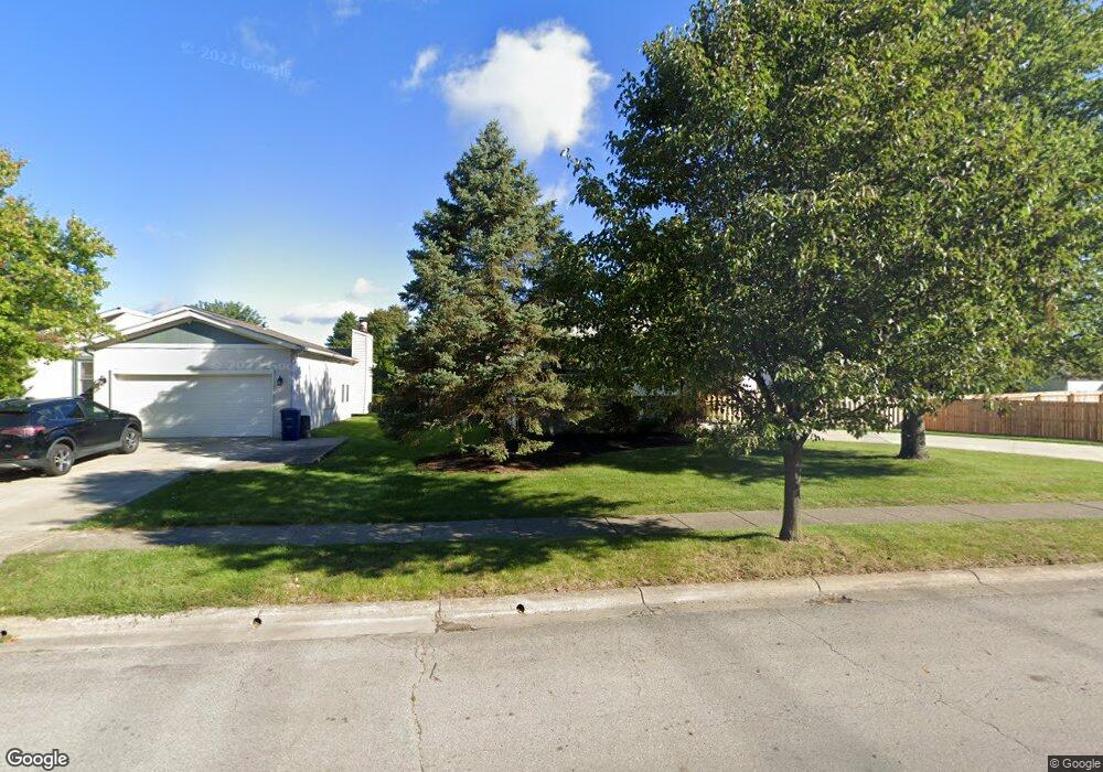
3054 Essington Dr Dublin, OH 43017
Riverside NeighborhoodEstimated Value: $375,000 - $393,000
3
Beds
3
Baths
1,646
Sq Ft
$232/Sq Ft
Est. Value
About This Home
This home is located at 3054 Essington Dr, Dublin, OH 43017 and is currently estimated at $382,543, approximately $232 per square foot. 3054 Essington Dr is a home located in Franklin County with nearby schools including Riverside Elementary School, Ann Simpson Davis Middle School, and Dublin Scioto High School.
Ownership History
Date
Name
Owned For
Owner Type
Purchase Details
Closed on
Feb 28, 2018
Sold by
Bussa Michael D and Bussa Teresa
Bought by
The Bussa Family Revocable Trust
Current Estimated Value
Purchase Details
Closed on
Nov 2, 2012
Sold by
Bussa Michael D and Bussa Teresa
Bought by
Bussa Michael D and Bussa Teresa
Home Financials for this Owner
Home Financials are based on the most recent Mortgage that was taken out on this home.
Original Mortgage
$88,500
Interest Rate
3.28%
Mortgage Type
New Conventional
Purchase Details
Closed on
Jun 3, 1996
Sold by
Rebecca Parrett and Rebecca Ayers
Bought by
Carroll Michael D Bussa and Carroll Teresa
Home Financials for this Owner
Home Financials are based on the most recent Mortgage that was taken out on this home.
Original Mortgage
$108,750
Interest Rate
7.99%
Mortgage Type
New Conventional
Purchase Details
Closed on
Sep 21, 1993
Create a Home Valuation Report for This Property
The Home Valuation Report is an in-depth analysis detailing your home's value as well as a comparison with similar homes in the area
Home Values in the Area
Average Home Value in this Area
Purchase History
| Date | Buyer | Sale Price | Title Company |
|---|---|---|---|
| The Bussa Family Revocable Trust | -- | None Available | |
| Bussa Michael D | -- | None Available | |
| Carroll Michael D Bussa | $114,500 | -- | |
| -- | $97,500 | -- |
Source: Public Records
Mortgage History
| Date | Status | Borrower | Loan Amount |
|---|---|---|---|
| Closed | Bussa Michael D | $88,500 | |
| Closed | Carroll Michael D Bussa | $108,750 |
Source: Public Records
Tax History Compared to Growth
Tax History
| Year | Tax Paid | Tax Assessment Tax Assessment Total Assessment is a certain percentage of the fair market value that is determined by local assessors to be the total taxable value of land and additions on the property. | Land | Improvement |
|---|---|---|---|---|
| 2024 | $6,687 | $110,570 | $39,030 | $71,540 |
| 2023 | $6,593 | $110,565 | $39,025 | $71,540 |
| 2022 | $5,581 | $86,980 | $37,490 | $49,490 |
| 2021 | $5,672 | $86,980 | $37,490 | $49,490 |
| 2020 | $5,637 | $86,980 | $37,490 | $49,490 |
| 2019 | $4,899 | $66,920 | $28,840 | $38,080 |
| 2018 | $4,607 | $66,920 | $28,840 | $38,080 |
| 2017 | $4,523 | $66,920 | $28,840 | $38,080 |
| 2016 | $4,269 | $59,330 | $17,610 | $41,720 |
| 2015 | $4,296 | $59,330 | $17,610 | $41,720 |
| 2014 | $4,300 | $59,330 | $17,610 | $41,720 |
| 2013 | $2,079 | $56,490 | $16,765 | $39,725 |
Source: Public Records
Map
Nearby Homes
- 3087 Strathaven Ct
- 6354 Emberwood Rd
- 3185 Middleboro Way
- 2947 Talbrock Cir
- 6342 Bannister Dr
- 3107 Hamden Ct
- 2951 Cranston Dr Unit 2953
- 2970 Black Kettle Trail
- 6040 Thatcher Dr
- 3263 Scioto Ridge Rd
- 2960 Sawdust Ln Unit 2960
- 2946 Sawdust Ln
- 6241 Buck Ridge Rd
- 5850 Meadowhurst Way
- 5622 Riverside Dr
- 2800 Amana Ct
- 5753 Newgate Rd Unit 5753
- 5735 Newbank Cir Unit 303
- 6802 Chesley Rd
- 5672 Barry Trace Unit 5672
- 3062 Essington Dr
- 6257 Emberwood Rd
- 6251 Emberwood Rd
- 6263 Emberwood Rd
- 3070 Essington Dr
- 6269 Emberwood Rd
- 3071 Aleshire Dr
- 3078 Essington Dr
- 6275 Emberwood Rd
- 6230 Maryhurst Dr
- 3037 Essington Dr
- 3079 Aleshire Dr
- 6281 Emberwood Rd
- 6288 Shaftsbury Ln
- 3086 Essington Dr
- 6223 Emberwood Rd
- 6222 Maryhurst Dr
- 6262 Emberwood Rd
- 6256 Emberwood Rd
- 6296 Shaftsbury Ln