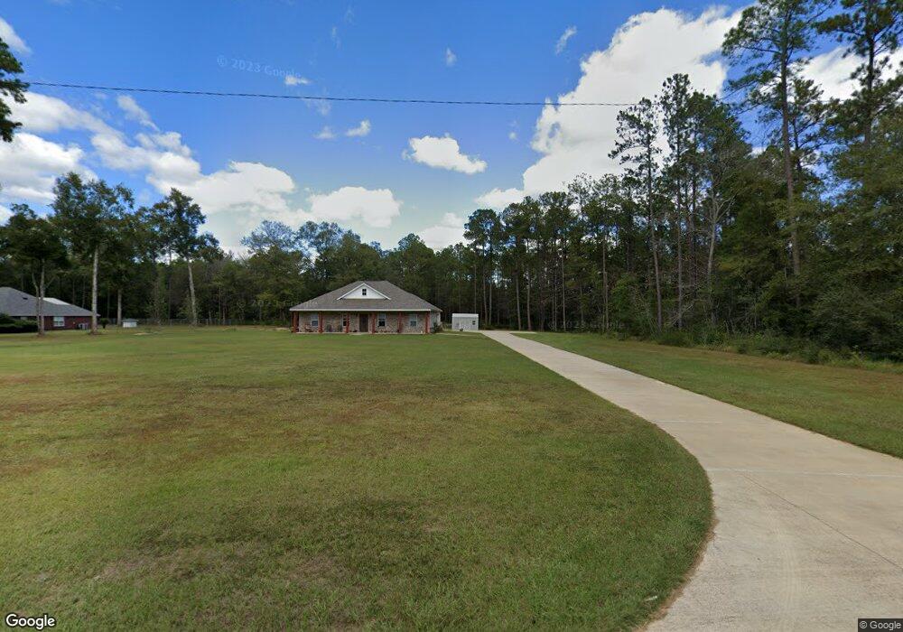
3055 Kennie Pierce Rd Moss Point, MS 39562
Estimated Value: $207,000 - $258,000
--
Bed
--
Bath
1,683
Sq Ft
$138/Sq Ft
Est. Value
About This Home
This home is located at 3055 Kennie Pierce Rd, Moss Point, MS 39562 and is currently estimated at $232,934, approximately $138 per square foot. 3055 Kennie Pierce Rd is a home with nearby schools including East Central Lower Elementary School, East Central Upper Elementary School, and East Central Middle School.
Ownership History
Date
Name
Owned For
Owner Type
Purchase Details
Closed on
Oct 2, 2019
Sold by
Simmons Stephen and Teer Zandra
Bought by
Simmons Stephen and Teer Zandra
Current Estimated Value
Create a Home Valuation Report for This Property
The Home Valuation Report is an in-depth analysis detailing your home's value as well as a comparison with similar homes in the area
Home Values in the Area
Average Home Value in this Area
Purchase History
| Date | Buyer | Sale Price | Title Company |
|---|---|---|---|
| Simmons Stephen | -- | -- |
Source: Public Records
Tax History Compared to Growth
Tax History
| Year | Tax Paid | Tax Assessment Tax Assessment Total Assessment is a certain percentage of the fair market value that is determined by local assessors to be the total taxable value of land and additions on the property. | Land | Improvement |
|---|---|---|---|---|
| 2024 | $869 | $15,221 | $1,519 | $13,702 |
| 2023 | $869 | $15,221 | $1,519 | $13,702 |
| 2022 | $844 | $14,736 | $0 | $0 |
| 2021 | $844 | $14,736 | $14,736 | $0 |
| 2020 | $874 | $14,736 | $1,407 | $13,329 |
| 2019 | $365 | $3,053 | $3,053 | $0 |
| 2018 | $372 | $3,053 | $3,053 | $0 |
| 2017 | $378 | $3,053 | $3,053 | $0 |
| 2016 | $363 | $3,053 | $3,053 | $0 |
| 2015 | $365 | $20,350 | $20,350 | $0 |
| 2014 | $359 | $3,053 | $3,053 | $0 |
| 2013 | $347 | $3,053 | $3,053 | $0 |
Source: Public Records
Map
Nearby Homes
- 17116 Pierce St
- 0 Big Point Unit 4125782
- 19029 Roger Davis Rd
- 3513 Jerry Davis Rd
- 3016 Ed Parker Rd
- 2530 Hardy Parker Rd
- 0 Grafe Homestead Rd Unit 4113097
- 13875 Wolf Ridge Rd Unit LotWP001
- 13875 Wolf Ridge Rd
- 27 Acres Brinkman Rd E
- 21629 Mississippi 63
- 0 R B Dickerson Rd
- 7605 Methodist Church Rd
- 0 Dr Unit 4052148
- 0 Ms-613 Hwy Unit 4116583
- 0 Ms-613 Hwy Unit 4107607
- 0 Ms-613 Hwy Unit 4107612
- 0 Ms-613 Hwy Unit 4116582
- Lot 111 River Place
- 0 Sampras Blvd Unit 4130535
- 3017 Kennie Pierce Rd
- 3101 Kennie Pierce Rd
- 3024 Kennie Pierce Rd
- 3013 Kennie Pierce Rd
- 17128 Pierce St
- 3009 Kennie Pierce Rd
- 3020 Kennie Pierce Rd
- 17113 Highway 63
- 3005 Kennie Pierce Rd
- 3301 Shattles Rd
- 17308 Satsuma
- 17424 Highway 63
- 17312 Highway 63
- 17300 Satsuma
- 17314 Satsuma
- 17121 Pierce St
- 17108 Pierce St
- 17320 Highway 63
- 17121 Red Top Ln
- 17112 Pierce St