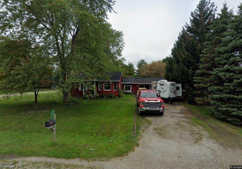
3055 Range Rd Port Huron, MI 48060
Estimated Value: $162,488 - $252,000
Studio
1
Bath
1,028
Sq Ft
$202/Sq Ft
Est. Value
About This Home
This home is located at 3055 Range Rd, Port Huron, MI 48060 and is currently estimated at $207,872, approximately $202 per square foot. 3055 Range Rd is a home located in St. Clair County with nearby schools including Michigamme Elementary School, Central Middle School, and Port Huron High School.
Create a Home Valuation Report for This Property
The Home Valuation Report is an in-depth analysis detailing your home's value as well as a comparison with similar homes in the area
Home Values in the Area
Average Home Value in this Area
Tax History
| Year | Tax Paid | Tax Assessment Tax Assessment Total Assessment is a certain percentage of the fair market value that is determined by local assessors to be the total taxable value of land and additions on the property. | Land | Improvement |
|---|---|---|---|---|
| 2025 | $844 | $77,900 | $0 | $0 |
| 2024 | $819 | $72,500 | $0 | $0 |
| 2023 | $756 | $62,900 | $0 | $0 |
| 2022 | $1,397 | $54,600 | $0 | $0 |
| 2020 | $1,355 | $47,300 | $0 | $47,300 |
| 2019 | $1,334 | $44,800 | $0 | $0 |
| 2018 | $1,307 | $44,800 | $0 | $0 |
| 2017 | $1,282 | $43,300 | $0 | $0 |
| 2016 | $621 | $43,300 | $0 | $0 |
| 2015 | -- | $38,300 | $0 | $38,300 |
| 2014 | -- | $35,800 | $35,800 | $0 |
| 2013 | -- | $34,400 | $0 | $0 |
Source: Public Records
Map
Nearby Homes
- 4459 Cambridge Dr
- 3115 Spruce Dr
- 4224 Atkins Rd
- 000 Atkins Rd Atkins Rd
- 0000 Atkins Atkins Rd
- 4901 Lorwood Dr
- 3349 Charmwood Dr
- 4911 Castlewood Dr
- 2668 Range Rd
- 3345 Beach Rd
- 4570 Atkins Rd
- 4380 Lapeer Rd
- 0 Lapeer Rd Unit 50137357
- 3075 Westcott Dr
- 3971 N River Rd
- 0000 W Water St
- 4167 N River Rd
- 4612 Smith Rd
- 3559 Lightle Rd
- Lot #9 Thornton Dr
Your Personal Tour Guide
Ask me questions while you tour the home.