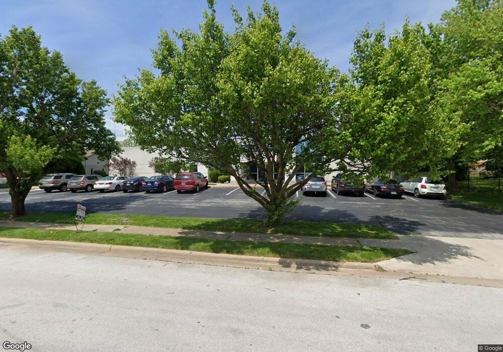
3057 E Cairo St Springfield, MO 65802
Bingham NeighborhoodEstimated Value: $1,658,216
Studio
--
Bath
1,495
Sq Ft
$1,109/Sq Ft
Est. Value
About This Home
This home is located at 3057 E Cairo St, Springfield, MO 65802 and is currently estimated at $1,658,216, approximately $1,109 per square foot. 3057 E Cairo St is a home located in Greene County with nearby schools including Bingham Elementary School, Hickory Hills K-8 School, and Glendale High School.
Ownership History
Date
Name
Owned For
Owner Type
Purchase Details
Closed on
Sep 6, 2013
Sold by
Us Bank Na
Bought by
Buddy Webb & Company Real Estate Inc
Current Estimated Value
Home Financials for this Owner
Home Financials are based on the most recent Mortgage that was taken out on this home.
Original Mortgage
$580,000
Outstanding Balance
$432,129
Interest Rate
4.36%
Mortgage Type
Future Advance Clause Open End Mortgage
Estimated Equity
$1,226,087
Create a Home Valuation Report for This Property
The Home Valuation Report is an in-depth analysis detailing your home's value as well as a comparison with similar homes in the area
Home Values in the Area
Average Home Value in this Area
Purchase History
| Date | Buyer | Sale Price | Title Company |
|---|---|---|---|
| Buddy Webb & Company Real Estate Inc | -- | None Available |
Source: Public Records
Mortgage History
| Date | Status | Borrower | Loan Amount |
|---|---|---|---|
| Open | Buddy Webb & Company Real Estate Inc | $580,000 |
Source: Public Records
Tax History
| Year | Tax Paid | Tax Assessment Tax Assessment Total Assessment is a certain percentage of the fair market value that is determined by local assessors to be the total taxable value of land and additions on the property. | Land | Improvement |
|---|---|---|---|---|
| 2025 | $18,945 | $314,590 | $52,480 | $262,110 |
| 2024 | $15,431 | $240,920 | $26,300 | $214,620 |
| 2023 | $15,358 | $240,920 | $26,300 | $214,620 |
| 2022 | $15,663 | $240,920 | $26,300 | $214,620 |
| 2021 | $15,662 | $240,920 | $26,300 | $214,620 |
| 2020 | $16,260 | $240,860 | $26,300 | $214,560 |
| 2019 | $15,872 | $240,860 | $26,300 | $214,560 |
| 2018 | $15,726 | $238,720 | $26,300 | $212,420 |
| 2017 | $15,591 | $235,390 | $26,300 | $209,090 |
| 2016 | $15,349 | $235,390 | $26,300 | $209,090 |
| 2015 | $15,231 | $235,390 | $26,300 | $209,090 |
| 2014 | $17,448 | $268,030 | $32,860 | $235,170 |
Source: Public Records
Map
Nearby Homes
- 217 N Ken Ave
- 514 S Prince Ln
- 620 S Belcrest Ave
- 2838 E Cherry St
- 2700 E Horning St
- 502 N Oak Grove Ave
- 2626 E Elm St
- 2918 E Monroe Terrace
- 746 N Oak Grove Ave
- 2810 E Madison St
- 2845 E Lombard St
- 2926 E Lombard St
- 3705 E Cypress St
- 2965 E Belmont St
- 3717 E Woodhue St
- 3722 E Woodhue St
- Lot 59 E Woodhue St
- Lot 38 E Woodhue St
- Lot 17 E Woodhue St
- Lot 60 E Woodhue St
- 210 S Union Ave
- 3015 E Cairo St
- 3015 E Cairo St
- 3120 E Cairo St
- 3148 E Chestnut Expy
- 3045 E Chestnut Expy
- 209 N Belcrest Ave
- 2920 E Chestnut Expy
- 3003 E Chestnut Expy
- 216 N Prince Ln
- 210 N Prince Ln
- 224 N Prince Ln
- 202 N Prince Ln
- 302 N Prince Ln
- 208 S Prince Ln
- 310 N Prince Ln
- 210 S Prince Ln
- 3065 E Elm St
- 214 S Prince Ln
- 220 S Prince Ln
Your Personal Tour Guide
Ask me questions while you tour the home.
