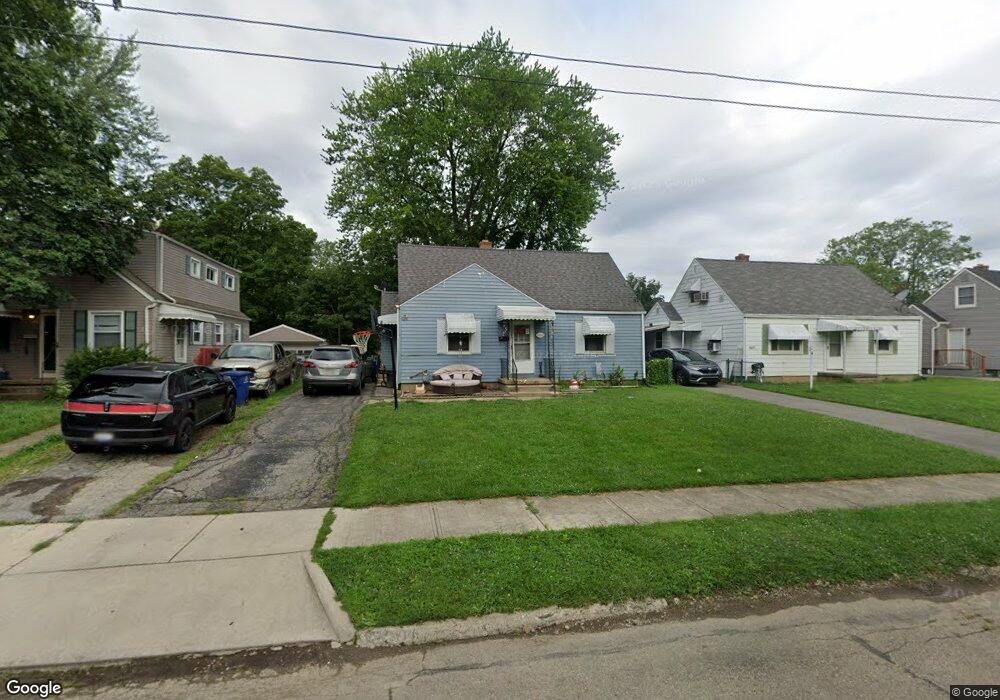
3057 Karl Rd Columbus, OH 43224
North Linden NeighborhoodEstimated Value: $168,973 - $210,000
3
Beds
1
Bath
1,106
Sq Ft
$175/Sq Ft
Est. Value
About This Home
This home is located at 3057 Karl Rd, Columbus, OH 43224 and is currently estimated at $193,993, approximately $175 per square foot. 3057 Karl Rd is a home located in Franklin County with nearby schools including Huy Elementary School, Medina Middle School, and Mifflin High School.
Ownership History
Date
Name
Owned For
Owner Type
Purchase Details
Closed on
Jan 12, 2024
Sold by
Hibbard Ronald A and Hibbard Karen S
Bought by
Hibbard Family Trust and Hibbard
Current Estimated Value
Purchase Details
Closed on
Mar 8, 2013
Sold by
Hollis Edward J and Hollis Kimberly A
Bought by
Hibbard Ronald A and Hibbard Karen S
Purchase Details
Closed on
Feb 1, 1990
Bought by
Hollis Edward J
Purchase Details
Closed on
May 1, 1985
Create a Home Valuation Report for This Property
The Home Valuation Report is an in-depth analysis detailing your home's value as well as a comparison with similar homes in the area
Home Values in the Area
Average Home Value in this Area
Purchase History
| Date | Buyer | Sale Price | Title Company |
|---|---|---|---|
| Hibbard Family Trust | -- | None Listed On Document | |
| Hibbard Ronald A | $18,200 | Bexley Title Box | |
| Hollis Edward J | $52,900 | -- | |
| -- | $44,000 | -- |
Source: Public Records
Tax History Compared to Growth
Tax History
| Year | Tax Paid | Tax Assessment Tax Assessment Total Assessment is a certain percentage of the fair market value that is determined by local assessors to be the total taxable value of land and additions on the property. | Land | Improvement |
|---|---|---|---|---|
| 2024 | $2,453 | $53,520 | $11,900 | $41,620 |
| 2023 | $2,422 | $53,515 | $11,900 | $41,615 |
| 2022 | $2,030 | $38,190 | $6,300 | $31,890 |
| 2021 | $2,033 | $38,190 | $6,300 | $31,890 |
| 2020 | $2,099 | $38,190 | $6,300 | $31,890 |
| 2019 | $1,086 | $17,470 | $5,250 | $12,220 |
| 2018 | $756 | $17,470 | $5,250 | $12,220 |
| 2017 | $777 | $17,470 | $5,250 | $12,220 |
| 2016 | $469 | $6,900 | $3,260 | $3,640 |
| 2015 | $427 | $6,900 | $3,260 | $3,640 |
| 2014 | $428 | $6,900 | $3,260 | $3,640 |
| 2013 | $999 | $25,270 | $3,815 | $21,455 |
Source: Public Records
Map
Nearby Homes
- 3071 Karl Rd
- 3107 Hamilton Ave
- 1247 Weldon Ave
- 3129 McGuffey Rd
- 2981 Gerbert Rd
- 1225 Sandlin Ave
- 2916 Hamilton Ave
- 2913 Gerbert Rd
- 2950 Grasmere Ave
- 2905 Ontario St
- 3268 McGuffey Rd
- 3105 Atwood Terrace
- 3056 Medina Ave
- 2996 Atwood Terrace
- 3134 Medina Ave
- 3087 Hiawatha St
- 2860 Grasmere Ave
- 2888 Howey Rd
- 2890 Medina Ave
- 2899 Howey Rd