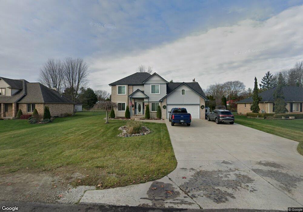
3057 Lindsay Ln Port Huron, MI 48060
Estimated Value: $336,000 - $370,000
4
Beds
4
Baths
2,237
Sq Ft
$158/Sq Ft
Est. Value
About This Home
This home is located at 3057 Lindsay Ln, Port Huron, MI 48060 and is currently estimated at $353,641, approximately $158 per square foot. 3057 Lindsay Ln is a home located in St. Clair County with nearby schools including Michigamme Elementary School, Central Middle School, and Port Huron High School.
Ownership History
Date
Name
Owned For
Owner Type
Purchase Details
Closed on
Jun 10, 2019
Sold by
Miles Johnson
Bought by
Johnson Miles and Johnson Amber
Current Estimated Value
Home Financials for this Owner
Home Financials are based on the most recent Mortgage that was taken out on this home.
Original Mortgage
$172,000
Outstanding Balance
$150,911
Interest Rate
4.2%
Mortgage Type
New Conventional
Estimated Equity
$202,730
Purchase Details
Closed on
Jul 18, 2018
Sold by
Neasbie Alston
Bought by
Johnson Miles
Home Financials for this Owner
Home Financials are based on the most recent Mortgage that was taken out on this home.
Original Mortgage
$166,000
Interest Rate
4.5%
Mortgage Type
New Conventional
Purchase Details
Closed on
Aug 23, 2007
Sold by
King Deborah L and King John N
Bought by
The Bank Of New York Trust Company
Create a Home Valuation Report for This Property
The Home Valuation Report is an in-depth analysis detailing your home's value as well as a comparison with similar homes in the area
Home Values in the Area
Average Home Value in this Area
Purchase History
| Date | Buyer | Sale Price | Title Company |
|---|---|---|---|
| Johnson Miles | -- | Liberty Title | |
| Johnson Miles | $188,000 | None Listed On Document | |
| The Bank Of New York Trust Company | $229,500 | None Available |
Source: Public Records
Mortgage History
| Date | Status | Borrower | Loan Amount |
|---|---|---|---|
| Open | Johnson Miles | $172,000 | |
| Previous Owner | Johnson Miles | $166,000 |
Source: Public Records
Tax History Compared to Growth
Tax History
| Year | Tax Paid | Tax Assessment Tax Assessment Total Assessment is a certain percentage of the fair market value that is determined by local assessors to be the total taxable value of land and additions on the property. | Land | Improvement |
|---|---|---|---|---|
| 2025 | $4,282 | $169,800 | $0 | $0 |
| 2024 | $2,253 | $159,600 | $0 | $0 |
| 2023 | $2,079 | $147,300 | $0 | $0 |
| 2022 | $3,842 | $138,500 | $0 | $0 |
| 2021 | $3,517 | $124,100 | $0 | $0 |
| 2020 | $3,517 | $110,600 | $0 | $110,600 |
| 2019 | $3,452 | $104,700 | $0 | $0 |
| 2018 | $3,371 | $104,700 | $0 | $0 |
| 2017 | $3,296 | $99,200 | $0 | $0 |
| 2016 | $1,707 | $99,200 | $0 | $0 |
| 2015 | -- | $100,700 | $0 | $100,700 |
| 2014 | -- | $96,100 | $96,100 | $0 |
| 2013 | -- | $94,700 | $0 | $0 |
Source: Public Records
Map
Nearby Homes
- 2940 Westland Dr
- 3408 N Burwick Dr
- 3409 Ancient Dr
- 3335 W Water St
- 0000 W Water St
- 2475 Sharon Ln
- 3228 Turnberry
- 3178 Oakwood Dr
- 3196 Oakwood Dr
- 2863 Beach Rd
- 00 Parker Rd
- 3345 Beach Rd
- 2806 Woodstock Dr
- 2650 Alger Rd
- 2838 Elmwood St
- 2549 Riverwood Dr
- 0000 Manuel St
- 3152 Spruce Dr
- 3115 Spruce Dr
- 2045 Yeager St
- 3067 Lindsay Ln
- 3047 Lindsay Ln
- 3064 Lindsay Ln
- 3077 Lindsay Ln
- 3039 Lindsay Ln
- 3046 Lindsay Ln
- 3076 Lindsay Ln
- 3056 Lindsay Ln
- 3038 Lindsay Ln Unit Bldg-Unit
- 3038 Lindsay Ln
- 3085 Lindsay Ln
- 3031 Lindsay Ln
- 3084 Lindsay Ln
- 3032 Mayfield St
- 3030 Lindsay Ln
- 3034 Mayfield St
- 3028 Mayfield St
- 3097 Lindsay Ln
- lot 16 Mayfield Dr
- lot 14 Mayfield Dr