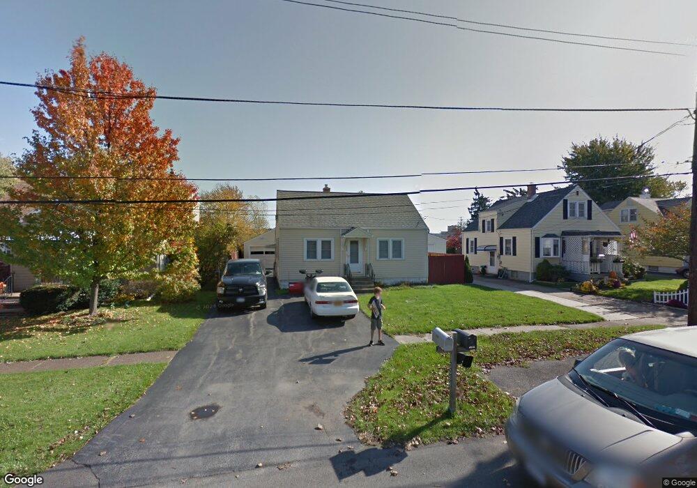
3059 Lyth Rd Buffalo, NY 14218
Estimated Value: $208,000 - $229,000
4
Beds
1
Bath
1,071
Sq Ft
$203/Sq Ft
Est. Value
About This Home
This home is located at 3059 Lyth Rd, Buffalo, NY 14218 and is currently estimated at $216,913, approximately $202 per square foot. 3059 Lyth Rd is a home located in Erie County with nearby schools including Allendale Elementary School, West Middle School, and West Seneca West Senior High School.
Ownership History
Date
Name
Owned For
Owner Type
Purchase Details
Closed on
Dec 22, 2005
Sold by
Jamieson Carol and Muck Carol
Bought by
Muck Carol
Current Estimated Value
Home Financials for this Owner
Home Financials are based on the most recent Mortgage that was taken out on this home.
Original Mortgage
$4,262
Interest Rate
6.39%
Mortgage Type
New Conventional
Purchase Details
Closed on
Apr 27, 2000
Sold by
Jamieson Carol and Kalman Ethel J
Bought by
Jamieson Carol
Purchase Details
Closed on
Aug 17, 1998
Sold by
Palys Timothy J
Bought by
Jamieson-Palys Carol and Kalman Ethel J
Purchase Details
Closed on
Feb 29, 1996
Purchase Details
Closed on
May 10, 1995
Sold by
Davis Martin E
Bought by
Palys Timothy J
Create a Home Valuation Report for This Property
The Home Valuation Report is an in-depth analysis detailing your home's value as well as a comparison with similar homes in the area
Home Values in the Area
Average Home Value in this Area
Purchase History
| Date | Buyer | Sale Price | Title Company |
|---|---|---|---|
| Muck Carol | -- | None Available | |
| Jamieson Carol | -- | -- | |
| Jamieson-Palys Carol | -- | -- | |
| -- | -- | -- | |
| Palys Timothy J | $77,000 | -- |
Source: Public Records
Mortgage History
| Date | Status | Borrower | Loan Amount |
|---|---|---|---|
| Closed | Muck Carol | $4,262 |
Source: Public Records
Tax History Compared to Growth
Tax History
| Year | Tax Paid | Tax Assessment Tax Assessment Total Assessment is a certain percentage of the fair market value that is determined by local assessors to be the total taxable value of land and additions on the property. | Land | Improvement |
|---|---|---|---|---|
| 2024 | $3,784 | $51,000 | $5,000 | $46,000 |
| 2023 | $3,720 | $51,000 | $5,000 | $46,000 |
| 2022 | $3,579 | $51,000 | $5,000 | $46,000 |
| 2021 | $3,594 | $51,000 | $5,000 | $46,000 |
| 2020 | $2,979 | $51,000 | $5,000 | $46,000 |
| 2019 | $2,608 | $51,000 | $5,000 | $46,000 |
| 2018 | $2,781 | $51,000 | $5,000 | $46,000 |
| 2017 | $1,480 | $51,000 | $5,000 | $46,000 |
| 2016 | $2,651 | $51,000 | $5,000 | $46,000 |
| 2015 | -- | $51,000 | $5,000 | $46,000 |
| 2014 | -- | $51,000 | $5,000 | $46,000 |
Source: Public Records
Map
Nearby Homes
- 3055 Mckinley Pkwy
- 52 Kennedy Dr
- 3295 Mckinley Pkwy
- 169 Edison St
- 3341 Carol Ct
- 3387 Bethford Dr
- 3396 Bethford Dr
- 65 Grant Blvd
- 3209-3211 Abbott Rd Unit 3209
- 4328 Oakwood Ave
- 101 South Dr
- 5113 Lake Ave
- 113 South Dr
- 115 South Dr
- 152 Burmon Dr
- 3457 Dolphin Dr
- 4241 Elmwood Ave
- 4218 Salem Dr
- 39 Ludel Terrace
- 3648 S Park Ave