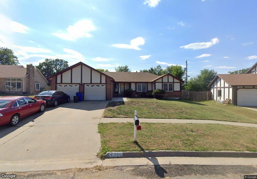
306 Arapahoe Ct Junction City, KS 66441
Estimated Value: $205,000 - $282,000
3
Beds
3
Baths
3,320
Sq Ft
$78/Sq Ft
Est. Value
About This Home
This home is located at 306 Arapahoe Ct, Junction City, KS 66441 and is currently estimated at $257,581, approximately $77 per square foot. 306 Arapahoe Ct is a home located in Geary County with nearby schools including Spring Valley Elementary School, Junction City Middle School, and Junction City Senior High School.
Ownership History
Date
Name
Owned For
Owner Type
Purchase Details
Closed on
Jul 15, 2010
Sold by
Johnson Thea
Bought by
Murphy Willie C and Murphy Linda K
Current Estimated Value
Home Financials for this Owner
Home Financials are based on the most recent Mortgage that was taken out on this home.
Original Mortgage
$175,000
Outstanding Balance
$116,638
Interest Rate
4.78%
Estimated Equity
$140,943
Purchase Details
Closed on
Oct 28, 2009
Sold by
Johnson Thea
Bought by
Johnson Montrula
Create a Home Valuation Report for This Property
The Home Valuation Report is an in-depth analysis detailing your home's value as well as a comparison with similar homes in the area
Home Values in the Area
Average Home Value in this Area
Purchase History
| Date | Buyer | Sale Price | Title Company |
|---|---|---|---|
| Murphy Willie C | -- | Heartland Title Services Inc | |
| Johnson Montrula | -- | -- |
Source: Public Records
Mortgage History
| Date | Status | Borrower | Loan Amount |
|---|---|---|---|
| Open | Johnson Montrula | $175,000 |
Source: Public Records
Tax History Compared to Growth
Tax History
| Year | Tax Paid | Tax Assessment Tax Assessment Total Assessment is a certain percentage of the fair market value that is determined by local assessors to be the total taxable value of land and additions on the property. | Land | Improvement |
|---|---|---|---|---|
| 2025 | $4,228 | $30,775 | $3,059 | $27,716 |
| 2024 | $3,998 | $28,762 | $2,887 | $25,875 |
| 2023 | $3,996 | $27,066 | $2,832 | $24,234 |
| 2022 | $0 | $24,915 | $2,713 | $22,202 |
| 2021 | $0 | $22,517 | $2,551 | $19,966 |
| 2020 | $3,632 | $22,407 | $2,497 | $19,910 |
| 2019 | $3,612 | $22,256 | $2,050 | $20,206 |
| 2018 | $3,595 | $22,256 | $2,050 | $20,206 |
| 2017 | $3,704 | $22,713 | $2,527 | $20,186 |
| 2016 | $3,762 | $22,839 | $1,403 | $21,436 |
| 2015 | $3,311 | $20,953 | $1,403 | $19,550 |
| 2014 | $3,079 | $20,355 | $1,403 | $18,952 |
Source: Public Records
Map
Nearby Homes
- 1912 Winona Cir
- 2204 Elk Ct
- 316 Michaels Way
- 313 Caroline Ct
- 716 Tall Grass Dr
- 1708 Limestone Ln
- 1041 Sandusky Dr
- 1117 Coyote Dr
- 1308 Sandusky Dr
- 516 Tamerisk Dr
- 0000 Stoneridge Dr
- 1218 Caroline Ave
- 1309 Spring Hill Dr
- 1231 Mcfarland Rd
- 1337 Elm Creek Dr
- 1309 Caroline Ave
- 2718 Blaine Ct
- 2720 Sage Ct
- 1331 Spring Hill Dr
- 2703 Valley Dr