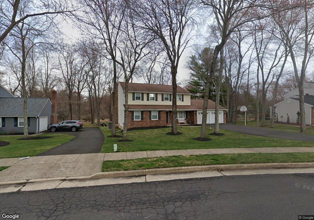
306 Charles St Southampton, PA 18966
Estimated Value: $653,000 - $692,000
4
Beds
3
Baths
2,301
Sq Ft
$292/Sq Ft
Est. Value
About This Home
This home is located at 306 Charles St, Southampton, PA 18966 and is currently estimated at $672,111, approximately $292 per square foot. 306 Charles St is a home located in Bucks County with nearby schools including Davis Elementary School, Klinger Middle School, and William Tennent High School.
Ownership History
Date
Name
Owned For
Owner Type
Purchase Details
Closed on
Sep 24, 2001
Sold by
Levinson Lewis M and Levinson Vicki
Bought by
Pastre Joseph R and Pastre Nancy J
Current Estimated Value
Home Financials for this Owner
Home Financials are based on the most recent Mortgage that was taken out on this home.
Original Mortgage
$210,000
Outstanding Balance
$81,292
Interest Rate
6.89%
Estimated Equity
$590,819
Purchase Details
Closed on
Oct 6, 1980
Bought by
Levinson Lewis M and Levinson Vicki
Create a Home Valuation Report for This Property
The Home Valuation Report is an in-depth analysis detailing your home's value as well as a comparison with similar homes in the area
Home Values in the Area
Average Home Value in this Area
Purchase History
| Date | Buyer | Sale Price | Title Company |
|---|---|---|---|
| Pastre Joseph R | $262,500 | Lawyers Title Insurance Corp | |
| Levinson Lewis M | $97,000 | -- |
Source: Public Records
Mortgage History
| Date | Status | Borrower | Loan Amount |
|---|---|---|---|
| Open | Pastre Joseph R | $210,000 |
Source: Public Records
Tax History Compared to Growth
Tax History
| Year | Tax Paid | Tax Assessment Tax Assessment Total Assessment is a certain percentage of the fair market value that is determined by local assessors to be the total taxable value of land and additions on the property. | Land | Improvement |
|---|---|---|---|---|
| 2025 | $7,529 | $35,200 | $7,120 | $28,080 |
| 2024 | $7,529 | $35,200 | $7,120 | $28,080 |
| 2023 | $7,300 | $35,200 | $7,120 | $28,080 |
| 2022 | $7,146 | $35,200 | $7,120 | $28,080 |
| 2021 | $7,017 | $35,200 | $7,120 | $28,080 |
| 2020 | $6,920 | $35,200 | $7,120 | $28,080 |
| 2019 | $6,665 | $35,200 | $7,120 | $28,080 |
| 2018 | $6,512 | $35,200 | $7,120 | $28,080 |
| 2017 | $6,328 | $35,200 | $7,120 | $28,080 |
| 2016 | $6,328 | $35,200 | $7,120 | $28,080 |
| 2015 | -- | $35,200 | $7,120 | $28,080 |
| 2014 | -- | $35,200 | $7,120 | $28,080 |
Source: Public Records
Map
Nearby Homes
- 325 Toll Dr
- 185 Toll Dr
- 415 New Rd
- 530 Andrew Dr
- 377 Holly Dr
- 206 E Hampton Crossing
- 19 Belmont Station
- 615 Belmont Ave
- 55 Belmont Station Unit G55
- 52 Belmont Station
- 43 Davisville Rd
- 117 Maple Ave
- 1001 Hemlock Place
- 1106 Steamboat Station Unit 1106
- 766 Meadow Dr
- 725 E County Line Rd
- 967 Jeffrey Dr
- 909 Carlin Dr
- 1307 Steamboat Station Unit 1307
- 603 Steamboat Station Unit 603