Estimated Value: $152,000 - $292,000
2
Beds
1
Bath
1,361
Sq Ft
$176/Sq Ft
Est. Value
About This Home
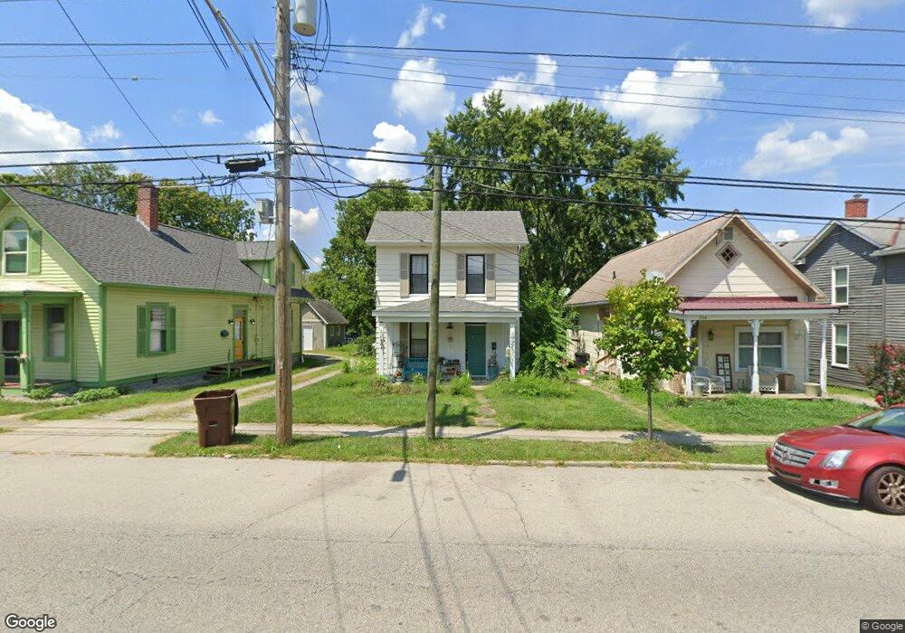
This home is located at 306 E Main St Unit A, Mason, OH 45040 and is currently estimated at $240,116, approximately $176 per square foot. 306 E Main St Unit A is a home located in Warren County with nearby schools including Mason Intermediate Elementary School, Mason Middle School, and William Mason High School.
Ownership History
Date
Name
Owned For
Owner Type
Purchase Details
Closed on
Mar 29, 2022
Sold by
Jemkel Properties Llc
Bought by
2Fishproperties Llc
Current Estimated Value
Purchase Details
Closed on
Nov 18, 2020
Sold by
Reed Gordon D and Durbin Jennifer
Bought by
Jemkel Properties Llc
Purchase Details
Closed on
Jun 27, 2007
Sold by
Fisher Carolyn L and Paul G Fisher Trust
Bought by
Apple Tree Properties Llc
Home Financials for this Owner
Home Financials are based on the most recent Mortgage that was taken out on this home.
Original Mortgage
$837,600
Interest Rate
6.37%
Mortgage Type
Purchase Money Mortgage
Purchase Details
Closed on
Jan 2, 1990
Sold by
Stang Pamela D and Stang Pamela D
Bought by
Reed and Reed Gordon D
Purchase Details
Closed on
May 26, 1988
Sold by
Chipman John L and Chipman Ane J
Bought by
Stang and Stang Pamela D
Purchase Details
Closed on
Mar 3, 1980
Sold by
Atwood Atwood and Atwood Donald J
Create a Home Valuation Report for This Property
The Home Valuation Report is an in-depth analysis detailing your home's value as well as a comparison with similar homes in the area
Home Values in the Area
Average Home Value in this Area
Purchase History
| Date | Buyer | Sale Price | Title Company |
|---|---|---|---|
| 2Fishproperties Llc | -- | None Listed On Document | |
| Jemkel Properties Llc | $105,000 | Prodigy Title Agency | |
| Apple Tree Properties Llc | $1,050,000 | Attorney | |
| Reed | $55,500 | -- | |
| Stang | $40,000 | -- | |
| -- | $37,500 | -- |
Source: Public Records
Mortgage History
| Date | Status | Borrower | Loan Amount |
|---|---|---|---|
| Previous Owner | Apple Tree Properties Llc | $837,600 |
Source: Public Records
Tax History
| Year | Tax Paid | Tax Assessment Tax Assessment Total Assessment is a certain percentage of the fair market value that is determined by local assessors to be the total taxable value of land and additions on the property. | Land | Improvement |
|---|---|---|---|---|
| 2025 | $2,541 | $61,150 | $22,110 | $39,040 |
| 2024 | $2,541 | $61,150 | $22,110 | $39,040 |
| 2023 | $2,238 | $45,528 | $10,878 | $34,650 |
| 2022 | $2,209 | $45,528 | $10,878 | $34,650 |
| 2021 | $2,064 | $44,909 | $10,878 | $34,031 |
| 2020 | $1,913 | $36,512 | $8,845 | $27,668 |
| 2019 | $1,759 | $36,512 | $8,845 | $27,668 |
| 2018 | $1,764 | $36,512 | $8,845 | $27,668 |
| 2017 | $1,822 | $35,193 | $8,656 | $26,537 |
| 2016 | $1,877 | $35,193 | $8,656 | $26,537 |
| 2015 | $1,881 | $35,193 | $8,656 | $26,537 |
| 2014 | $1,957 | $34,170 | $8,400 | $25,760 |
| 2013 | $1,962 | $35,960 | $8,840 | $27,120 |
Source: Public Records
Map
Nearby Homes
- 306 E Main St
- 304 E Main St
- 314 E Main St
- 107 Cowan Dr
- 220 Kings Mills Rd
- 5130 Franklin Park St
- 5173 Franklin Park St
- 5239 Concord Crossing Dr
- 4922 Bordeaux Ln Unit 4922
- 4268 Fontenay
- 4943 Isaac Ln
- 4782 Bordeaux Ln
- 4178 Marival Way
- 4734 Margaret Ct
- 4684 Court Yard Dr
- 5104 Lexington Ct
- 600 W Church St
- 3 Carnell Place
- 4163 Spyglass Hill Unit 4163
- 4153 Spyglass Hill Unit 4153
- 304 E Main St Unit A
- 308 E Main St
- 308 E Main St Unit A
- 310 E Main St
- 310 E Main St Unit A
- 302 E Main St
- 312 E Main St
- 312 E Main St Unit A
- 314 E Main St Unit A
- 300 E Main St
- 305 E Main St
- 212 E Main St
- 316 E Main St
- 316 E Main St Unit A
- 307 E Main St
- 311 E Main St
- 210 E Main St
- 313 E Main St
- 208 E Main St
- 205 E North St
Your Personal Tour Guide
Ask me questions while you tour the home.