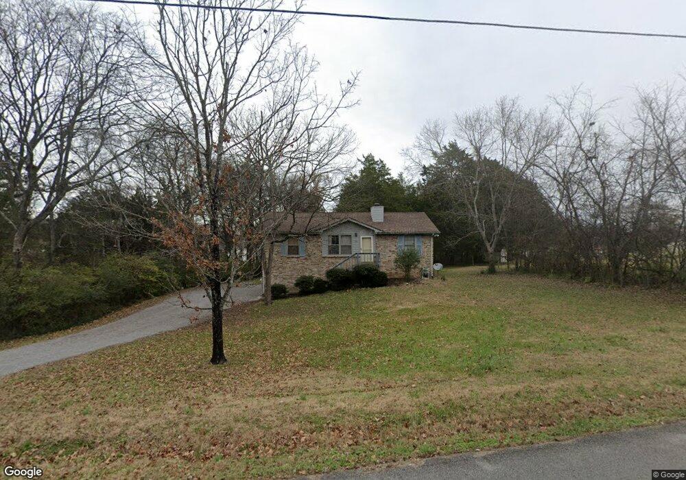
306 Jim Joe Alley Mount Juliet, TN 37122
Estimated Value: $305,985 - $426,000
--
Bed
2
Baths
1,075
Sq Ft
$343/Sq Ft
Est. Value
About This Home
This home is located at 306 Jim Joe Alley, Mount Juliet, TN 37122 and is currently estimated at $368,746, approximately $343 per square foot. 306 Jim Joe Alley is a home located in Wilson County with nearby schools including Mt. Juliet Elementary School, Mt. Juliet Middle School, and Green Hill High School.
Ownership History
Date
Name
Owned For
Owner Type
Purchase Details
Closed on
Jan 24, 2003
Sold by
Duerbeck Kurtis G and Duerbeck Lillian
Bought by
Baker Mary M
Current Estimated Value
Purchase Details
Closed on
Jan 23, 2002
Bought by
Baker Mary M
Purchase Details
Closed on
Nov 20, 1989
Bought by
Duerbeck Kurtis C
Purchase Details
Closed on
Feb 27, 1987
Bought by
Wilmore Jack Carter
Purchase Details
Closed on
Aug 4, 1986
Bought by
House Bernest & Wanda
Purchase Details
Closed on
Aug 9, 1980
Create a Home Valuation Report for This Property
The Home Valuation Report is an in-depth analysis detailing your home's value as well as a comparison with similar homes in the area
Home Values in the Area
Average Home Value in this Area
Purchase History
| Date | Buyer | Sale Price | Title Company |
|---|---|---|---|
| Baker Mary M | $123,000 | -- | |
| Baker Mary M | $123,000 | -- | |
| Duerbeck Kurtis C | $81,800 | -- | |
| Wilmore Jack Carter | $69,900 | -- | |
| House Bernest & Wanda | $10,500 | -- | |
| -- | -- | -- |
Source: Public Records
Tax History Compared to Growth
Tax History
| Year | Tax Paid | Tax Assessment Tax Assessment Total Assessment is a certain percentage of the fair market value that is determined by local assessors to be the total taxable value of land and additions on the property. | Land | Improvement |
|---|---|---|---|---|
| 2024 | $1,050 | $55,000 | $18,750 | $36,250 |
| 2022 | $1,044 | $54,700 | $18,750 | $35,950 |
| 2021 | $1,104 | $54,700 | $18,750 | $35,950 |
| 2020 | $971 | $54,700 | $18,750 | $35,950 |
| 2019 | $120 | $36,175 | $12,500 | $23,675 |
| 2018 | $971 | $36,175 | $12,500 | $23,675 |
| 2017 | $971 | $36,175 | $12,500 | $23,675 |
| 2016 | $971 | $36,175 | $12,500 | $23,675 |
| 2015 | $1,002 | $36,175 | $12,500 | $23,675 |
| 2014 | $901 | $32,530 | $0 | $0 |
Source: Public Records
Map
Nearby Homes
- 415 Willis Pass
- 212 Jackson Trail
- 1120 Brookstone Blvd
- 271 Page Dr
- 144 W Division St
- 700 Castle Rd
- 1013 Brookstone Blvd
- 1520 Brookstone Cir
- 1105 Camden Cir
- 493 Page Dr
- 2112 Brookstone Dr
- 3107 Oxford Dr
- 4014 Ethan Ave
- 2001 Lynnhaven Ct
- 1 Dogwood Dr
- 506 Page Dr
- 2002 Lynnhaven Ct
- 87 E Hill St
- 1720 Hartford Ln
- 233 Curd Rd
- 217 Jackson Trail
- 304 Jim Joe Alley
- 410 Willis Pass
- 219 Jackson Trail
- 408 Willis Pass
- 412 Willis Pass
- 215 Jackson Trail
- 303 Jim Joe Alley
- 406 Willis Pass
- 221 Jackson Trail
- 213 Jackson Trail
- 211 Jackson Trail
- 404 Willis Pass
- 226 Jackson Trail
- 209 Jackson Trail
- 228 Jackson Trail
- 224 Jackson Trail
- 411 Willis Pass
- 230 Jackson Trail
- 417 Willis Pass