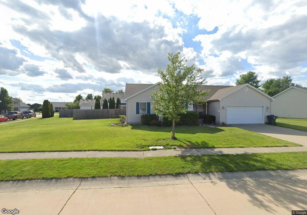
306 Kings Mantle Ct Mount Zion, IL 62549
Estimated Value: $299,589 - $339,000
--
Bed
--
Bath
1,672
Sq Ft
$191/Sq Ft
Est. Value
About This Home
This home is located at 306 Kings Mantle Ct, Mount Zion, IL 62549 and is currently estimated at $318,897, approximately $190 per square foot. 306 Kings Mantle Ct is a home located in Macon County with nearby schools including McGaughey Elementary School, Mt. Zion Elementary School, and Mt. Zion Intermediate School.
Ownership History
Date
Name
Owned For
Owner Type
Purchase Details
Closed on
Jun 16, 2006
Sold by
Lewis Steven A
Bought by
Tenuto Steven B and Tenuto Molly E
Current Estimated Value
Home Financials for this Owner
Home Financials are based on the most recent Mortgage that was taken out on this home.
Original Mortgage
$135,000
Outstanding Balance
$80,077
Interest Rate
6.73%
Mortgage Type
New Conventional
Estimated Equity
$238,820
Create a Home Valuation Report for This Property
The Home Valuation Report is an in-depth analysis detailing your home's value as well as a comparison with similar homes in the area
Home Values in the Area
Average Home Value in this Area
Purchase History
| Date | Buyer | Sale Price | Title Company |
|---|---|---|---|
| Tenuto Steven B | $189,000 | None Available |
Source: Public Records
Mortgage History
| Date | Status | Borrower | Loan Amount |
|---|---|---|---|
| Open | Tenuto Steven B | $135,000 |
Source: Public Records
Tax History Compared to Growth
Tax History
| Year | Tax Paid | Tax Assessment Tax Assessment Total Assessment is a certain percentage of the fair market value that is determined by local assessors to be the total taxable value of land and additions on the property. | Land | Improvement |
|---|---|---|---|---|
| 2024 | $6,524 | $89,585 | $8,470 | $81,115 |
| 2023 | $6,314 | $83,320 | $7,878 | $75,442 |
| 2022 | $6,043 | $79,029 | $7,472 | $71,557 |
| 2021 | $5,869 | $74,036 | $7,000 | $67,036 |
| 2020 | $5,510 | $70,623 | $10,453 | $60,170 |
| 2019 | $5,510 | $70,623 | $10,453 | $60,170 |
| 2018 | $5,344 | $68,820 | $10,186 | $58,634 |
| 2017 | $5,272 | $67,497 | $9,990 | $57,507 |
| 2016 | $5,220 | $66,323 | $9,816 | $56,507 |
| 2015 | $5,049 | $65,667 | $9,719 | $55,948 |
| 2014 | $4,867 | $65,667 | $9,719 | $55,948 |
| 2013 | $4,924 | $65,667 | $9,719 | $55,948 |
Source: Public Records
Map
Nearby Homes
- 50 Sundance Dr
- 1610 Robin Ct
- 24 Buttonridge Place
- 925 S Wildwood Dr
- 1820 Buckhead Ln
- 2125 Buckhead Ave
- 1935 Buckhead Ct
- 860 W Wildwood Dr
- 2110 Buckhead Ln
- 2130 Buckhead Ave
- 2020 Buckhead Ln
- 2030 Buckhead Ln
- 570 Fawn Ct
- 265 Carrington Ave
- 574 N Antler Dr
- 3330 S Baltimore Ave
- 3930 S Mount Zion Rd
- 125 W Walnut St
- 524 Elm St
- 1440 N Alexander Dr
- 304 Kings Mantle Ct
- 318 Kings Mantle Ct
- 7 Sundance Dr
- 305 Kings Mantle Ct
- 307 Kings Mantle Ct
- 313 Kings Mantle Ct
- 303 Kings Mantle Ct
- 315 Kings Mantle Ct
- 309 Kings Mantle Ct
- 326 Kings Mantle Ct
- 311 Kings Mantle Ct
- 317 Kings Mantle Ct
- 319 Kings Mantle Ct
- 301 Kings Mantle Ct
- 321 Kings Mantle Ct
- 9 Sundance Dr
- 415 Desert Rose Ct
- 6 Sundance Dr
- 327 Kings Mantle Ct
- 425 Desert Rose Ct