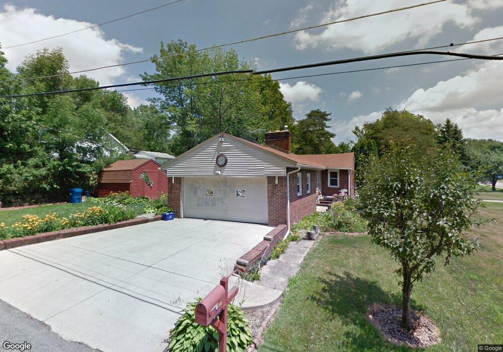
306 Mathews Rd Youngstown, OH 44512
Estimated Value: $129,730 - $176,000
4
Beds
1
Bath
1,164
Sq Ft
$131/Sq Ft
Est. Value
About This Home
This home is located at 306 Mathews Rd, Youngstown, OH 44512 and is currently estimated at $152,683, approximately $131 per square foot. 306 Mathews Rd is a home located in Mahoning County with nearby schools including Robinwood Lane Elementary School, Boardman Glenwood Junior High School, and Boardman High School.
Ownership History
Date
Name
Owned For
Owner Type
Purchase Details
Closed on
May 31, 2023
Sold by
Logiudice Donald W
Bought by
Logiudice Curtis M
Current Estimated Value
Purchase Details
Closed on
Jan 11, 2022
Sold by
Logiudice Robert C
Bought by
Logiudice Donald W
Purchase Details
Closed on
Jun 13, 2018
Sold by
Logiudice Robert C
Bought by
Logiudice Dominic Charles
Purchase Details
Closed on
Jan 10, 1992
Bought by
Lo Giudice Robert C
Create a Home Valuation Report for This Property
The Home Valuation Report is an in-depth analysis detailing your home's value as well as a comparison with similar homes in the area
Home Values in the Area
Average Home Value in this Area
Purchase History
| Date | Buyer | Sale Price | Title Company |
|---|---|---|---|
| Logiudice Curtis M | -- | -- | |
| Logiudice Donald W | $26,800 | None Listed On Document | |
| Logiudice Donald W | $26,800 | None Listed On Document | |
| Logiudice Dominic Charles | -- | None Available | |
| Logiudice Robert C | -- | None Available | |
| Lo Giudice Robert C | -- | -- |
Source: Public Records
Tax History Compared to Growth
Tax History
| Year | Tax Paid | Tax Assessment Tax Assessment Total Assessment is a certain percentage of the fair market value that is determined by local assessors to be the total taxable value of land and additions on the property. | Land | Improvement |
|---|---|---|---|---|
| 2024 | $1,655 | $31,570 | $5,800 | $25,770 |
| 2023 | $1,633 | $31,570 | $5,800 | $25,770 |
| 2022 | $1,127 | $25,620 | $6,270 | $19,350 |
| 2021 | $1,128 | $25,620 | $6,270 | $19,350 |
| 2020 | $1,133 | $25,620 | $6,270 | $19,350 |
| 2019 | $1,184 | $24,190 | $6,270 | $17,920 |
| 2018 | $982 | $24,190 | $6,270 | $17,920 |
| 2017 | $979 | $24,190 | $6,270 | $17,920 |
| 2016 | $1,072 | $25,490 | $6,970 | $18,520 |
| 2015 | $1,050 | $25,490 | $6,970 | $18,520 |
| 2014 | $1,053 | $25,490 | $6,970 | $18,520 |
| 2013 | $1,040 | $25,490 | $6,970 | $18,520 |
Source: Public Records
Map
Nearby Homes
- 0 Mathews Rd Unit 5038026
- 6001 Applecrest Dr
- 178 Mathews Rd
- 197 Mathews Rd Unit B
- 167 Afton Ave
- 268 Erskine Ave
- 424 Mathews Rd
- 323 Melrose Ave
- 642 Oakridge Dr
- 796 Edenridge Dr
- 88 Arlene Ave
- 5522 Southern Blvd
- 707 Oakridge Dr
- 0 Mulberry Ln Unit 5119623
- 0 Cranberry Ln Unit 5119702
- 0 Indianola Rd
- 6785 Tanglewood Dr
- 792 Forest Ridge Dr
- 44 Gertrude Ave
- 77 Melrose Ave
- 312 Mathews Rd
- 5797 Border Ave
- 6092 Applecrest Ct
- 290 Mathews Rd
- 0 Mathews Rd Unit 3754233
- 0 Mathews Rd Unit 1501182
- 5750 Border Ave
- 6093 Applecrest Ct
- 6082 Applecrest Ct
- 0 Mathews Rd Unit 3109842
- 0 Mathews Rd Unit 3148972
- 0 Mathews Rd Unit 3373468
- 0 Mathews Rd Unit 3636151
- 6083 Applecrest Ct
- 6083 Applecrest Ct Unit 1&2
- 6083 Applecrest Ct Unit 1
- 5731 Border Ave
- 326 Mathews Rd
- 254 Mathews Rd
- 321 Multi Mathews Rd