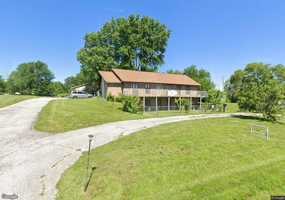
306 N F Hwy Chilhowee, MO 64733
Estimated Value: $211,000 - $328,000
3
Beds
4
Baths
2,573
Sq Ft
$96/Sq Ft
Est. Value
About This Home
This home is located at 306 N F Hwy, Chilhowee, MO 64733 and is currently estimated at $246,361, approximately $95 per square foot. 306 N F Hwy is a home located in Johnson County with nearby schools including Chilhowee Elementary School and Chilhowee High School.
Ownership History
Date
Name
Owned For
Owner Type
Purchase Details
Closed on
Jul 24, 2014
Sold by
Riley Michael L and Riley Katherine V
Bought by
Kearney Eric M and Kearney Stacey A
Current Estimated Value
Home Financials for this Owner
Home Financials are based on the most recent Mortgage that was taken out on this home.
Original Mortgage
$64,000
Outstanding Balance
$48,767
Interest Rate
4.17%
Mortgage Type
New Conventional
Estimated Equity
$197,594
Create a Home Valuation Report for This Property
The Home Valuation Report is an in-depth analysis detailing your home's value as well as a comparison with similar homes in the area
Home Values in the Area
Average Home Value in this Area
Purchase History
| Date | Buyer | Sale Price | Title Company |
|---|---|---|---|
| Kearney Eric M | -- | Western Missouri Title Co |
Source: Public Records
Mortgage History
| Date | Status | Borrower | Loan Amount |
|---|---|---|---|
| Open | Kearney Eric M | $64,000 |
Source: Public Records
Tax History Compared to Growth
Tax History
| Year | Tax Paid | Tax Assessment Tax Assessment Total Assessment is a certain percentage of the fair market value that is determined by local assessors to be the total taxable value of land and additions on the property. | Land | Improvement |
|---|---|---|---|---|
| 2024 | $1,201 | $14,027 | $0 | $0 |
| 2023 | $1,201 | $14,027 | $0 | $0 |
| 2022 | $1,142 | $13,437 | $0 | $0 |
| 2021 | $1,142 | $13,437 | $0 | $0 |
| 2020 | $1,108 | $12,847 | $0 | $0 |
| 2019 | $1,089 | $12,847 | $0 | $0 |
| 2017 | $1,052 | $12,847 | $0 | $0 |
| 2016 | $1,058 | $12,847 | $0 | $0 |
| 2015 | $1,095 | $12,847 | $0 | $0 |
| 2014 | $1,074 | $12,847 | $0 | $0 |
Source: Public Records
Map
Nearby Homes
- 924 NW 501 Rd
- 871 SW 301st Rd
- 700 SW 800th Rd
- O Hwy and Sw 1200th Rd
- 0 O Hwy Tracts C and D Hwy Unit HMS2571559
- TBD SW 101st Rd
- 1318 NW 911p Rd
- 1244 SW 101st Rd
- 808 SW O Hwy
- 169 SW 800th Rd
- 739 SW 700th Rd
- 1287 SE State Route 13 N A
- 1246 Missouri 13
- 1287 SE State Route 13
- 10368 NW Highway O
- 833 SW 1101st Rd
- 938 SW 13 Hwy
- 324 N Main St
- 312 N Main St
- 920 NW 501 County Rd
- 303 E State Route 2
- 301 E Howard St
- 1097 SW Highway F
- 209 E State Route 2
- 202 E Pine St
- 207 E State Route 2
- 305 E Pine St
- 519 SW State Route 2
- 305 N Pennsylvania St
- 201 E Howard St
- 206 E State Route 2
- 1105 SW 551st Rd
- 204 N Rock Island Rd
- 203 E Pine St
- 200 E 2 Hwy
- 306 N Pennsylvania St
- 109 E State Route 2
- 209 N Pennsylvania St
- 209 N Pennsylvania St
- 310 N Pennsylvania St