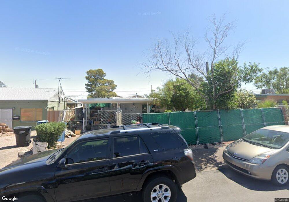
306 Tungsten St Henderson, NV 89015
Downtown Henderson NeighborhoodEstimated Value: $281,000 - $384,000
3
Beds
2
Baths
1,070
Sq Ft
$309/Sq Ft
Est. Value
About This Home
This home is located at 306 Tungsten St, Henderson, NV 89015 and is currently estimated at $330,499, approximately $308 per square foot. 306 Tungsten St is a home located in Clark County with nearby schools including Gordon Mccaw Elementary School, Robert L Taylor Elementary School, and Lyal Burkholder Middle School.
Ownership History
Date
Name
Owned For
Owner Type
Purchase Details
Closed on
Nov 19, 2018
Sold by
Campbell Gregory Allan
Bought by
Sadovich Juliana Marvel Maria
Current Estimated Value
Purchase Details
Closed on
Nov 25, 2014
Sold by
Sadovich Juliana Marvel Maria and Sadovich Joseph Vallier
Bought by
Sadovich Juliana Marvel Maria
Purchase Details
Closed on
Jul 26, 2011
Sold by
Sadovich Maryellen Vallier
Bought by
Sadovich Juliana Marvel Maria and Sadovich Joseph Vallier
Create a Home Valuation Report for This Property
The Home Valuation Report is an in-depth analysis detailing your home's value as well as a comparison with similar homes in the area
Home Values in the Area
Average Home Value in this Area
Purchase History
| Date | Buyer | Sale Price | Title Company |
|---|---|---|---|
| Sadovich Juliana Marvel Maria | -- | Roc Title | |
| Mckenzie Denise | $125,000 | Roc Title | |
| Sadovich Juliana Marvel Maria | -- | None Available | |
| Sadovich Juliana Marvel Maria | $50,000 | None Available |
Source: Public Records
Tax History Compared to Growth
Tax History
| Year | Tax Paid | Tax Assessment Tax Assessment Total Assessment is a certain percentage of the fair market value that is determined by local assessors to be the total taxable value of land and additions on the property. | Land | Improvement |
|---|---|---|---|---|
| 2025 | $491 | $41,206 | $22,050 | $19,156 |
| 2024 | $491 | $41,206 | $22,050 | $19,156 |
| 2023 | $491 | $41,171 | $23,450 | $17,721 |
| 2022 | $477 | $36,478 | $20,300 | $16,178 |
| 2021 | $463 | $35,630 | $20,300 | $15,330 |
| 2020 | $446 | $33,183 | $18,200 | $14,983 |
| 2019 | $433 | $27,876 | $13,300 | $14,576 |
| 2018 | $421 | $27,236 | $13,300 | $13,936 |
| 2017 | $706 | $24,341 | $10,500 | $13,841 |
| 2016 | $395 | $20,885 | $7,350 | $13,535 |
| 2015 | $393 | $18,128 | $4,900 | $13,228 |
| 2014 | $381 | $12,752 | $4,900 | $7,852 |
Source: Public Records
Map
Nearby Homes
- 335 W Basic Rd
- 126 Magnesium St
- 116 W Victory Rd
- 211 W Atlantic Ave
- 206 W Atlantic Ave
- 27 Magnesium St
- 203 W Pacific Ave
- 234 Denver Way
- 211 Viewmont Dr
- 240 W Fairway Rd
- 205 Carson Way
- 139 E van Wagenen St
- 15 Washington Way
- 130 W Fairway Rd
- 603 Buchanan Ave
- 405 Box Elder Way
- 39 E Pacific Ave
- 0 None Unit 2690079
- 30 Lowery St
- 379 Morgan Crest Dr
- 310 Tungsten St
- 302 Tungsten St
- 314 Tungsten St
- 307 W Atlantic Ave
- 307 W Atlantic Ave Unit G
- 307 W Atlantic Ave Unit F
- 307 W Atlantic Ave Unit C
- 307 W Atlantic Ave Unit D
- 307 W Atlantic Ave Unit E
- 303 Tungsten St
- 311 W Atlantic Ave
- 303 W Atlantic Ave
- 303 W Atlantic Ave Unit A
- 303 W Atlantic Ave Unit B
- 307 Tungsten St
- 318 Tungsten St
- 286 Tungsten St
- 311 Tungsten St
- 315 W Atlantic Ave
- 315 Tungsten St