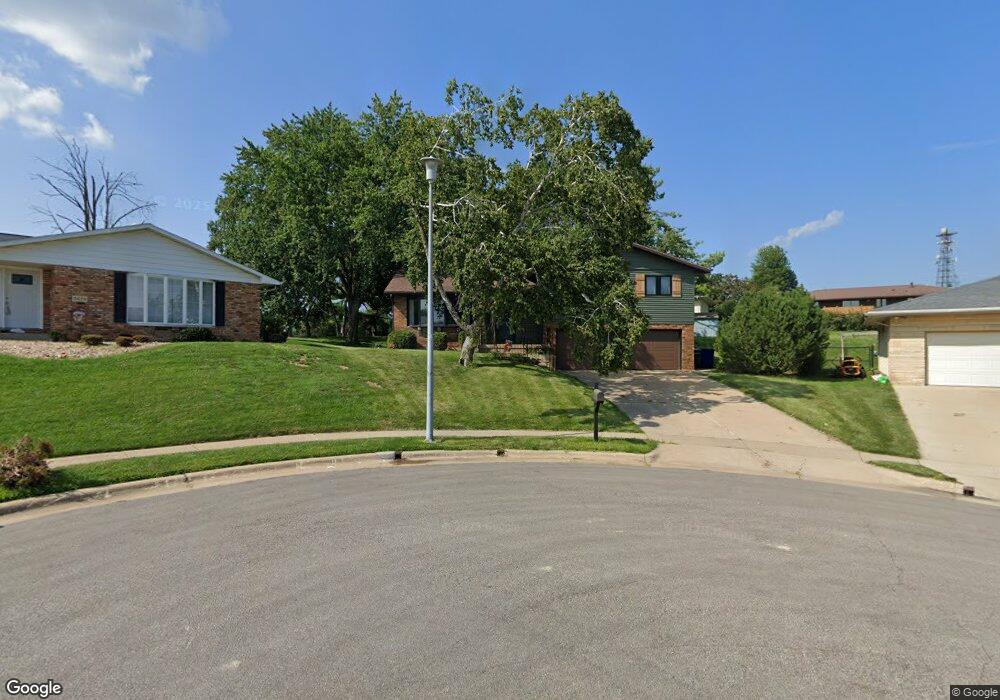
3065 Powers Ct Dubuque, IA 52001
Estimated Value: $296,633 - $330,000
3
Beds
3
Baths
1,970
Sq Ft
$159/Sq Ft
Est. Value
About This Home
This home is located at 3065 Powers Ct, Dubuque, IA 52001 and is currently estimated at $313,158, approximately $158 per square foot. 3065 Powers Ct is a home located in Dubuque County with nearby schools including Hoover Elementary School, Eleanor Roosevelt Middle School, and Dubuque Senior High School.
Ownership History
Date
Name
Owned For
Owner Type
Purchase Details
Closed on
Dec 13, 2011
Sold by
Baumhover Roger G and Baumhover Mary Ellen
Bought by
Steil Martin E and Steil Schantel M
Current Estimated Value
Home Financials for this Owner
Home Financials are based on the most recent Mortgage that was taken out on this home.
Original Mortgage
$168,873
Outstanding Balance
$116,074
Interest Rate
4.11%
Mortgage Type
FHA
Estimated Equity
$197,084
Purchase Details
Closed on
Nov 2, 2009
Sold by
Baumhover Roger G and Baumhover Mary Ellen
Bought by
Baumhover Roger G and Baumhover Mary Ellen
Create a Home Valuation Report for This Property
The Home Valuation Report is an in-depth analysis detailing your home's value as well as a comparison with similar homes in the area
Home Values in the Area
Average Home Value in this Area
Purchase History
| Date | Buyer | Sale Price | Title Company |
|---|---|---|---|
| Steil Martin E | $175,000 | None Available | |
| Baumhover Roger G | -- | None Available |
Source: Public Records
Mortgage History
| Date | Status | Borrower | Loan Amount |
|---|---|---|---|
| Open | Steil Martin E | $168,873 |
Source: Public Records
Tax History Compared to Growth
Tax History
| Year | Tax Paid | Tax Assessment Tax Assessment Total Assessment is a certain percentage of the fair market value that is determined by local assessors to be the total taxable value of land and additions on the property. | Land | Improvement |
|---|---|---|---|---|
| 2025 | $3,660 | $288,500 | $53,100 | $235,400 |
| 2024 | $3,660 | $264,800 | $48,100 | $216,700 |
| 2023 | $3,550 | $264,800 | $48,100 | $216,700 |
| 2022 | $3,462 | $218,240 | $45,540 | $172,700 |
| 2021 | $3,462 | $218,240 | $45,540 | $172,700 |
| 2020 | $3,356 | $197,450 | $43,010 | $154,440 |
| 2019 | $3,356 | $197,450 | $43,010 | $154,440 |
| 2018 | $3,302 | $189,070 | $40,480 | $148,590 |
| 2017 | $3,210 | $189,070 | $40,480 | $148,590 |
| 2016 | $3,140 | $174,720 | $40,480 | $134,240 |
| 2015 | $3,140 | $174,720 | $40,480 | $134,240 |
| 2014 | $3,006 | $172,090 | $40,480 | $131,610 |
Source: Public Records
Map
Nearby Homes
- 2146 Avalon Rd
- 2035 Broadlawn Rd
- 3080 Saint Anne Dr
- 2290 Theda Dr
- 2380 Trygg Dr
- 1790 Horizon Ct
- 3112 Kaufmann Ave
- 2095 Mullin Rd
- 1762 Churchill Dr
- 3519 Hillcrest Rd
- 3462 Asbury Rd
- 2347 Coventry Park Unit C-011
- 2560 Crissy Dr
- 1730 Chaney Rd
- 2145 Saint John Dr
- 2614 Crissy Dr
- 3424 Glencove Ln
- 3631 Keymeer Dr
- Lot Hillcrest Rd
- 3427 Crestwood Dr
- 3055 Powers Ct
- 3070 Vail Trail Ct
- 3075 Powers Ct
- 2262 Cherbourg Ct
- 3080 Vail Trail Ct
- 3060 Vail Trail Ct
- 2242 Cherbourg Ct
- 3070 Powers Ct
- 3051 Powers Ct
- 2045 Judson Dr
- 2282 Cherbourg Ct
- 3060 Powers Ct
- 3050 Vail Trail Ct
- 2222 Cherbourg Ct
- 3138 Foothill Ct
- 3050 Powers Ct
- 3090 Vail Trail Ct
- 3118 Foothill Ct
- 2255 Cherbourg Ct
- 3075 Vail Trail