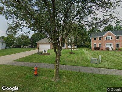
3069 Sparrow Flight Dr Seven Hills, OH 44131
Estimated Value: $398,000 - $432,000
4
Beds
3
Baths
2,558
Sq Ft
$162/Sq Ft
Est. Value
About This Home
This home is located at 3069 Sparrow Flight Dr, Seven Hills, OH 44131 and is currently estimated at $413,431, approximately $161 per square foot. 3069 Sparrow Flight Dr is a home located in Cuyahoga County with nearby schools including Green Valley Elementary School, Normandy High School, and Hillside Middle School.
Ownership History
Date
Name
Owned For
Owner Type
Purchase Details
Closed on
Aug 8, 2017
Sold by
Grillo Placido S and Grillo Nicole L
Bought by
Motley Vicki
Current Estimated Value
Home Financials for this Owner
Home Financials are based on the most recent Mortgage that was taken out on this home.
Original Mortgage
$247,500
Interest Rate
3.96%
Mortgage Type
Purchase Money Mortgage
Purchase Details
Closed on
Jan 16, 2017
Sold by
Dienes Katalin and Komar Elizabth Vaci
Bought by
Grillo Placido S
Purchase Details
Closed on
Jun 10, 1994
Sold by
Reilly E Donald
Bought by
Dienes Frank and Dienes Katalin
Purchase Details
Closed on
Jan 6, 1992
Bought by
Reilly E Donald
Purchase Details
Closed on
Jan 1, 1990
Bought by
Perrico Property
Create a Home Valuation Report for This Property
The Home Valuation Report is an in-depth analysis detailing your home's value as well as a comparison with similar homes in the area
Home Values in the Area
Average Home Value in this Area
Purchase History
| Date | Buyer | Sale Price | Title Company |
|---|---|---|---|
| Motley Vicki | $275,000 | Ort | |
| Grillo Placido S | $11,500 | None Available | |
| Dienes Frank | $208,000 | -- | |
| Reilly E Donald | $207,000 | -- | |
| Perrico Property | -- | -- |
Source: Public Records
Mortgage History
| Date | Status | Borrower | Loan Amount |
|---|---|---|---|
| Open | Motley Max | $236,500 | |
| Closed | Motley Vicki | $247,500 |
Source: Public Records
Tax History Compared to Growth
Tax History
| Year | Tax Paid | Tax Assessment Tax Assessment Total Assessment is a certain percentage of the fair market value that is determined by local assessors to be the total taxable value of land and additions on the property. | Land | Improvement |
|---|---|---|---|---|
| 2024 | $6,162 | $103,670 | $25,410 | $78,260 |
| 2023 | $7,401 | $106,860 | $25,060 | $81,800 |
| 2022 | $7,359 | $106,860 | $25,060 | $81,800 |
| 2021 | $7,586 | $106,860 | $25,060 | $81,800 |
| 2020 | $7,687 | $96,250 | $22,580 | $73,680 |
| 2019 | $7,387 | $275,000 | $64,500 | $210,500 |
| 2018 | $7,192 | $96,250 | $22,580 | $73,680 |
| 2017 | $3,359 | $39,380 | $26,570 | $12,810 |
| 2016 | $7,352 | $88,240 | $26,570 | $61,670 |
| 2015 | $6,558 | $88,240 | $26,570 | $61,670 |
| 2014 | $6,558 | $83,230 | $25,060 | $58,170 |
Source: Public Records
Map
Nearby Homes
- 0 V L Gene Dr
- 4253 Vincent Dr
- 1159 Orchardview Rd
- 3187 Jasmine Dr
- 4300 Lake Charles Dr
- 7480 Ludwin Dr
- 200 Village Dr Unit 15
- VL Orchardview Rd
- 0 Hillside Rd
- 8086 Mccreary Rd
- 7417 Broadview Rd
- 7214 Hawthorne Trace
- 7178 Hawthorn Trace
- 3938 E Wallings Rd
- 4520 E Wallings Rd
- 6119 E Sprague Rd
- 1632 Jo Ann Dr
- 6315 Brookside Rd
- 1903 David Ave
- 1760 W Sprague Rd
- 3069 Sparrow Flight Dr
- 3127 Sparrow Flight Dr
- 3011 Sparrow Flight Dr
- 7665 Quail Hollow Dr
- 7667 Quail Hollow Dr
- 3185 Sparrow Flight Dr
- 7663 Quail Hollow Dr
- 7669 Quail Hollow Dr
- 2945 Wynde Tree Dr
- 7661 Quail Hollow Dr
- 3243 Sparrow Flight Dr
- 3190 Sparrow Flight Dr
- 2977 Wynde Tree Dr
- 3301 Sparrow Flight Dr
- 3330 Sparrow Flight Dr
- 2910 Wynde Tree Dr
- 2850 Wynde Tree Dr
- 7662 Quail Hollow Dr
- 7664 Quail Hollow Dr
- 2790 Wynde Tree Dr