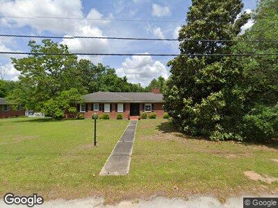
307 N Meadow Dr Manning, SC 29102
Estimated Value: $219,544 - $270,000
4
Beds
3
Baths
2,755
Sq Ft
$91/Sq Ft
Est. Value
About This Home
This home is located at 307 N Meadow Dr, Manning, SC 29102 and is currently estimated at $251,136, approximately $91 per square foot. 307 N Meadow Dr is a home located in Clarendon County with nearby schools including Manning Early Childhood Center, Manning Primary School, and Manning Elementary School.
Ownership History
Date
Name
Owned For
Owner Type
Purchase Details
Closed on
Jul 18, 2006
Sold by
Failmezger Michael S
Bought by
Lee Mark and Lee Michelle
Current Estimated Value
Home Financials for this Owner
Home Financials are based on the most recent Mortgage that was taken out on this home.
Original Mortgage
$115,000
Outstanding Balance
$70,503
Interest Rate
6.68%
Mortgage Type
Future Advance Clause Open End Mortgage
Estimated Equity
$173,349
Create a Home Valuation Report for This Property
The Home Valuation Report is an in-depth analysis detailing your home's value as well as a comparison with similar homes in the area
Home Values in the Area
Average Home Value in this Area
Purchase History
| Date | Buyer | Sale Price | Title Company |
|---|---|---|---|
| Lee Mark | $150,000 | None Available |
Source: Public Records
Mortgage History
| Date | Status | Borrower | Loan Amount |
|---|---|---|---|
| Open | Lee Mark | $39,500 | |
| Closed | Lee Mark C | $15,000 | |
| Open | Lee Mark | $115,000 |
Source: Public Records
Tax History Compared to Growth
Tax History
| Year | Tax Paid | Tax Assessment Tax Assessment Total Assessment is a certain percentage of the fair market value that is determined by local assessors to be the total taxable value of land and additions on the property. | Land | Improvement |
|---|---|---|---|---|
| 2024 | $1,739 | $5,720 | $0 | $0 |
| 2023 | $1,667 | $5,720 | $400 | $5,320 |
| 2022 | $1,650 | $5,720 | $400 | $5,320 |
| 2021 | $1,631 | $5,528 | $360 | $5,168 |
| 2020 | $1,631 | $5,528 | $360 | $5,168 |
| 2019 | $1,558 | $5,528 | $360 | $5,168 |
| 2018 | $1,519 | $5,528 | $0 | $0 |
| 2017 | $1,501 | $5,528 | $0 | $0 |
| 2016 | $1,498 | $5,528 | $0 | $0 |
| 2015 | $1,425 | $5,564 | $360 | $5,204 |
| 2014 | $1,428 | $5,564 | $360 | $5,204 |
| 2013 | -- | $5,564 | $360 | $5,204 |
Source: Public Records
Map
Nearby Homes
- 510 Woodland Dr
- 408 Toccoa Dr
- 309 Toccoa Dr
- TBD S Mill St
- 21 E South St
- 1026 Jamie Ct
- 404 S Church St
- 537 Sunset Dr
- 20 Acres - TBD S Carolina 260
- TBD Sylvan Dr
- 200 W Boyce St
- 204 W Boyce St
- 0000 S Brooks St
- TBD S Carolina 260
- 633 Sykes St
- 200 Mariposa St
- 1112 Blue Heron Pointe
- 40 Rigby St
- 202 E Huggins St
- 00 Church St
- 307 N Meadow Dr
- 301 N Meadow Dr
- 311 N Meadow Dr
- 119 N Meadow Dr
- 310 N Meadow Dr
- 308 Sunset Dr
- 1390 Galloway Rd
- 302 N Meadow Dr
- 304 Sunset Dr
- 317 N Meadow Dr
- 1665 Princess Trace Cir
- 316 Sunset Dr
- 312 N Meadow Dr
- 302 Sunset Dr
- 336 Sunset Dr
- 312 Sunset Dr
- 206 Sunset Dr
- 320 Sunset Dr
- 321 N Meadow Dr
- 324 Sunset Dr