307 S Grove Park Rd Memphis, TN 38117
East Memphis NeighborhoodEstimated Value: $534,000 - $718,000
About This Home
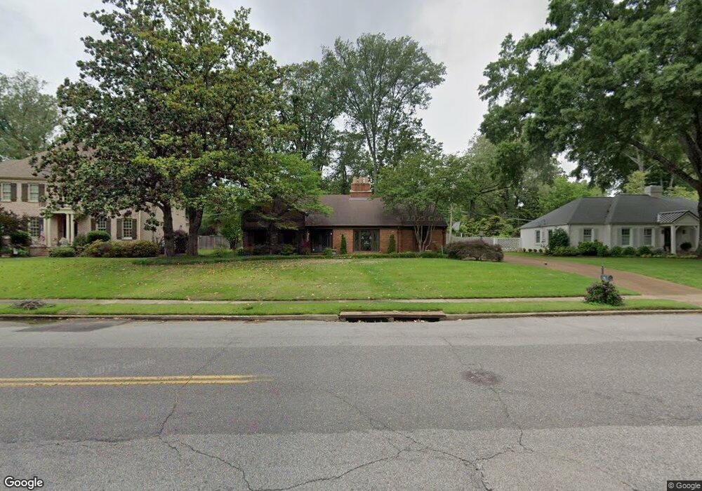
This home is located at 307 S Grove Park Rd, Memphis, TN 38117 and is currently estimated at $589,275, approximately $152 per square foot. 307 S Grove Park Rd is a home located in Shelby County with nearby schools including White Station Elementary School, White Station High, and White Station Middle.
Ownership History
We collect this data history from publicly available records. To have your information removed, we recommend requesting removal directly through your county’s website.
Purchase Details
Purchase Details
Home Financials for this Owner
Home Financials are based on the most recent Mortgage that was taken out on this home.Home Values in the Area
Average Home Value in this Area
Purchase History
We collect this data history from publicly available records. To have your information removed, we recommend requesting removal directly through your county’s website.
| Date | Buyer | Sale Price | Title Company |
|---|---|---|---|
| -- | Burdette Law Firm | ||
| $330,000 | -- |
Mortgage History
We collect this data history from publicly available records. To have your information removed, we recommend requesting removal directly through your county’s website.
| Date | Status | Borrower | Loan Amount |
|---|---|---|---|
| Previous Owner | $150,000 |
Tax History
We collect this data history from publicly available records. To have your information removed, we recommend requesting removal directly through your county’s website.
| Year | Tax Paid | Tax Assessment Tax Assessment Total Assessment is a certain percentage of the fair market value that is determined by local assessors to be the total taxable value of land and additions on the property. | Land | Improvement |
|---|---|---|---|---|
| 2025 | $3,529 | $131,175 | $37,925 | $93,250 |
| 2024 | -- | $102,200 | $36,950 | $65,250 |
| 2023 | $6,226 | $102,200 | $36,950 | $65,250 |
| 2022 | $6,226 | $102,200 | $36,950 | $65,250 |
| 2021 | $2,773 | $102,200 | $36,950 | $65,250 |
| 2020 | $8,047 | $111,050 | $36,950 | $74,100 |
| 2019 | $3,549 | $111,050 | $36,950 | $74,100 |
| 2018 | $3,549 | $111,050 | $36,950 | $74,100 |
| 2017 | $3,633 | $111,050 | $36,950 | $74,100 |
| 2016 | $4,596 | $105,175 | $0 | $0 |
| 2014 | $4,596 | $105,175 | $0 | $0 |
Map
- 271 Wakefield Dr
- 311 E Cherry Cir
- 4386 W Cherry Place Dr
- 223 E Cherry Cir
- 4400 Poplar Ave Unit 21
- 199 S Grove Park Rd
- 371 W Cherry Cir
- 427 S Perkins Rd Unit 427-2
- 427 S Perkins Rd Unit 427-1
- 405 S Perkins Rd Unit 430
- 4351 Tuckahoe Rd
- 158 Grove Park Cir
- 365 Caraway Cove Unit 5A
- 154 Perkins Extension
- 399 Greenfield Rd
- 4725 Mint Dr Unit 23AL
- 4710 Gwynne Rd
- 130 Greenbriar Dr
- 4735 Mint Dr Unit 28C
- 99 Perkins Extension
- 297 S Grove Park Rd
- 317 S Grove Park Rd
- 287 S Grove Park Rd
- 327 S Grove Park Rd
- 300 S Grove Park Rd
- 320 E Cherry Cir
- 310 E Cherry Cir
- 279 S Grove Park Rd
- 284 S Grove Park Rd
- 332 S Grove Park Rd
- 339 S Grove Park Rd
- 4517 Laurelwood Dr
- 271 S Grove Park Rd
- 370 E Cherry Cir
- 290 Cherry Cir E
- 280 E Cherry Cir
- 4532 Laurelwood Dr
- 353 S Grove Park Rd
- 4529 Laurelwood Dr
- 4530 Aldersgate Rd
Ask me questions while you tour the home.