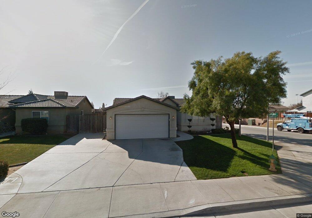
307 Sherman Peak Dr Bakersfield, CA 93308
North Country Meadows NeighborhoodEstimated Value: $337,646 - $356,000
4
Beds
2
Baths
1,322
Sq Ft
$264/Sq Ft
Est. Value
About This Home
This home is located at 307 Sherman Peak Dr, Bakersfield, CA 93308 and is currently estimated at $349,412, approximately $264 per square foot. 307 Sherman Peak Dr is a home located in Kern County with nearby schools including Wingland Elementary School, Standard Middle School, and North High School.
Ownership History
Date
Name
Owned For
Owner Type
Purchase Details
Closed on
Apr 2, 2008
Sold by
Wells Fargo Bank Na
Bought by
Ansolabehere Junemarie
Current Estimated Value
Home Financials for this Owner
Home Financials are based on the most recent Mortgage that was taken out on this home.
Original Mortgage
$101,500
Outstanding Balance
$65,129
Interest Rate
6.22%
Mortgage Type
Purchase Money Mortgage
Estimated Equity
$284,283
Purchase Details
Closed on
Dec 13, 2007
Sold by
Farley Lisa R
Bought by
Wells Fargo Bank Na and Option One Mortgage Loan Trust 2005-4 As
Purchase Details
Closed on
Feb 7, 2007
Sold by
Phillips Lisa R and Farley Lisa R
Bought by
Phillips Lisa R
Home Financials for this Owner
Home Financials are based on the most recent Mortgage that was taken out on this home.
Original Mortgage
$37,700
Interest Rate
6.19%
Mortgage Type
New Conventional
Purchase Details
Closed on
Jul 24, 2004
Sold by
Childress David J and Childress Melissa R
Bought by
Farley Lisa R
Home Financials for this Owner
Home Financials are based on the most recent Mortgage that was taken out on this home.
Original Mortgage
$159,960
Interest Rate
6.5%
Mortgage Type
New Conventional
Purchase Details
Closed on
Oct 3, 2002
Sold by
Childress David J
Bought by
Childress David J and Childress Melissa R
Home Financials for this Owner
Home Financials are based on the most recent Mortgage that was taken out on this home.
Original Mortgage
$20,000
Interest Rate
5.89%
Mortgage Type
Credit Line Revolving
Purchase Details
Closed on
May 24, 2000
Sold by
G W Homes Inc
Bought by
Childress David J
Home Financials for this Owner
Home Financials are based on the most recent Mortgage that was taken out on this home.
Original Mortgage
$96,367
Interest Rate
7.89%
Mortgage Type
FHA
Purchase Details
Closed on
Feb 28, 2000
Sold by
Dewalt Group Inc
Bought by
G W Homes Inc
Create a Home Valuation Report for This Property
The Home Valuation Report is an in-depth analysis detailing your home's value as well as a comparison with similar homes in the area
Home Values in the Area
Average Home Value in this Area
Purchase History
| Date | Buyer | Sale Price | Title Company |
|---|---|---|---|
| Ansolabehere Junemarie | $165,000 | First American Title Ins Co | |
| Wells Fargo Bank Na | $212,500 | Accommodation | |
| Phillips Lisa R | -- | Chicago Title Company | |
| Farley Lisa R | $200,000 | First American Title | |
| Childress David J | -- | Chicago Title | |
| Childress David J | $101,500 | Fidelity National Title Co | |
| G W Homes Inc | $18,500 | Fidelity National Title Co |
Source: Public Records
Mortgage History
| Date | Status | Borrower | Loan Amount |
|---|---|---|---|
| Open | Ansolabehere Junemarie | $101,500 | |
| Previous Owner | Phillips Lisa R | $37,700 | |
| Previous Owner | Farley Lisa R | $159,960 | |
| Previous Owner | Childress David J | $20,000 | |
| Previous Owner | Childress David J | $96,367 | |
| Closed | Childress David J | $4,849 | |
| Closed | Farley Lisa R | $39,990 |
Source: Public Records
Tax History
| Year | Tax Paid | Tax Assessment Tax Assessment Total Assessment is a certain percentage of the fair market value that is determined by local assessors to be the total taxable value of land and additions on the property. | Land | Improvement |
|---|---|---|---|---|
| 2025 | $3,678 | $216,715 | $78,802 | $137,913 |
| 2024 | $3,560 | $212,466 | $77,257 | $135,209 |
| 2023 | $3,560 | $208,301 | $75,743 | $132,558 |
| 2022 | $3,463 | $204,217 | $74,258 | $129,959 |
| 2021 | $3,358 | $200,213 | $72,802 | $127,411 |
| 2020 | $3,246 | $198,161 | $72,056 | $126,105 |
| 2019 | $3,127 | $188,000 | $47,000 | $141,000 |
| 2018 | $2,989 | $182,000 | $46,000 | $136,000 |
| 2017 | $2,942 | $176,000 | $44,000 | $132,000 |
| 2016 | $2,690 | $173,000 | $43,000 | $130,000 |
| 2015 | $2,643 | $170,000 | $43,000 | $127,000 |
| 2014 | $2,526 | $160,000 | $40,000 | $120,000 |
Source: Public Records
Map
Nearby Homes
- 328 Deep Creek Dr
- 238 Tanner Michael Dr
- 243 Deep Creek Dr
- 201 Star Ct
- 400 Dry Meadow Ln
- 283 Bighorn Meadow Dr
- 239 Bighorn Meadow Dr
- 2800 N Chester Ave
- 2716 N Chester Ave
- 2810 N Chester Ave
- 104 Brighton Way
- 608 Orchid Dr
- 2612 Loganberry Ct
- 407 W China Grade Loop
- 202 Sunny Meadow Dr
- 413 W China Grade Loop
- 419 W China Grade Loop
- 425 W China Grade Loop
- 325 W Pilot Ave
- 327 Douglas St
- 303 Sherman Peak Dr
- 306 Tanner Michael Dr
- 299 Sherman Peak Dr
- 302 Tanner Michael Dr
- 315 Sherman Peak Dr
- 298 Tanner Michael Dr
- 295 Sherman Peak Dr
- 318 Tanner Michael Dr
- 304 Sherman Peak Dr
- 319 Sherman Peak Dr
- 312 Sherman Peak Dr
- 294 Tanner Michael Dr
- 300 Sherman Peak Dr
- 291 Sherman Peak Dr
- 322 Tanner Michael Dr
- 316 Sherman Peak Dr
- 296 Sherman Peak Dr
- 323 Sherman Peak Dr
- 290 Tanner Michael Dr
- 320 Sherman Peak Dr
Your Personal Tour Guide
Ask me questions while you tour the home.