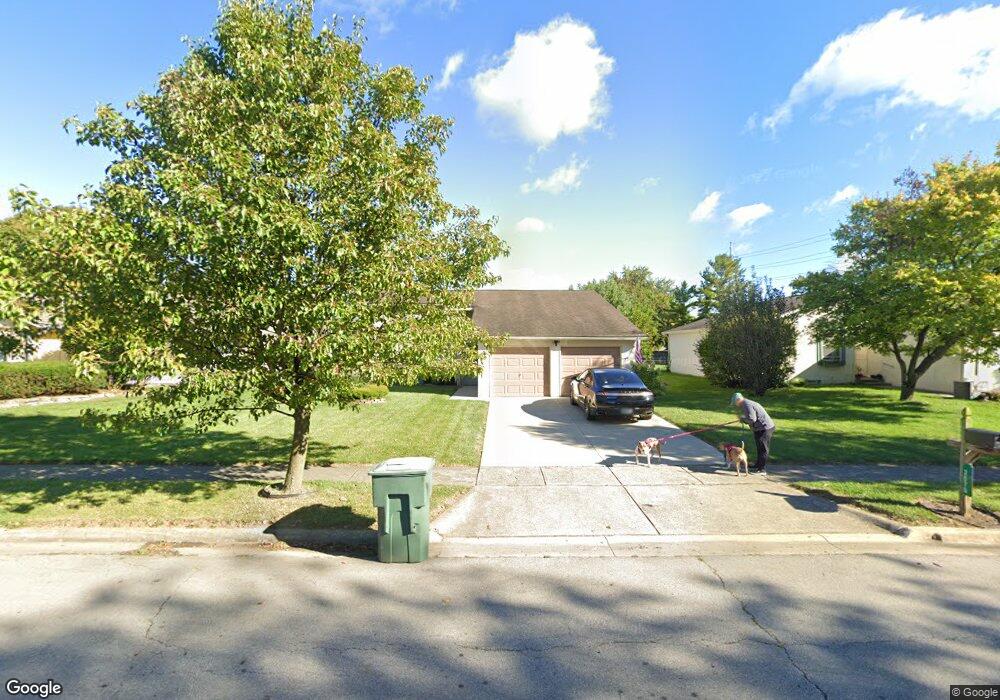
3070 Essington Dr Dublin, OH 43017
Riverside NeighborhoodEstimated Value: $332,000 - $386,000
4
Beds
2
Baths
1,730
Sq Ft
$210/Sq Ft
Est. Value
About This Home
This home is located at 3070 Essington Dr, Dublin, OH 43017 and is currently estimated at $363,325, approximately $210 per square foot. 3070 Essington Dr is a home located in Franklin County with nearby schools including Riverside Elementary School, Ann Simpson Davis Middle School, and Dublin Scioto High School.
Ownership History
Date
Name
Owned For
Owner Type
Purchase Details
Closed on
Apr 20, 2011
Sold by
Tobe Bradley P and Tobe Andrea
Bought by
Lefever Sean A
Current Estimated Value
Home Financials for this Owner
Home Financials are based on the most recent Mortgage that was taken out on this home.
Original Mortgage
$146,197
Outstanding Balance
$100,627
Interest Rate
4.75%
Mortgage Type
FHA
Estimated Equity
$262,698
Purchase Details
Closed on
Nov 22, 2002
Sold by
Pang Elaine and Pang Elaine P
Bought by
Tobe Bradley P
Home Financials for this Owner
Home Financials are based on the most recent Mortgage that was taken out on this home.
Original Mortgage
$116,400
Interest Rate
6.38%
Mortgage Type
Purchase Money Mortgage
Purchase Details
Closed on
Feb 8, 1991
Bought by
Pang Elaine
Purchase Details
Closed on
May 1, 1985
Purchase Details
Closed on
Dec 1, 1980
Create a Home Valuation Report for This Property
The Home Valuation Report is an in-depth analysis detailing your home's value as well as a comparison with similar homes in the area
Home Values in the Area
Average Home Value in this Area
Purchase History
| Date | Buyer | Sale Price | Title Company |
|---|---|---|---|
| Lefever Sean A | $150,000 | Trinity Tit | |
| Tobe Bradley P | $120,000 | Real Living Title | |
| Pang Elaine | $81,900 | -- | |
| -- | $74,000 | -- | |
| -- | $63,000 | -- |
Source: Public Records
Mortgage History
| Date | Status | Borrower | Loan Amount |
|---|---|---|---|
| Open | Lefever Sean A | $146,197 | |
| Previous Owner | Tobe Bradley P | $116,400 |
Source: Public Records
Tax History Compared to Growth
Tax History
| Year | Tax Paid | Tax Assessment Tax Assessment Total Assessment is a certain percentage of the fair market value that is determined by local assessors to be the total taxable value of land and additions on the property. | Land | Improvement |
|---|---|---|---|---|
| 2024 | $6,391 | $105,670 | $34,930 | $70,740 |
| 2023 | $6,301 | $105,665 | $34,930 | $70,735 |
| 2022 | $4,289 | $66,850 | $25,550 | $41,300 |
| 2021 | $4,359 | $66,850 | $25,550 | $41,300 |
| 2020 | $4,333 | $66,850 | $25,550 | $41,300 |
| 2019 | $3,767 | $51,450 | $19,670 | $31,780 |
| 2018 | $3,622 | $51,450 | $19,670 | $31,780 |
| 2017 | $3,478 | $51,450 | $19,670 | $31,780 |
| 2016 | $3,441 | $47,820 | $14,110 | $33,710 |
| 2015 | $3,463 | $47,820 | $14,110 | $33,710 |
| 2014 | $3,466 | $47,820 | $14,110 | $33,710 |
| 2013 | $1,676 | $45,535 | $13,440 | $32,095 |
Source: Public Records
Map
Nearby Homes
- 3087 Strathaven Ct
- 6354 Emberwood Rd
- 3185 Middleboro Way
- 2947 Talbrock Cir
- 6342 Bannister Dr
- 3107 Hamden Ct
- 2970 Black Kettle Trail
- 2951 Cranston Dr Unit 2953
- 6040 Thatcher Dr
- 3263 Scioto Ridge Rd
- 6241 Buck Ridge Rd
- 2960 Sawdust Ln Unit 2960
- 2946 Sawdust Ln
- 5850 Meadowhurst Way
- 5622 Riverside Dr
- 5753 Newgate Rd Unit 5753
- 5735 Newbank Cir Unit 303
- 5672 Barry Trace Unit 5672
- 5657 Barry Trace
- 3158 Kingsmead Trace Unit 3158
- 3062 Essington Dr
- 3078 Essington Dr
- 3086 Essington Dr
- 3054 Essington Dr
- 3071 Aleshire Dr
- 3079 Aleshire Dr
- 3094 Essington Dr
- 3087 Aleshire Dr
- 6230 Maryhurst Dr
- 3081 Essington Dr
- 3095 Aleshire Dr
- 6288 Shaftsbury Ln
- 3100 Essington Dr
- 6257 Emberwood Rd
- 3089 Essington Dr
- 6263 Emberwood Rd
- 6251 Emberwood Rd
- 6269 Emberwood Rd
- 3103 Aleshire Dr
- 6275 Emberwood Rd