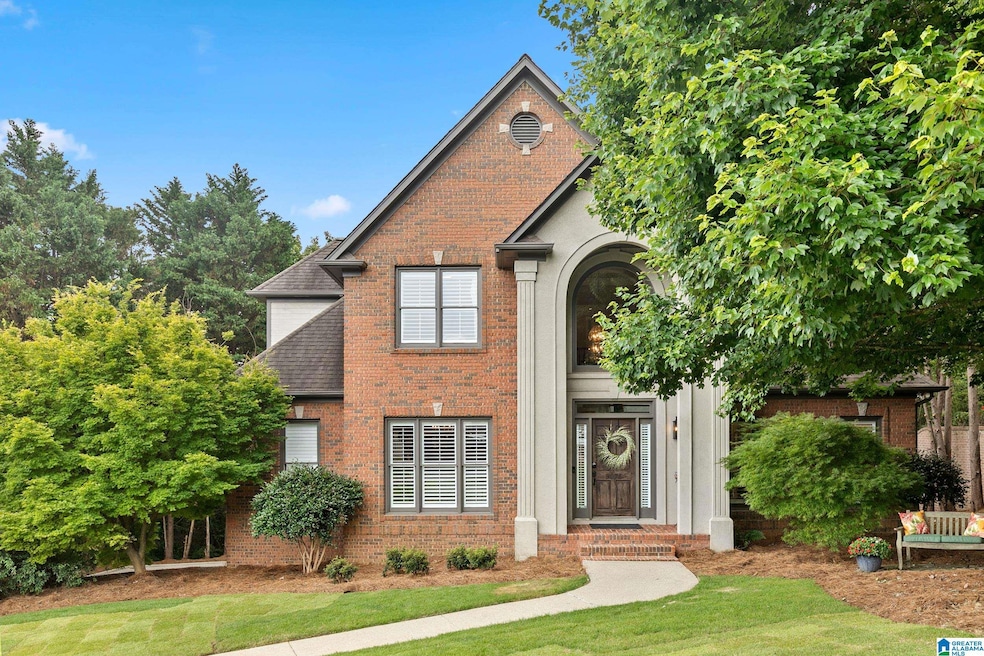
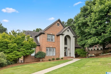
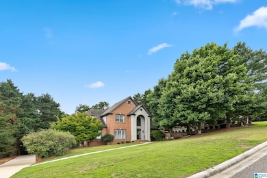
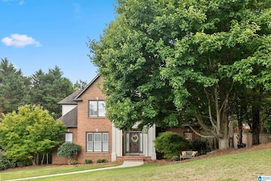
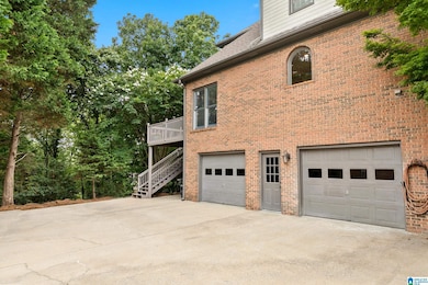

3071 Somerset Trace Birmingham, AL 35242
Estimated payment $3,789/month
Highlights
- Family Room with Fireplace
- Soaking Tub
- Recessed Lighting
- Inverness Elementary School Rated A
- Views
- Laundry Room
About This Home
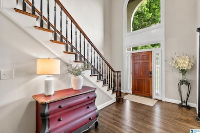
Nestled in one of the most sought-after subdivisions, this beautifully updated home invites you in through a grand two-story foyer. To your left, a formal dining room w/an elegant coffered ceiling sets the tone for upscale living. Straight ahead, the spacious family room offers a wall of windows framing tranquil views of private wooded surroundings.The kitchen is a dream, completely updated w/crisp white cabinetry, white quartz countertops, stainless appliances, new hardware, a breakfast bar, & eating area. Step out to an open-air deck, perfect for morning coffee.The master suite is your private retreat, featuring separate vanities, a walk-in shower, & garden tub. Upstairs, you’ll find 3 BR & 2 full baths, offering comfort & privacy for family or guests. The daylight basement adds even more living space, boasting a cozy den w/an updated wet bar, playroom, & full bath. Step outside to a beautiful stone patio that leads down to a serene koi pond & peaceful wooded backdrop! 2 car garage!
Home Details
Home Type
- Single Family
Est. Annual Taxes
- $2,204
Year Built
- Built in 1997
HOA Fees
- Property has a Home Owners Association
Parking
- Garage
- Basement Garage
- Side Facing Garage
Interior Spaces
- Soaking Tub
- Recessed Lighting
- Gas Fireplace
- Family Room with Fireplace
- Property Views
- Basement
Laundry
- Laundry Room
- Laundry on main level
- Washer and Electric Dryer Hookup
Utilities
- Forced Air Heating System
- Gas Water Heater
Community Details
Map
Home Values in the Area
Average Home Value in this Area
Tax History
| Year | Tax Paid | Tax Assessment Tax Assessment Total Assessment is a certain percentage of the fair market value that is determined by local assessors to be the total taxable value of land and additions on the property. | Land | Improvement |
|---|---|---|---|---|
| 2024 | $2,204 | $50,080 | $0 | $0 |
| 2023 | $2,092 | $48,480 | $0 | $0 |
| 2022 | $1,993 | $46,220 | $0 | $0 |
| 2021 | $1,831 | $42,540 | $0 | $0 |
| 2020 | $1,718 | $39,980 | $0 | $0 |
| 2019 | $1,835 | $42,640 | $0 | $0 |
| 2017 | $1,697 | $39,500 | $0 | $0 |
| 2015 | $1,617 | $37,680 | $0 | $0 |
| 2014 | $1,591 | $37,080 | $0 | $0 |
Property History
| Date | Event | Price | List to Sale | Price per Sq Ft |
|---|---|---|---|---|
| 09/29/2025 09/29/25 | Price Changed | $675,000 | -1.5% | $174 / Sq Ft |
| 08/16/2025 08/16/25 | Price Changed | $685,000 | -0.6% | $177 / Sq Ft |
| 07/15/2025 07/15/25 | Price Changed | $689,000 | -0.8% | $178 / Sq Ft |
| 07/02/2025 07/02/25 | Price Changed | $694,900 | -0.7% | $179 / Sq Ft |
| 06/11/2025 06/11/25 | For Sale | $699,900 | -- | $180 / Sq Ft |
Purchase History
| Date | Type | Sale Price | Title Company |
|---|---|---|---|
| Warranty Deed | $316,000 | -- | |
| Corporate Deed | $291,000 | -- |
Mortgage History
| Date | Status | Loan Amount | Loan Type |
|---|---|---|---|
| Open | $284,400 | No Value Available | |
| Previous Owner | $261,900 | No Value Available |
Source: Greater Alabama MLS
MLS Number: 21421771
APN: 03-9-30-0-002-001-136
Disclaimer: Certain information contained herein is derived from information provided by parties other than Homes.com. All information provided is deemed reliable, but is not guaranteed to be accurate and should be independently verified.
![]() IDX information is provided exclusively for personal, non-commercial use, and may not be used for any purpose other than to identify prospective properties consumers may be interested in purchasing. Information is deemed reliable but not guaranteed.
IDX information is provided exclusively for personal, non-commercial use, and may not be used for any purpose other than to identify prospective properties consumers may be interested in purchasing. Information is deemed reliable but not guaranteed.
- 3100 Somerset Trace
- 2552 Magnolia Place
- 2047 Stone Brook Dr
- 3213 Brook Highland Trace
- 3212 Brook Highland Trace
- 1804 Stone Brook Ln
- 1020 Townes Ct
- 2076 Brook Highland Ridge
- 5330 Meadowlark Ln
- 2080 Brook Highland Ridge
- 905 Barristers Ct
- 706 Barristers Ct
- 708 Barristers Ct Unit 708
- 181 Lenox Dr
- 710 Barristers Ct
- 4227 Ashington Dr
- 2096 Brook Highland Ridge
- 126 Lenox Dr
- 145 Brook Highland Cove
- 225 Courtside Dr
- One Eagle Ridge Dr
- 1 Meadow Dr
- 229 Lenox Ln
- 105 Lenox Dr
- 1000 Hunt Cliff Rd
- 120 Whitby Ln
- 7278 Cahaba Valley Rd
- 10 Kenley Way
- 3100 Heatherbrooke Rd
- 7273 Cahaba Valley Rd
- 1022 Windsor Dr
- 3 Greenhill Pkwy
- 1107 Windsor Square
- 201 Retreat Dr
- 241 Meadow Croft Cir Unit 41
- 27000 Crestline Rd
- 1709 Morning Sun Cir Unit 1709
- 850 Shoal Run Trail
- 101 Cahaba Park Cir
- 1208 Morning Sun Dr Unit 1208
