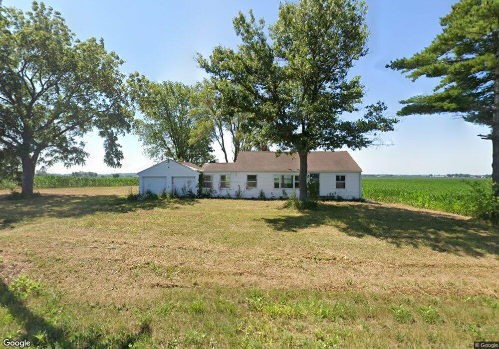
30721 Capp Rd Sterling, IL 61081
Estimated Value: $87,620 - $243,000
Studio
--
Bath
--
Sq Ft
43,560
Sq Ft Lot
About This Home
This home is located at 30721 Capp Rd, Sterling, IL 61081 and is currently estimated at $161,655. 30721 Capp Rd is a home located in Whiteside County.
Ownership History
Date
Name
Owned For
Owner Type
Purchase Details
Closed on
Sep 5, 2024
Sold by
Oltmanns Steven W
Bought by
Koster Peter
Current Estimated Value
Purchase Details
Closed on
Apr 23, 2020
Sold by
Koster David
Bought by
Oltmanns Steven W
Purchase Details
Closed on
Mar 26, 2014
Sold by
Andreas Rosalee
Bought by
Koster David
Purchase Details
Closed on
May 4, 2007
Sold by
Andreas Quinn and Andreas Loren L
Bought by
Andreas Rosalee and Andreas Loren L
Create a Home Valuation Report for This Property
The Home Valuation Report is an in-depth analysis detailing your home's value as well as a comparison with similar homes in the area
Purchase History
| Date | Buyer | Sale Price | Title Company |
|---|---|---|---|
| Koster Peter | $30,000 | None Listed On Document | |
| Oltmanns Steven W | -- | None Available | |
| Koster David | $55,500 | Nti | |
| Andreas Rosalee | $63,000 | None Available |
Source: Public Records
Tax History
| Year | Tax Paid | Tax Assessment Tax Assessment Total Assessment is a certain percentage of the fair market value that is determined by local assessors to be the total taxable value of land and additions on the property. | Land | Improvement |
|---|---|---|---|---|
| 2024 | $1,476 | $21,700 | $5,072 | $16,628 |
| 2023 | $1,376 | $20,208 | $4,723 | $15,485 |
| 2022 | $1,283 | $18,448 | $4,312 | $14,136 |
| 2021 | $1,266 | $17,844 | $4,732 | $13,112 |
| 2020 | $1,203 | $16,818 | $4,460 | $12,358 |
| 2019 | $1,135 | $15,556 | $4,125 | $11,431 |
| 2018 | $1,116 | $15,344 | $4,069 | $11,275 |
| 2017 | $1,119 | $14,877 | $3,945 | $10,932 |
| 2016 | $1,194 | $15,791 | $4,187 | $11,604 |
| 2015 | $165 | $27,553 | $3,977 | $23,576 |
| 2014 | $725 | $15,500 | $4,110 | $11,390 |
| 2013 | $165 | $27,553 | $3,977 | $23,576 |
Source: Public Records
Map
Nearby Homes
- 104 Gaston St
- 0 Pilgrim Rd Unit 22272762
- 1725 Heritage Dr
- Lot 3 Lenox Rd
- Lot 5 Lenox Rd
- Lot 4 Lenox Rd
- 0 E Lincolnway Unit MRD12284937
- 2408 16th Ave
- 2212 12th Ave
- Lot 4 E 19th St
- Lot 1 E 19th St
- 1825 18th Ave
- 905 E 21st St
- Lot 403 E 21st St
- 2912 Woodlawn Rd
- 17619 Grandview Dr
- 0000 Hubbard St
- 802 E 19th St
- 1307 Sinnissippi Park Rd
- 1275 Winn Rd
- 20021 Polo Rd
- 000 Polo Rd
- 19986 Polo Rd
- 20287 Polo Rd
- 19698 Polo Rd
- 20325 Polo Rd
- 20374 Polo Rd
- 31080 Rick Rd
- 20024 Freeport Rd
- 19398 Polo Rd
- 19331 Polo Rd
- 19877 Freeport Rd
- 20342 Freeport Rd
- 20227 Freeport Rd
- 20436 Freeport Rd
- 20436 Freeport Rd
- 19555 Freeport Rd
- 31480 Rick Rd
- 19531 Freeport Rd
- 19380 Freeport Rd
Your Personal Tour Guide
Ask me questions while you tour the home.