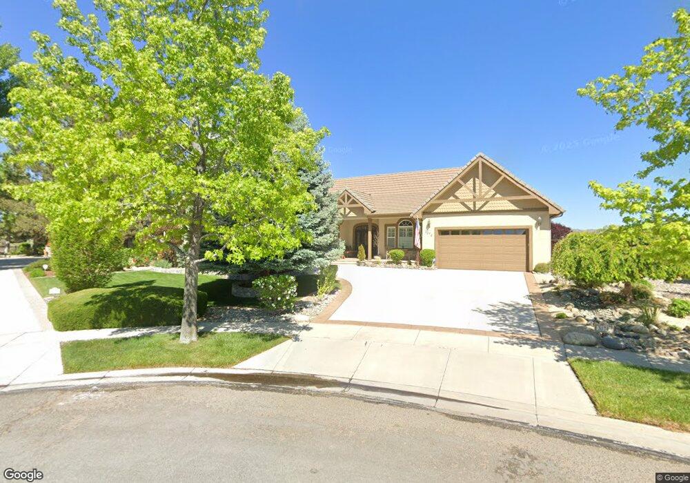
3074 Diamond Dust Ct Unit 4B Sparks, NV 89436
Wingfield Springs NeighborhoodEstimated Value: $977,770 - $1,103,000
4
Beds
4
Baths
3,264
Sq Ft
$317/Sq Ft
Est. Value
About This Home
This home is located at 3074 Diamond Dust Ct Unit 4B, Sparks, NV 89436 and is currently estimated at $1,036,193, approximately $317 per square foot. 3074 Diamond Dust Ct Unit 4B is a home located in Washoe County with nearby schools including Van Gorder Elementary School, Sky Ranch Middle School, and Spanish Springs High School.
Ownership History
Date
Name
Owned For
Owner Type
Purchase Details
Closed on
Jun 23, 2012
Sold by
Piper Robert A and Piper Barbara N
Bought by
Piper Family Revocable Trust
Current Estimated Value
Purchase Details
Closed on
Aug 29, 2011
Sold by
Henderson Alan K and Henderson Lucinda N
Bought by
Piper Robert A and Piper Barbara N
Home Financials for this Owner
Home Financials are based on the most recent Mortgage that was taken out on this home.
Original Mortgage
$275,000
Outstanding Balance
$190,108
Interest Rate
4.46%
Mortgage Type
New Conventional
Estimated Equity
$846,085
Purchase Details
Closed on
Oct 15, 2003
Sold by
Henderson Alan K and Henderson Lucinda N
Bought by
Henderson Alan K and Henderson Lucinda N
Purchase Details
Closed on
Sep 9, 2002
Sold by
Henderson Alan K and Henderson Lucinda N
Bought by
Henderson Alan K and Henderson Lucinda N
Home Financials for this Owner
Home Financials are based on the most recent Mortgage that was taken out on this home.
Original Mortgage
$480,700
Interest Rate
6.37%
Purchase Details
Closed on
Sep 27, 2001
Sold by
Henderson Alan K and Henderson Lucinda N
Bought by
Henderson Alan K and Henderson Lucinda N
Home Financials for this Owner
Home Financials are based on the most recent Mortgage that was taken out on this home.
Original Mortgage
$415,000
Interest Rate
6.91%
Purchase Details
Closed on
Jul 17, 1997
Sold by
Henderson Alan K and Henderson Lucinda N
Bought by
Henderson Alan K and Henderson Lucinda N
Purchase Details
Closed on
Oct 14, 1996
Sold by
Loeb Enterprises Ltd Liability Company
Bought by
Henderson Alan K and Henderson Lucinda N
Home Financials for this Owner
Home Financials are based on the most recent Mortgage that was taken out on this home.
Original Mortgage
$75,000
Interest Rate
7.85%
Create a Home Valuation Report for This Property
The Home Valuation Report is an in-depth analysis detailing your home's value as well as a comparison with similar homes in the area
Home Values in the Area
Average Home Value in this Area
Purchase History
| Date | Buyer | Sale Price | Title Company |
|---|---|---|---|
| Piper Family Revocable Trust | -- | None Available | |
| Piper Robert A | $497,000 | First Centennial Reno | |
| Henderson Alan K | -- | -- | |
| Henderson Alan K | -- | First American Title | |
| Henderson Alan K | -- | First American Title | |
| Henderson Alan K | -- | First American Title | |
| Henderson Alan K | -- | First American Title | |
| Henderson Alan K | -- | -- | |
| Henderson Alan K | $110,000 | First American Title Co |
Source: Public Records
Mortgage History
| Date | Status | Borrower | Loan Amount |
|---|---|---|---|
| Open | Piper Robert A | $275,000 | |
| Previous Owner | Henderson Alan K | $480,700 | |
| Previous Owner | Henderson Alan K | $415,000 | |
| Previous Owner | Henderson Alan K | $75,000 |
Source: Public Records
Tax History Compared to Growth
Tax History
| Year | Tax Paid | Tax Assessment Tax Assessment Total Assessment is a certain percentage of the fair market value that is determined by local assessors to be the total taxable value of land and additions on the property. | Land | Improvement |
|---|---|---|---|---|
| 2025 | $5,643 | $257,105 | $65,100 | $192,005 |
| 2024 | $5,643 | $256,345 | $63,000 | $193,345 |
| 2023 | $5,480 | $246,928 | $63,700 | $183,229 |
| 2022 | $5,321 | $204,501 | $51,450 | $153,051 |
| 2021 | $5,167 | $193,741 | $41,178 | $152,563 |
| 2020 | $5,015 | $194,168 | $41,178 | $152,990 |
| 2019 | $4,871 | $186,320 | $38,675 | $147,645 |
| 2018 | $4,725 | $180,027 | $35,490 | $144,537 |
| 2017 | $4,590 | $170,516 | $34,300 | $136,216 |
| 2016 | $4,474 | $168,055 | $34,300 | $133,755 |
| 2015 | $4,465 | $157,216 | $26,950 | $130,266 |
| 2014 | $4,339 | $141,065 | $18,865 | $122,200 |
| 2013 | -- | $113,696 | $15,680 | $98,016 |
Source: Public Records
Map
Nearby Homes
- 3084 Diamond Dust Ct
- 6851 Woodburn Ct
- 6853 Eagle Wing Cir
- 7315 Silver King Dr
- 7050 Island Queen Ct Unit 16
- 6726 Runnymede Dr
- 6831 Island Queen Ct Unit 16
- 6952 Cinnamon Dr
- 2861 Friar Rock Ct
- 2850 Friar Rock Ct
- 7366 Grand Island Dr
- 2880 Friar Rock Ct
- 2003 Forest Grove Ln
- 7368 S Florentine Dr
- 2850 Billie Dove Ct
- 7045 Krug Dr
- 7420 Island Queen Dr
- 3706 Deutz Dr
- 3175 Sierra Dust Ct Unit 8B
- 3706 Lepus Dr
- 3084 Diamond Dust Ct Unit 422
- 3075 Diamond Dust Ct
- 3094 Diamond Dust Ct
- 3095 Diamond Dust Ct
- 6821 Eagle Wing Dr
- 6805 Eagle Wing Dr
- 6829 Eagle Wing Dr
- 6820 Eagle Wing Cir
- 6785 Eagle Wing Dr
- 6812 Eagle Wing Dr
- 6812 Eagle Wing Cir
- 6785 Eagle Wing Cir
- 6804 Eagle Wing Dr
- 6837 Eagle Wing Cir
- 6837 Eagle Wing Dr
- 6773 Eagle Wing Dr
- 6773 Eagle Wing Cir
- 6871 Woodburn Ct
- 6861 Woodburn Ct
- 6772 Eagle Wing Dr