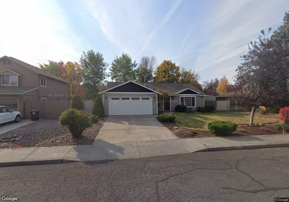
3075 Lansing Ct Bend, OR 97701
Mountain View NeighborhoodEstimated Value: $535,000 - $577,000
3
Beds
2
Baths
1,498
Sq Ft
$371/Sq Ft
Est. Value
About This Home
This home is located at 3075 Lansing Ct, Bend, OR 97701 and is currently estimated at $555,022, approximately $370 per square foot. 3075 Lansing Ct is a home located in Deschutes County with nearby schools including Buckingham Elementary School, Pilot Butte Middle School, and Mountain View Senior High School.
Ownership History
Date
Name
Owned For
Owner Type
Purchase Details
Closed on
Oct 15, 2019
Sold by
Caldentey Juan P and Caldentey Andrea L
Bought by
Lura Leslie M
Current Estimated Value
Purchase Details
Closed on
Aug 1, 2007
Sold by
Caldentey Juan P and Caldentey Andrea L
Bought by
Caldentey Juan P and Caldentey Andrea L
Purchase Details
Closed on
May 2, 2006
Sold by
Deponzi Ella O
Bought by
Caldentey Juan P and Caldentey Andrea L
Home Financials for this Owner
Home Financials are based on the most recent Mortgage that was taken out on this home.
Original Mortgage
$228,000
Interest Rate
6.29%
Mortgage Type
Fannie Mae Freddie Mac
Purchase Details
Closed on
Nov 23, 2005
Sold by
Deponzi Mark Anthony
Bought by
Deponzi Ella O and George & Ella Deponzi Trust
Create a Home Valuation Report for This Property
The Home Valuation Report is an in-depth analysis detailing your home's value as well as a comparison with similar homes in the area
Home Values in the Area
Average Home Value in this Area
Purchase History
| Date | Buyer | Sale Price | Title Company |
|---|---|---|---|
| Lura Leslie M | $390,000 | Western Title & Escrow | |
| Caldentey Juan P | -- | None Available | |
| Caldentey Juan P | $285,000 | First Amer Title Ins Co Or | |
| Deponzi Ella O | -- | -- |
Source: Public Records
Mortgage History
| Date | Status | Borrower | Loan Amount |
|---|---|---|---|
| Previous Owner | Caldentey Juan P | $228,000 |
Source: Public Records
Tax History
| Year | Tax Paid | Tax Assessment Tax Assessment Total Assessment is a certain percentage of the fair market value that is determined by local assessors to be the total taxable value of land and additions on the property. | Land | Improvement |
|---|---|---|---|---|
| 2025 | $3,590 | $212,460 | -- | -- |
| 2024 | $3,454 | $206,280 | -- | -- |
| 2023 | $3,202 | $200,280 | $0 | $0 |
| 2022 | $2,987 | $188,790 | $0 | $0 |
| 2021 | $2,992 | $183,300 | $0 | $0 |
| 2020 | $2,838 | $183,300 | $0 | $0 |
| 2019 | $2,760 | $177,970 | $0 | $0 |
| 2018 | $2,682 | $172,790 | $0 | $0 |
| 2017 | $2,603 | $167,760 | $0 | $0 |
| 2016 | $2,482 | $162,880 | $0 | $0 |
| 2015 | $2,414 | $158,140 | $0 | $0 |
| 2014 | $2,343 | $153,540 | $0 | $0 |
Source: Public Records
Map
Nearby Homes
- 3023 NE Lansing Ct
- 1310 NE Tucson Way
- 1297 NE Dawson Dr Unit A&B
- 1188 NE 27th St Unit 71
- 1188 NE 27th St Unit 19
- 1152 NE Locksley Dr
- 2934 NE Dogwood Dr
- 804 NE Providence Dr
- 21533 Stony Ridge Rd
- 2711 NE Yellow Ribbon Dr
- 21347 Starling Dr
- 21430 E Highway 20
- 940 NE Purcell Blvd
- 21503 Oconnor Way
- 21489 Oconnor Way Unit 17
- 21505 Oconnor Way
- 21517 Oconnor Way
- 21493 Oconnor Way
- 21491 Oconnor Way
- 21519 Oconnor Way
- 3075 NE Lansing Ct
- 3059 Lansing Ct
- 3059 NE Lansing Ct
- 3023 Lansing Ct
- 3015 Lansing Ct
- 3078 Lansing Ct
- 3062 Lansing Ct
- 3096 Lansing Ct
- 3110 Lansing Ct
- 3062 NE Charleston Ct
- 3020 Lansing Ct
- 3037 NE Lansing Ct
- 3037 NE Lansing Ct
- 3078 NE Lansing Ct
- 3109 NE Lansing Ct
- 3109 NE Lansing Ct
- 3044 NE Charleston Ct
- 3076 NE Charleston Ct
- 3096 NE Lansing Ct
- 3044 NE Lansing Ct
Your Personal Tour Guide
Ask me questions while you tour the home.