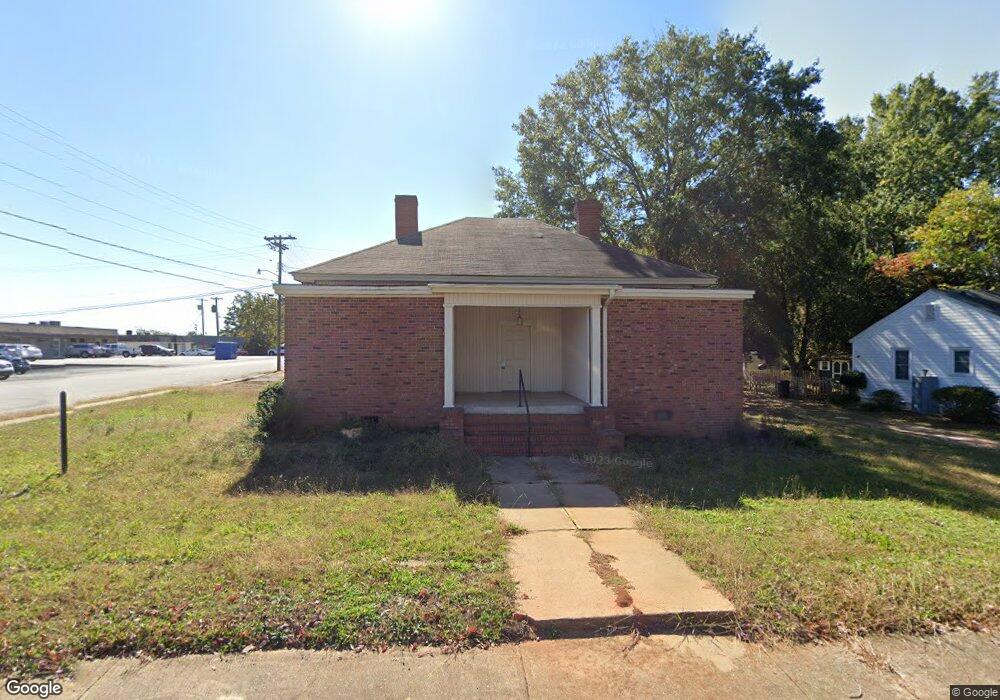
308 Broad St Anderson, SC 29621
Estimated Value: $191,846
3
Beds
--
Bath
2,164
Sq Ft
$89/Sq Ft
Est. Value
About This Home
This home is located at 308 Broad St, Anderson, SC 29621 and is currently estimated at $191,846, approximately $88 per square foot. 308 Broad St is a home located in Anderson County with nearby schools including Concord Elementary School, McCants Middle School, and T.L. Hanna High School.
Ownership History
Date
Name
Owned For
Owner Type
Purchase Details
Closed on
Aug 20, 2025
Sold by
Bryant Kevin
Bought by
Our Sweet Peas Llc
Current Estimated Value
Purchase Details
Closed on
Mar 21, 2024
Sold by
Bryant Pharmacy And Supply Inc
Bought by
Bryant Kevin
Purchase Details
Closed on
Mar 6, 2024
Sold by
Laham Hassan
Bought by
Bryant Pharmacy And Supply Inc
Purchase Details
Closed on
Aug 25, 2020
Sold by
Smith Kathleen S
Bought by
Elder Carcline
Purchase Details
Closed on
Mar 7, 2019
Sold by
Kordonowy Caroline Lee L
Bought by
Laham Hassan
Create a Home Valuation Report for This Property
The Home Valuation Report is an in-depth analysis detailing your home's value as well as a comparison with similar homes in the area
Home Values in the Area
Average Home Value in this Area
Purchase History
| Date | Buyer | Sale Price | Title Company |
|---|---|---|---|
| Our Sweet Peas Llc | -- | None Listed On Document | |
| Bryant Kevin | -- | None Listed On Document | |
| Bryant Pharmacy And Supply Inc | $185,000 | None Listed On Document | |
| Elder Carcline | -- | None Listed On Document | |
| Elder Caroline | $92,000 | None Listed On Document | |
| Elder Carcline | -- | None Available | |
| Elder Caroline | $92,000 | None Available | |
| Laham Hassan | $80,000 | None Available | |
| Laham Hassan | -- | None Available |
Source: Public Records
Tax History Compared to Growth
Tax History
| Year | Tax Paid | Tax Assessment Tax Assessment Total Assessment is a certain percentage of the fair market value that is determined by local assessors to be the total taxable value of land and additions on the property. | Land | Improvement |
|---|---|---|---|---|
| 2024 | $2,287 | $6,000 | $2,000 | $4,000 |
| 2023 | $2,287 | $6,000 | $2,000 | $4,000 |
| 2022 | $2,249 | $6,000 | $2,000 | $4,000 |
| 2021 | $2,035 | $4,760 | $1,350 | $3,410 |
| 2020 | $2,035 | $4,760 | $1,350 | $3,410 |
| 2019 | $2,783 | $6,510 | $1,350 | $5,160 |
| 2018 | $2,754 | $6,510 | $1,350 | $5,160 |
| 2017 | -- | $6,510 | $1,350 | $5,160 |
| 2016 | $2,479 | $5,920 | $1,350 | $4,570 |
| 2015 | -- | $7,570 | $1,350 | $6,220 |
| 2014 | $3,160 | $7,570 | $1,350 | $6,220 |
Source: Public Records
Map
Nearby Homes
- 211 Cater St
- 705 E Mauldin St
- 0 High Shoals Rd
- 208 Cater St
- 401 Berkshire Hill
- 406 Moultrie Square
- 220 Moultrie Square
- 707 Windsor Dr
- 2010 Boulevard Heights
- 1102 Greenacres
- 1014 Tribble St
- 2014 College Ave
- 1008 Tribble St
- 1106 Greenacres
- 228 Santorini Way
- 504 Piedmont Ave
- 703 E Calhoun St
- 110 Clinton Dr
- 108 Clinton Dr
- 1212 W End Ave
- 304 Broad St
- 302 Broad St
- 307 Broad St
- 1221 N Fant St
- 307 Broad St
- 305 Broad St
- 300 Broad St
- 303 Broad St
- 303 Brock Rd
- 301 Broad St
- 1405 Ella St
- 1300 Oakland Ave
- 1404 Oakland Ave
- 1407 Ella St
- 1209 N Fant St Unit 1208 Ella Street
- 209 Peachtree St
- 1208 Oakland Ave
- 1206 Ella St
- 209 Broad St
- 304 E Highland Ave