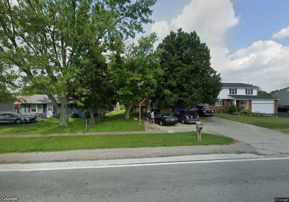
308 Hubbard Rd Galloway, OH 43119
Estimated Value: $247,000 - $283,420
3
Beds
2
Baths
1,246
Sq Ft
$211/Sq Ft
Est. Value
About This Home
This home is located at 308 Hubbard Rd, Galloway, OH 43119 and is currently estimated at $263,105, approximately $211 per square foot. 308 Hubbard Rd is a home located in Franklin County with nearby schools including Galloway Ridge Intermediate School, Alton Hall Elementary School, and Norton Middle School.
Ownership History
Date
Name
Owned For
Owner Type
Purchase Details
Closed on
Nov 29, 1999
Sold by
Flowers James P and Kessler Flowers Catherine J
Bought by
Lilly Kevin and Lilly Nanciann
Current Estimated Value
Home Financials for this Owner
Home Financials are based on the most recent Mortgage that was taken out on this home.
Original Mortgage
$76,000
Outstanding Balance
$26,051
Interest Rate
9.12%
Estimated Equity
$237,054
Purchase Details
Closed on
Jul 6, 1993
Purchase Details
Closed on
Sep 23, 1987
Create a Home Valuation Report for This Property
The Home Valuation Report is an in-depth analysis detailing your home's value as well as a comparison with similar homes in the area
Home Values in the Area
Average Home Value in this Area
Purchase History
| Date | Buyer | Sale Price | Title Company |
|---|---|---|---|
| Lilly Kevin | $95,000 | Chelsea Title Agency | |
| -- | $73,900 | -- | |
| -- | $63,900 | -- |
Source: Public Records
Mortgage History
| Date | Status | Borrower | Loan Amount |
|---|---|---|---|
| Open | Lilly Kevin | $76,000 |
Source: Public Records
Tax History Compared to Growth
Tax History
| Year | Tax Paid | Tax Assessment Tax Assessment Total Assessment is a certain percentage of the fair market value that is determined by local assessors to be the total taxable value of land and additions on the property. | Land | Improvement |
|---|---|---|---|---|
| 2024 | $11,857 | $78,400 | $20,370 | $58,030 |
| 2023 | $4,547 | $78,400 | $20,370 | $58,030 |
| 2022 | $2,770 | $45,330 | $9,170 | $36,160 |
| 2021 | $2,815 | $45,330 | $9,170 | $36,160 |
| 2020 | $2,802 | $45,330 | $9,170 | $36,160 |
| 2019 | $2,673 | $37,770 | $7,630 | $30,140 |
| 2018 | $2,561 | $37,770 | $7,630 | $30,140 |
| 2017 | $2,519 | $37,770 | $7,630 | $30,140 |
| 2016 | $2,457 | $33,640 | $5,670 | $27,970 |
| 2015 | $2,457 | $33,640 | $5,670 | $27,970 |
| 2014 | $2,459 | $33,640 | $5,670 | $27,970 |
| 2013 | $1,352 | $37,380 | $6,300 | $31,080 |
Source: Public Records
Map
Nearby Homes
- 8482 Dover Crest Ct
- 8626 Fairbrook Ave
- 287 Greenlake St
- 8595 Abbot Cove Ave
- 8527 Carbine Place
- 8747 Crestwater Dr
- 70 Riverside Dr
- 8421 Union Dr
- 8654 Cadet Dr N
- 8528 Cadence Dr
- 8520 Cadence Dr
- 10763 Southwood Rd
- 0 Dellinger Rd Unit 9 2030113
- 1280 Four Star Dr W
- 360 State Route 142 NE
- 270 State Route 142 NE
- 9519 High Free Pike
- 74 S Chester St
- 545 Trillium Dr
- 430 Trillium Dr
- 316 Hubbard Rd
- 300 Hubbard Rd
- 324 Hubbard Rd
- 317 Idlebrook Place
- 309 Idlebrook Place
- 325 Idlebrook Place
- 301 Idlebrook Place
- 284 Hubbard Rd
- 332 Hubbard Rd
- 307 Hubbard Rd
- 333 Idlebrook Place
- 323 Hubbard Rd
- 341 Idlebrook Place
- 276 Hubbard Rd
- 285 Idlebrook Place
- 8560 Renaa Ave
- 285 Hubbard Rd
- 322 Idlebrook Place
- 338 Hubbard Rd
- 308 Idlebrook Place