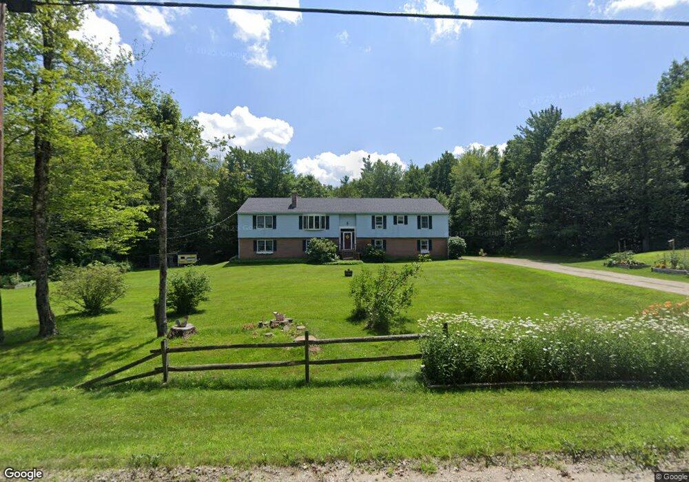
308 Thompson Rd Colrain, MA 01340
Colrain NeighborhoodEstimated Value: $327,947 - $492,000
4
Beds
3
Baths
2,400
Sq Ft
$177/Sq Ft
Est. Value
About This Home
This home is located at 308 Thompson Rd, Colrain, MA 01340 and is currently estimated at $423,987, approximately $176 per square foot. 308 Thompson Rd is a home located in Franklin County with nearby schools including Mohawk Trail Regional High School.
Ownership History
Date
Name
Owned For
Owner Type
Purchase Details
Closed on
May 28, 2004
Sold by
Brown Lorraine M and Brown Reginald A
Bought by
Johnston Brian Steven and Babineau Diane May
Current Estimated Value
Home Financials for this Owner
Home Financials are based on the most recent Mortgage that was taken out on this home.
Original Mortgage
$172,000
Interest Rate
5.88%
Mortgage Type
Purchase Money Mortgage
Create a Home Valuation Report for This Property
The Home Valuation Report is an in-depth analysis detailing your home's value as well as a comparison with similar homes in the area
Home Values in the Area
Average Home Value in this Area
Purchase History
| Date | Buyer | Sale Price | Title Company |
|---|---|---|---|
| Johnston Brian Steven | $215,000 | -- |
Source: Public Records
Mortgage History
| Date | Status | Borrower | Loan Amount |
|---|---|---|---|
| Open | Johnston Brian Steven | $164,000 | |
| Closed | Johnston Brian Steven | $172,000 | |
| Previous Owner | Johnston Brian Steven | $75,000 |
Source: Public Records
Tax History Compared to Growth
Tax History
| Year | Tax Paid | Tax Assessment Tax Assessment Total Assessment is a certain percentage of the fair market value that is determined by local assessors to be the total taxable value of land and additions on the property. | Land | Improvement |
|---|---|---|---|---|
| 2025 | $4,077 | $223,300 | $41,200 | $182,100 |
| 2024 | $4,238 | $223,300 | $41,200 | $182,100 |
| 2023 | $4,403 | $224,300 | $40,600 | $183,700 |
| 2022 | $4,530 | $221,200 | $35,800 | $185,400 |
| 2021 | $4,698 | $222,000 | $34,800 | $187,200 |
| 2020 | $4,373 | $219,400 | $34,800 | $184,600 |
| 2019 | $4,433 | $215,500 | $34,800 | $180,700 |
| 2018 | $4,394 | $217,100 | $34,800 | $182,300 |
| 2017 | $4,308 | $218,700 | $34,800 | $183,900 |
| 2016 | $3,992 | $213,700 | $34,800 | $178,900 |
| 2015 | $3,893 | $215,200 | $34,800 | $180,400 |
Source: Public Records
Map
Nearby Homes
- 61 Ed Clark Rd
- 251 Phillips Hill Rd
- 829 Pennel Hill Rd
- 1917 Stowe Mountain Rd
- 4668 Vermont 112
- 0 Jacksonville Rd
- 442 Mcmillan Rd
- 594 Massachusetts 8a
- 104 Karen Day Rd
- 6036 Jacksonville Stage Rd
- 2173 Vermont 8a
- 295 Jacksonville Rd
- 380 Smith Rd
- 1154 Vermont 8a
- 6 Chippewa Dr
- 1192 Chapel Hill Rd
- 491 Whitneyville Rd
- 139 Taylor Brook Rd
- 32 Navaho Ln
- 66 Reil Ln
- 314 Thompson Rd
- 309 Thompson Rd
- 278 Ed Clark Rd
- 267 Ed Clark Rd
- 287 Ed Clark Rd
- 0 Thompson Rd
- 294 Thompson Rd
- 274 Ed Clark Rd
- 261 Ed Clark Rd
- 303 Thompson Rd
- 285 Thompson Rd
- 238 Ed Clark Rd
- 259 Ed Clark Rd
- 282 Thompson Rd
- 301 Ed Clark Rd
- 245 Ed Clark Rd
- 271 Thompson Rd
- 63 Christian Hill Rd
- 311 Ed Clark Rd
- 82 Christian Hill Rd