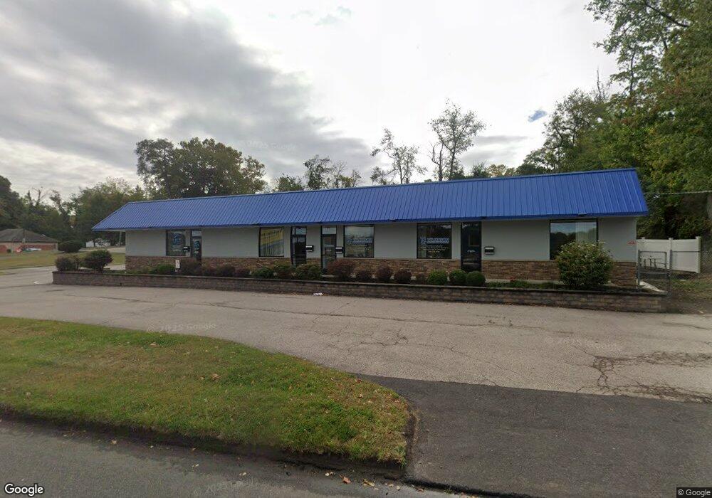
3081 Route 73 S Maple Shade, NJ 08052
Estimated Value: $1,121,035
--
Bed
--
Bath
10,000
Sq Ft
$112/Sq Ft
Est. Value
About This Home
This home is located at 3081 Route 73 S, Maple Shade, NJ 08052 and is currently estimated at $1,121,035, approximately $112 per square foot. 3081 Route 73 S is a home located in Burlington County with nearby schools including Ralph J Steinhauer Elementary School, Maude M. Wilkins Elementary School, and Howard R Yocum School.
Ownership History
Date
Name
Owned For
Owner Type
Purchase Details
Closed on
Jun 14, 2021
Sold by
Shade Point Llc
Bought by
3081 Rt 73 Llc
Current Estimated Value
Home Financials for this Owner
Home Financials are based on the most recent Mortgage that was taken out on this home.
Original Mortgage
$784,500
Outstanding Balance
$710,930
Interest Rate
2.96%
Mortgage Type
Purchase Money Mortgage
Estimated Equity
$410,105
Purchase Details
Closed on
Feb 8, 2013
Sold by
Chowaniec Stanley S and Chowaniec Florence
Bought by
Shade Point Llc
Create a Home Valuation Report for This Property
The Home Valuation Report is an in-depth analysis detailing your home's value as well as a comparison with similar homes in the area
Home Values in the Area
Average Home Value in this Area
Purchase History
| Date | Buyer | Sale Price | Title Company |
|---|---|---|---|
| 3081 Rt 73 Llc | $800,000 | Surety Title Company | |
| Shade Point Llc | $422,500 | Infinity Title Agency Inc |
Source: Public Records
Mortgage History
| Date | Status | Borrower | Loan Amount |
|---|---|---|---|
| Open | 3081 Rt 73 Llc | $784,500 |
Source: Public Records
Tax History Compared to Growth
Tax History
| Year | Tax Paid | Tax Assessment Tax Assessment Total Assessment is a certain percentage of the fair market value that is determined by local assessors to be the total taxable value of land and additions on the property. | Land | Improvement |
|---|---|---|---|---|
| 2025 | $31,127 | $820,000 | $256,200 | $563,800 |
| 2024 | $30,225 | $820,000 | $256,200 | $563,800 |
| 2023 | $30,225 | $820,000 | $256,200 | $563,800 |
| 2022 | $29,758 | $820,000 | $256,200 | $563,800 |
| 2021 | $29,471 | $820,000 | $256,200 | $563,800 |
| 2020 | $29,553 | $820,000 | $256,200 | $563,800 |
| 2019 | $28,470 | $820,000 | $256,200 | $563,800 |
| 2018 | $27,978 | $820,000 | $256,200 | $563,800 |
| 2017 | $27,650 | $820,000 | $256,200 | $563,800 |
| 2016 | $17,108 | $515,000 | $256,200 | $258,800 |
| 2015 | $16,738 | $515,000 | $256,200 | $258,800 |
| 2014 | $16,228 | $440,000 | $256,200 | $183,800 |
Source: Public Records
Map
Nearby Homes
- 218 E Germantown Ave
- 41 Orchard Ave
- 4 W Germantown Ave
- 12 Collins Ln
- 505 Greenwood Ave
- 425 Stiles Ave
- 432 N Coles Ave
- 301 N Coles Ave
- Ballad Plan at Villages at Moorestown
- Cadence Plan at Villages at Moorestown
- Odessa Plan at Villages at Moorestown
- 431 E Park Ave
- 29 W Broadway
- 3 Glacier Dr
- 124 Stiles Ave
- 104 E Laurelton Ave
- 22 Theodore Ave
- 48 N Terrace Ave
- 4 Smethwycke Dr
- 15 N Poplar Ave
- 229 5th Ave
- 270 Orchard Ave
- 225 5th Ave
- 262 Orchard Ave
- 254 Orchard Ave
- 221 5th Ave
- 246 Orchard Ave
- 219 5th Ave
- 226 5th Ave
- 238 Orchard Ave
- 209 5th Ave
- 224 5th Ave
- 222 5th Ave
- 265 Orchard Ave
- 230 Orchard Ave
- 911 Greenwood Ave
- 206 5th Ave Unit 2ND FL
- 206 5th Ave Unit 1ST FL
- 206 5th Ave
- 206 5th Ave Unit 2ND FLOOR