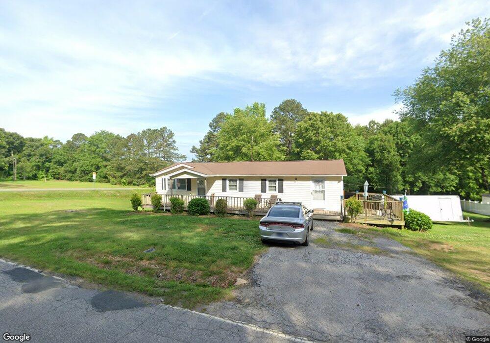
3081 Unity Church Rd Lancaster, SC 29720
Estimated Value: $145,000 - $170,000
Studio
1
Bath
1,104
Sq Ft
$141/Sq Ft
Est. Value
About This Home
This home is located at 3081 Unity Church Rd, Lancaster, SC 29720 and is currently estimated at $155,869, approximately $141 per square foot. 3081 Unity Church Rd is a home located in Lancaster County with nearby schools including Buford Elementary School, Buford Middle School, and Buford High School.
Ownership History
Date
Name
Owned For
Owner Type
Purchase Details
Closed on
Jan 24, 2020
Sold by
Glaeser Frank A and Glaeser Penny M
Bought by
Moser Jason and Moser Sharon
Current Estimated Value
Purchase Details
Closed on
Oct 20, 2010
Sold by
Klump Ronald W
Bought by
Glaeser Frank A and Glaeser Penny M
Home Financials for this Owner
Home Financials are based on the most recent Mortgage that was taken out on this home.
Original Mortgage
$68,000
Interest Rate
4.39%
Mortgage Type
Seller Take Back
Purchase Details
Closed on
Feb 9, 2005
Sold by
Klump Ronald W and Klump Judith Anne
Bought by
Klump Ronald W
Create a Home Valuation Report for This Property
The Home Valuation Report is an in-depth analysis detailing your home's value as well as a comparison with similar homes in the area
Home Values in the Area
Average Home Value in this Area
Purchase History
| Date | Buyer | Sale Price | Title Company |
|---|---|---|---|
| Moser Jason | $90,000 | Amrock | |
| Glaeser Frank A | $78,000 | -- | |
| Klump Ronald W | -- | -- |
Source: Public Records
Mortgage History
| Date | Status | Borrower | Loan Amount |
|---|---|---|---|
| Previous Owner | Glaeser Frank A | $68,000 |
Source: Public Records
Tax History
| Year | Tax Paid | Tax Assessment Tax Assessment Total Assessment is a certain percentage of the fair market value that is determined by local assessors to be the total taxable value of land and additions on the property. | Land | Improvement |
|---|---|---|---|---|
| 2024 | $540 | $3,524 | $592 | $2,932 |
| 2023 | $538 | $3,524 | $592 | $2,932 |
| 2022 | $536 | $3,524 | $592 | $2,932 |
| 2021 | $525 | $3,524 | $592 | $2,932 |
| 2020 | $1,270 | $2,616 | $592 | $2,024 |
| 2019 | $1,417 | $4,194 | $888 | $3,306 |
| 2018 | $1,363 | $4,194 | $888 | $3,306 |
| 2017 | $1,280 | $0 | $0 | $0 |
| 2016 | $1,263 | $0 | $0 | $0 |
| 2015 | $1,158 | $0 | $0 | $0 |
| 2014 | $1,158 | $0 | $0 | $0 |
| 2013 | $1,158 | $0 | $0 | $0 |
Source: Public Records
Map
Nearby Homes
- 2983 Frank Hallman Rd
- 2436 Campbell Lake Rd
- 000 Daystar Rd Unit 9
- 000 Daystar Rd Unit 4
- 000 Daystar Rd Unit 11
- 000 Daystar Rd Unit 14
- 000 Daystar Rd Unit 13
- 000 Daystar Rd Unit 7
- 000 Daystar Rd Unit 6
- 000 Daystar Rd Unit 16
- 000 Daystar Rd Unit 8
- 0 Monroe Hwy Unit CAR4213831
- 00 Old Pardue Rd
- 1005 Cane Manor Ct Unit 4
- 3236 Daystar Rd
- 1009 Cane Manor Ct Unit 3
- 1010 Cane Manor Ct Unit 8
- 1006 Cane Manor Ct Unit 7
- 1003 Cane Manor Ct Unit 5
- 3396 Thompson Rd
- 3093 Unity Church Rd
- 3103 Unity Church Rd
- 3057 Unity Church Rd
- 3052 Unity Church Rd
- 3040 Unity Church Rd
- 3123 Unity Church Rd
- 2780 Neill Rd
- 3143 Unity Church Rd
- 3023 Unity Church Rd
- 2762 Neill Rd
- 2546 Shiloh Unity Rd
- 2669 Shiloh Unity Rd
- 2742 Neill Rd
- 2747 Neill Rd
- 2741 Neill Rd
- 3162 Unity Church Rd
- 2728 Neill Rd
- 2492 State Road S-29-444
- 2472 Dudley Steele Rd
- 2485 Shiloh Unity Rd