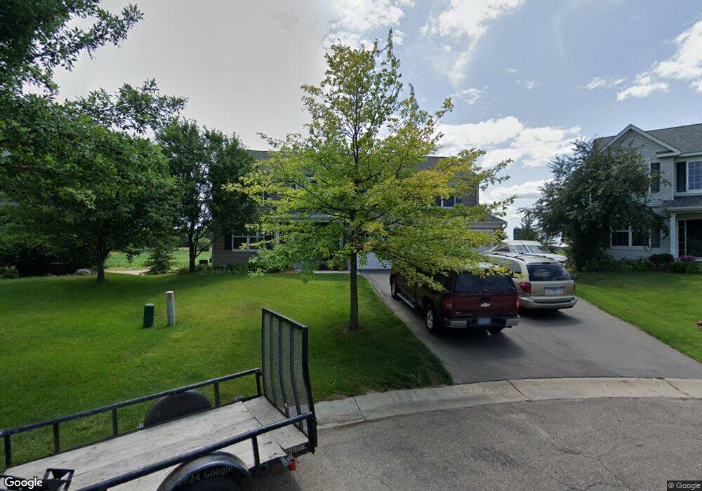
3082 Bluegrass Rd Chaska, MN 55318
Estimated Value: $574,831 - $657,000
4
Beds
4
Baths
3,067
Sq Ft
$203/Sq Ft
Est. Value
About This Home
This home is located at 3082 Bluegrass Rd, Chaska, MN 55318 and is currently estimated at $622,958, approximately $203 per square foot. 3082 Bluegrass Rd is a home located in Carver County with nearby schools including Jonathan Elementary School, Chaska Middle School East, and Chaska High School.
Ownership History
Date
Name
Owned For
Owner Type
Purchase Details
Closed on
Feb 11, 2011
Sold by
Federal Home Loan Mortgage Corporation
Bought by
Trost Evelyn D
Current Estimated Value
Home Financials for this Owner
Home Financials are based on the most recent Mortgage that was taken out on this home.
Original Mortgage
$263,057
Interest Rate
4.75%
Mortgage Type
FHA
Purchase Details
Closed on
Aug 11, 2003
Sold by
The Ryland Group Inc
Bought by
Light Charmaine and Light Fitzgerald
Create a Home Valuation Report for This Property
The Home Valuation Report is an in-depth analysis detailing your home's value as well as a comparison with similar homes in the area
Home Values in the Area
Average Home Value in this Area
Purchase History
| Date | Buyer | Sale Price | Title Company |
|---|---|---|---|
| Trost Evelyn D | $269,900 | -- | |
| Light Charmaine | $332,085 | -- |
Source: Public Records
Mortgage History
| Date | Status | Borrower | Loan Amount |
|---|---|---|---|
| Previous Owner | Trost Evelyn D | $263,057 |
Source: Public Records
Tax History
| Year | Tax Paid | Tax Assessment Tax Assessment Total Assessment is a certain percentage of the fair market value that is determined by local assessors to be the total taxable value of land and additions on the property. | Land | Improvement |
|---|---|---|---|---|
| 2025 | $6,238 | $535,600 | $95,000 | $440,600 |
| 2024 | $5,954 | $516,200 | $95,000 | $421,200 |
| 2023 | $5,590 | $506,500 | $95,000 | $411,500 |
| 2022 | $5,130 | $497,500 | $86,000 | $411,500 |
| 2021 | $4,826 | $398,400 | $66,300 | $332,100 |
| 2020 | $4,856 | $397,900 | $66,300 | $331,600 |
| 2019 | $4,780 | $373,800 | $63,200 | $310,600 |
| 2018 | $4,824 | $373,800 | $63,200 | $310,600 |
| 2017 | $4,862 | $373,100 | $63,200 | $309,900 |
| 2016 | $4,958 | $360,000 | $0 | $0 |
| 2015 | $4,794 | $357,400 | $0 | $0 |
| 2014 | $4,794 | $332,400 | $0 | $0 |
Source: Public Records
Map
Nearby Homes
- 3163 Clover Ridge Dr
- 3159 Clover Ridge Dr
- 10010 Corral Way
- 3141 Clover Ridge Dr
- 3139 Clover Ridge Dr
- 1741 Oak Creek Pass
- 10125 Corral Way
- 3115 Clover Ridge Dr
- 1737 Oak Creek Pass
- 1646 Isabella Pkwy
- 1732 Oak Creek Pass
- 1733 Oak Creek Pass
- 1728 Oak Creek Pass
- 1729 Oak Creek Pass
- 1634 Oak Creek Dr
- 1724 Oak Creek Pass
- 1725 Oak Creek Pass
- 1720 Oak Creek Pass
- 5405 Gestach Ln
- 5385 Gestach Ln
- 3083 Bluegrass Rd
- 3088 Bluegrass Rd
- 3089 Bluegrass Rd
- 3094 Bluegrass Rd
- 3095 Bluegrass Rd
- 3100 Bluegrass Rd
- 3101 Bluegrass Rd
- 3104 Bluegrass Rd
- 3124 Mulligan Ln
- 3105 Bluegrass Rd
- 3110 Bluegrass Rd
- 3111 Bluegrass Rd
- 3116 Bluegrass Rd
- 3130 Mulligan Ln
- 3123 Mulligan Ln
- 3136 Mulligan Ln
- 3117 Bluegrass Rd
- 3129 Mulligan Ln
- 3144 Mulligan Ln
- 2902 Hilltop Dr
Your Personal Tour Guide
Ask me questions while you tour the home.