Estimated Value: $76,000 - $149,000
3
Beds
1
Bath
1,276
Sq Ft
$94/Sq Ft
Est. Value
About This Home
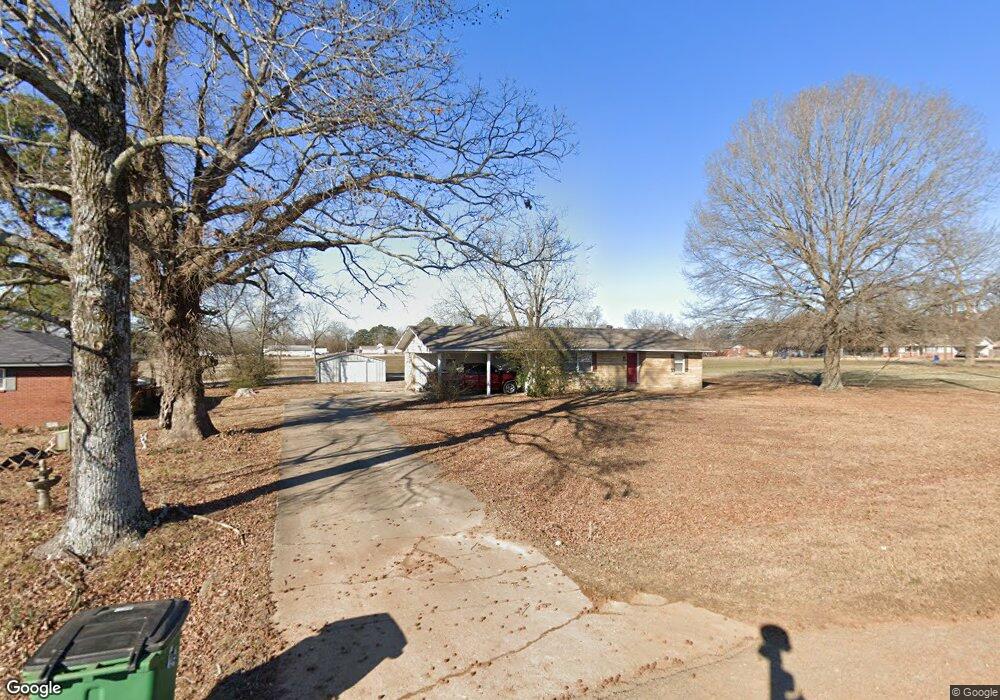
This home is located at 3084 Highway 31 S, Beebe, AR 72012 and is currently estimated at $119,996, approximately $94 per square foot. 3084 Highway 31 S is a home located in White County with nearby schools including Beebe Elementary School, Beebe Middle School, and Beebe Junior High School.
Ownership History
Date
Name
Owned For
Owner Type
Purchase Details
Closed on
Oct 31, 2017
Sold by
Castlerock 2017 Llc
Bought by
Skarda Scott Vencil and Skarda Deborah Ruth
Current Estimated Value
Purchase Details
Closed on
Jul 12, 2017
Sold by
Midfirst Bank
Bought by
Castlerock 2017 Llc
Purchase Details
Closed on
Nov 7, 2007
Sold by
Poulnott Charles H
Bought by
Midfirst Bank
Purchase Details
Closed on
Mar 14, 1997
Bought by
Poulnott Charles
Purchase Details
Closed on
Aug 15, 1996
Bought by
Hardesty Michael O and Hardesty Deborah
Purchase Details
Closed on
Mar 1, 1994
Bought by
Lewallen Mary K
Create a Home Valuation Report for This Property
The Home Valuation Report is an in-depth analysis detailing your home's value as well as a comparison with similar homes in the area
Purchase History
| Date | Buyer | Sale Price | Title Company |
|---|---|---|---|
| Skarda Scott Vencil | $39,000 | Professional Land Title Comp | |
| Castlerock 2017 Llc | $26,000 | None Available | |
| Midfirst Bank | $34,582 | None Available | |
| Poulnott Charles | $48,000 | -- | |
| Hardesty Michael O | $45,000 | -- | |
| Lewallen Mary K | -- | -- |
Source: Public Records
Tax History
| Year | Tax Paid | Tax Assessment Tax Assessment Total Assessment is a certain percentage of the fair market value that is determined by local assessors to be the total taxable value of land and additions on the property. | Land | Improvement |
|---|---|---|---|---|
| 2025 | $677 | $15,930 | $5,300 | $10,630 |
| 2024 | $677 | $15,930 | $5,300 | $10,630 |
| 2023 | $677 | $15,930 | $5,300 | $10,630 |
| 2022 | $677 | $15,930 | $5,300 | $10,630 |
| 2021 | $677 | $15,930 | $5,300 | $10,630 |
| 2020 | $626 | $14,720 | $3,200 | $11,520 |
| 2019 | $626 | $14,720 | $3,200 | $11,520 |
| 2018 | $626 | $14,720 | $3,200 | $11,520 |
| 2017 | $584 | $14,720 | $3,200 | $11,520 |
| 2016 | $584 | $13,740 | $3,200 | $10,540 |
| 2015 | $531 | $12,490 | $1,070 | $11,420 |
| 2014 | $531 | $12,490 | $1,070 | $11,420 |
Source: Public Records
Map
Nearby Homes
- 110 W Alabama St
- 616 S Elm St
- 421 S Cherry St
- 101 Lloyd Henderson Rd
- 111 Lloyd Henderson Rd
- 930 S Fir St
- 932 S Fir St
- 934 S Fir St
- 00 E Florida St
- 108 Baldwin Dr
- 155 Lloyd Henderson Rd
- 105 Powder River Dr
- 109 Powder River Dr
- 113 E Florida St
- 00 S Apple St
- 106 E Georgia St
- 204 S Apple St
- 202 S Apple St
- 206 N Elm St
- 204 S Holly St
- S Highway 31
- 3086 Highway 31 S
- 162 Clinton Cir
- 160 Clinton Cir
- 102 Clinton Cir
- 202 Alexander Dr
- 158 Clinton Cir
- 104 Clinton Cir
- 147 Clinton Cir
- 102 Alabama St
- 106 Clinton Cir
- 204 Alexander Dr
- 156 Clinton Cir
- 3096 Highway 31 S Unit B
- 106 Alabama St
- 145 Clinton Cir
- 0 Alabama St Unit 15027581
- 108 Alabama St
- 108 Clinton Cir
- 154 Clinton Cir
Your Personal Tour Guide
Ask me questions while you tour the home.