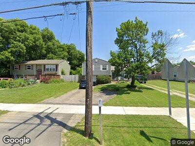
3084 Parsons Ave Columbus, OH 43207
Far South NeighborhoodEstimated Value: $174,000 - $215,000
3
Beds
2
Baths
1,000
Sq Ft
$194/Sq Ft
Est. Value
About This Home
This home is located at 3084 Parsons Ave, Columbus, OH 43207 and is currently estimated at $193,692, approximately $193 per square foot. 3084 Parsons Ave is a home located in Franklin County with nearby schools including Parsons Elementary School, Buckeye Middle School, and Marion-Franklin High School.
Ownership History
Date
Name
Owned For
Owner Type
Purchase Details
Closed on
Oct 15, 2007
Sold by
Eric D Martineau Co Lpa
Bought by
Hott Carl W and Hott Linda S
Current Estimated Value
Purchase Details
Closed on
Sep 12, 1978
Bought by
Hott Carl W
Create a Home Valuation Report for This Property
The Home Valuation Report is an in-depth analysis detailing your home's value as well as a comparison with similar homes in the area
Home Values in the Area
Average Home Value in this Area
Purchase History
| Date | Buyer | Sale Price | Title Company |
|---|---|---|---|
| Hott Carl W | -- | Attorney | |
| Eric D Martineau Co Lpa | -- | Attorney | |
| Hott Carl W | $39,000 | -- |
Source: Public Records
Mortgage History
| Date | Status | Borrower | Loan Amount |
|---|---|---|---|
| Open | Hott Linda S | $50,000 | |
| Open | Hensley Steven E | $136,620 | |
| Previous Owner | Hott Carl W | $64,999 | |
| Previous Owner | Hott Carl W | $10,213 | |
| Previous Owner | Hott Carl W | $66,000 |
Source: Public Records
Tax History Compared to Growth
Tax History
| Year | Tax Paid | Tax Assessment Tax Assessment Total Assessment is a certain percentage of the fair market value that is determined by local assessors to be the total taxable value of land and additions on the property. | Land | Improvement |
|---|---|---|---|---|
| 2024 | $2,600 | $67,730 | $18,760 | $48,970 |
| 2023 | $2,595 | $67,725 | $18,760 | $48,965 |
| 2022 | $1,449 | $36,690 | $11,870 | $24,820 |
| 2021 | $1,452 | $36,690 | $11,870 | $24,820 |
| 2020 | $1,454 | $36,690 | $11,870 | $24,820 |
| 2019 | $1,412 | $32,030 | $10,330 | $21,700 |
| 2018 | $1,382 | $32,030 | $10,330 | $21,700 |
| 2017 | $1,452 | $32,030 | $10,330 | $21,700 |
| 2016 | $1,493 | $31,290 | $5,810 | $25,480 |
| 2015 | $1,355 | $31,290 | $5,810 | $25,480 |
| 2014 | $1,359 | $31,290 | $5,810 | $25,480 |
| 2013 | $719 | $32,935 | $6,125 | $26,810 |
Source: Public Records
Map
Nearby Homes
- 3070 Parsons Ave
- 3128 Parsons Ave
- 3161 Lewis Rd
- 0 F Ave Unit 224036459
- 3197 E Ave
- 1633-1635 E Greenway Ave
- 273 E Alcott Rd
- 2852 Thorndale Ave
- 82 Schryver Rd
- 0 Thorndale Ave
- 78 Phelps Rd
- 780 Basswood Rd
- 2811 Dolby Dr
- 623 Colton Rd
- 167 Betz Rd
- 125 Betz Rd
- 2806 Claude Dr
- 115 W Castle Rd
- 82 Delray Rd
- 245 Marilla Rd
- 3084 Parsons Ave
- 3080 Parsons Ave
- 3092 Parsons Ave
- 3089 Lewis Rd
- 3085 Lewis Rd
- 3093 Lewis Rd
- 325 Southgate Dr
- 3075 Lewis Rd
- 3091 Parsons Ave
- 3100 Parsons Ave
- 3093 Parsons Ave
- 3101 Lewis Rd
- 3095 Parsons Ave
- 3104 Parsons Ave
- 3105 Lewis Rd
- 3097 Parsons Ave
- 2993 Parsons Ave
- 3109 Lewis Rd
- 3108 Parsons Ave
- 3099 Parsons Ave