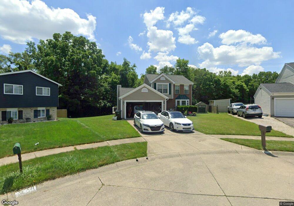
3087 Pittston Ct Columbus, OH 43231
Brandywine NeighborhoodEstimated Value: $288,000 - $316,000
3
Beds
3
Baths
1,419
Sq Ft
$215/Sq Ft
Est. Value
About This Home
This home is located at 3087 Pittston Ct, Columbus, OH 43231 and is currently estimated at $305,182, approximately $215 per square foot. 3087 Pittston Ct is a home located in Franklin County with nearby schools including Mark Twain Elementary School, Walnut Springs Middle School, and Westerville South High School.
Ownership History
Date
Name
Owned For
Owner Type
Purchase Details
Closed on
Aug 12, 2005
Sold by
Dexter Thomas L and Dexter Deborah L
Bought by
Bolton Vernon L
Current Estimated Value
Home Financials for this Owner
Home Financials are based on the most recent Mortgage that was taken out on this home.
Original Mortgage
$109,800
Outstanding Balance
$58,677
Interest Rate
5.93%
Mortgage Type
Fannie Mae Freddie Mac
Estimated Equity
$246,505
Purchase Details
Closed on
Nov 30, 1993
Bought by
Dexter Ii Thomas L
Purchase Details
Closed on
Jun 13, 1990
Create a Home Valuation Report for This Property
The Home Valuation Report is an in-depth analysis detailing your home's value as well as a comparison with similar homes in the area
Home Values in the Area
Average Home Value in this Area
Purchase History
| Date | Buyer | Sale Price | Title Company |
|---|---|---|---|
| Bolton Vernon L | $122,000 | Talon Group | |
| Dexter Ii Thomas L | -- | -- | |
| -- | $85,300 | -- |
Source: Public Records
Mortgage History
| Date | Status | Borrower | Loan Amount |
|---|---|---|---|
| Open | Bolton Vernon L | $109,800 |
Source: Public Records
Tax History Compared to Growth
Tax History
| Year | Tax Paid | Tax Assessment Tax Assessment Total Assessment is a certain percentage of the fair market value that is determined by local assessors to be the total taxable value of land and additions on the property. | Land | Improvement |
|---|---|---|---|---|
| 2024 | $4,448 | $89,250 | $21,140 | $68,110 |
| 2023 | $4,340 | $89,250 | $21,140 | $68,110 |
| 2022 | $3,503 | $54,990 | $10,960 | $44,030 |
| 2021 | $3,538 | $54,990 | $10,960 | $44,030 |
| 2020 | $3,526 | $54,990 | $10,960 | $44,030 |
| 2019 | $2,954 | $43,960 | $8,750 | $35,210 |
| 2018 | $2,886 | $43,960 | $8,750 | $35,210 |
| 2017 | $2,887 | $43,960 | $8,750 | $35,210 |
| 2016 | $2,879 | $39,870 | $9,030 | $30,840 |
| 2015 | $2,885 | $39,870 | $9,030 | $30,840 |
| 2014 | $2,888 | $39,870 | $9,030 | $30,840 |
| 2013 | $1,580 | $43,785 | $9,520 | $34,265 |
Source: Public Records
Map
Nearby Homes
- 3098 Bennington Ave
- 3010 Bennington Ave
- 3084 Omega Dr
- 3378 Trail Lane Ct
- 3392 Trail Lane Ct
- 2977 Ironstone Dr
- 2974 Footloose Dr
- 2903 Kilbourne Ave
- 4748 Black Sycamore Dr
- 2901 Footloose Dr
- 3491 Headford Ct
- 4279 Morsetown Ct
- 2691 Northwold Rd
- 4266 Morsetown Ct
- 4246 Morsetowne Ct E
- 4444 Trindel Way
- 4948 Black Sycamore Dr
- 0 Ashbury Rd
- 3577 Frenchpark Dr
- 4169 Commander Ln
- 3079 Pittston Ct
- 3095 Pittston Ct
- 3037 Bretton Woods Dr
- 3031 Bretton Woods Dr
- 3100 Pittston Ct
- 4565 Fairgrove Rd
- 4561 Fairgrove Rd
- 4569 Fairgrove Rd
- 4557 Fairgrove Rd
- 4573 Fairgrove Rd
- 3084 Pittston Ct
- 3092 Pittston Ct
- 3025 Bretton Woods Dr
- 4553 Fairgrove Rd
- 3053 Bretton Woods Dr
- 4577 Fairgrove Rd
- 4581 Fairgrove Rd
- 4549 Fairgrove Rd
- 3019 Bretton Woods Dr
- 3040 Bretton Woods Dr