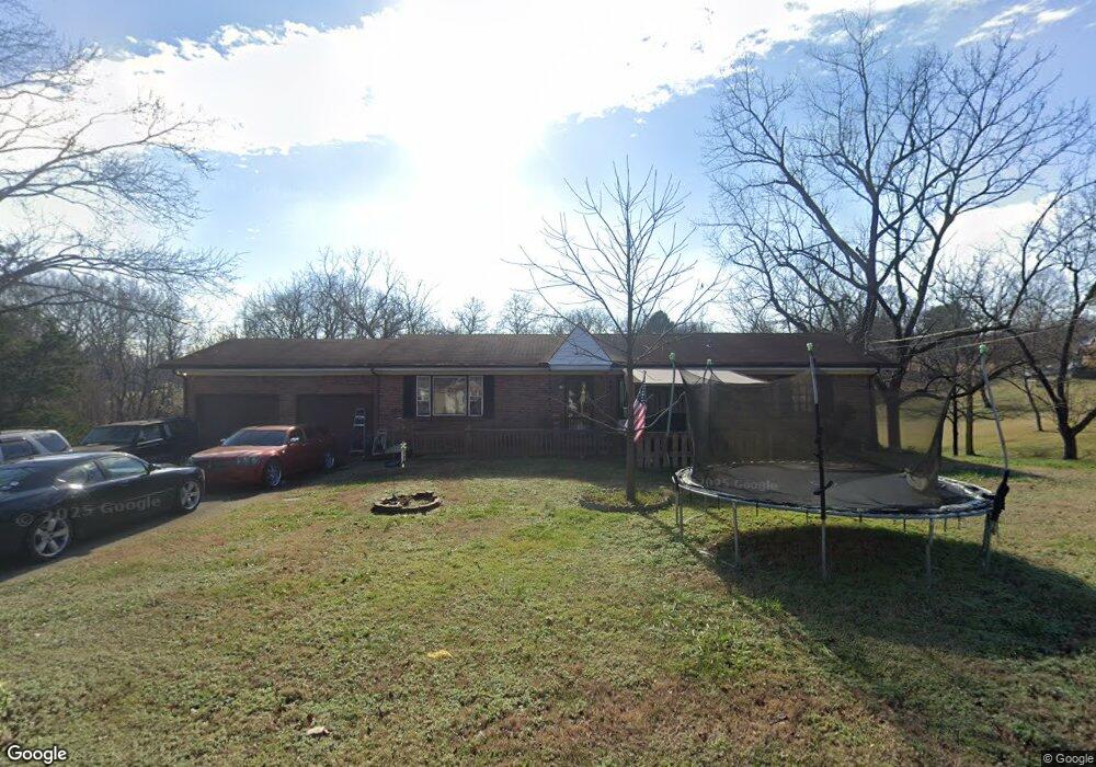
309 Forrest Lawn Ct Mount Juliet, TN 37122
Estimated Value: $372,474 - $401,000
--
Bed
2
Baths
1,425
Sq Ft
$271/Sq Ft
Est. Value
About This Home
This home is located at 309 Forrest Lawn Ct, Mount Juliet, TN 37122 and is currently estimated at $386,869, approximately $271 per square foot. 309 Forrest Lawn Ct is a home located in Wilson County with nearby schools including Mt. Juliet Elementary School, Mt. Juliet Middle School, and Green Hill High School.
Ownership History
Date
Name
Owned For
Owner Type
Purchase Details
Closed on
Feb 10, 2012
Sold by
Seals Debbie
Bought by
Austin Betty S and Baxter Gerl
Current Estimated Value
Purchase Details
Closed on
Jun 25, 2009
Sold by
Powell Jennifer L
Bought by
Deals Debbie
Purchase Details
Closed on
Jun 29, 2006
Sold by
Powell Paul B
Bought by
Powell Jennifer L
Purchase Details
Closed on
Oct 1, 2002
Sold by
Thomason Lisa A and Thomason Timothy L
Bought by
Powell Paul B
Home Financials for this Owner
Home Financials are based on the most recent Mortgage that was taken out on this home.
Original Mortgage
$110,000
Interest Rate
6.21%
Purchase Details
Closed on
Sep 23, 1996
Bought by
Thomason Lisa A and Thomason Timothy Thomason
Purchase Details
Closed on
Aug 23, 1977
Bought by
Raymer Paul and Raymer Frances
Create a Home Valuation Report for This Property
The Home Valuation Report is an in-depth analysis detailing your home's value as well as a comparison with similar homes in the area
Home Values in the Area
Average Home Value in this Area
Purchase History
| Date | Buyer | Sale Price | Title Company |
|---|---|---|---|
| Austin Betty S | $147,400 | -- | |
| Deals Debbie | -- | -- | |
| Powell Jennifer L | -- | -- | |
| Powell Paul B | $110,061 | -- | |
| Thomason Lisa A | $112,900 | -- | |
| Raymer Paul | -- | -- |
Source: Public Records
Mortgage History
| Date | Status | Borrower | Loan Amount |
|---|---|---|---|
| Previous Owner | Raymer Paul | $110,000 |
Source: Public Records
Tax History Compared to Growth
Tax History
| Year | Tax Paid | Tax Assessment Tax Assessment Total Assessment is a certain percentage of the fair market value that is determined by local assessors to be the total taxable value of land and additions on the property. | Land | Improvement |
|---|---|---|---|---|
| 2024 | $1,150 | $60,250 | $18,750 | $41,500 |
| 2022 | $1,150 | $60,250 | $18,750 | $41,500 |
| 2021 | $1,150 | $60,250 | $18,750 | $41,500 |
| 2020 | $946 | $60,250 | $18,750 | $41,500 |
| 2019 | $946 | $37,550 | $12,800 | $24,750 |
| 2018 | $946 | $37,550 | $12,800 | $24,750 |
| 2017 | $946 | $37,550 | $12,800 | $24,750 |
| 2016 | $946 | $37,550 | $12,800 | $24,750 |
| 2015 | $965 | $37,550 | $12,800 | $24,750 |
| 2014 | $885 | $34,435 | $0 | $0 |
Source: Public Records
Map
Nearby Homes
- 1229 Mount Vernon Ln
- 604 Georgian Way
- 202 Channell Ct
- 2006 Raven Crossing
- 1001 Livingstone Ln
- 106 Crosby Dr
- 108 Crosby Dr
- 110 Crosby Dr
- 102 Crosby Dr
- 201 Channell Ct
- 203 Channell Ct
- 205 Channell Ct
- 105 Crosby Dr
- 1034 Livingstone Ln
- 2202 Dinah Ct
- 50 Rankin Dr
- 1408 Tasmania Ct
- 3005 Nichols Vale
- 3013 Melbourne Ct E
- 503 Montrose Dr
- 307 Forrest Lawn Ct
- 301 Forrest Lawn Ct
- 205 Forrest Lawn Dr
- 305 Forrest Lawn Ct
- 303 Forrest Lawn Ct
- 207 Forrest Lawn Dr
- 203 Forrest Lawn Dr
- 209 Forrest Lawn Dr
- 305 Tanglewood Dr
- 306 Woodlawn Dr
- 304 Woodlawn Dr
- 105 Hickory Trace
- 206 Forrest Lawn Dr
- 204 Forrest Lawn Dr
- 107 Hickory Trace
- 302 Woodlawn Dr
- 109 Hickory Trace
- 400 Woodlawn Dr
- 111 Hickory Trace
- 211 Forrest Lawn Dr