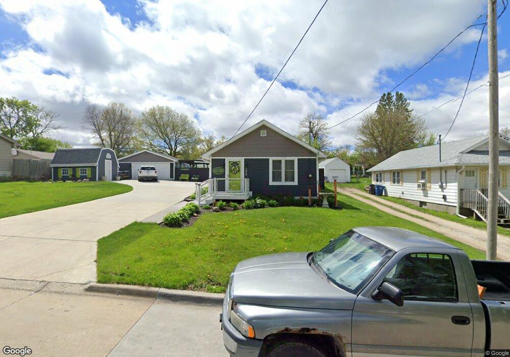
309 Hart Ave Des Moines, IA 50315
South Central DSM NeighborhoodEstimated Value: $148,000 - $161,175
1
Bed
1
Bath
612
Sq Ft
$253/Sq Ft
Est. Value
About This Home
This home is located at 309 Hart Ave, Des Moines, IA 50315 and is currently estimated at $155,044, approximately $253 per square foot. 309 Hart Ave is a home located in Polk County with nearby schools including Lovejoy Elementary School, Mccombs Middle School, and Lincoln High School.
Ownership History
Date
Name
Owned For
Owner Type
Purchase Details
Closed on
May 30, 2019
Sold by
Selsor Catherine S and Rawson Catherine S
Bought by
Rawson Catherine S and Rawson Edward D
Current Estimated Value
Purchase Details
Closed on
Dec 20, 2017
Sold by
Selsor Danny P
Bought by
Selsor Catherine S
Purchase Details
Closed on
Dec 13, 2017
Sold by
Selsor Danny P
Bought by
Selsor Catherine S
Create a Home Valuation Report for This Property
The Home Valuation Report is an in-depth analysis detailing your home's value as well as a comparison with similar homes in the area
Home Values in the Area
Average Home Value in this Area
Purchase History
| Date | Buyer | Sale Price | Title Company |
|---|---|---|---|
| Rawson Catherine S | -- | None Available | |
| Selsor Catherine S | -- | None Available | |
| Selsor Catherine S | -- | None Available |
Source: Public Records
Tax History Compared to Growth
Tax History
| Year | Tax Paid | Tax Assessment Tax Assessment Total Assessment is a certain percentage of the fair market value that is determined by local assessors to be the total taxable value of land and additions on the property. | Land | Improvement |
|---|---|---|---|---|
| 2025 | $2,562 | $176,200 | $41,200 | $135,000 |
| 2024 | $2,562 | $156,300 | $36,100 | $120,200 |
| 2023 | $2,524 | $156,300 | $36,100 | $120,200 |
| 2022 | $2,504 | $119,400 | $29,700 | $89,700 |
| 2021 | $1,940 | $119,400 | $29,700 | $89,700 |
| 2020 | $2,008 | $89,600 | $26,100 | $63,500 |
| 2019 | $1,904 | $89,600 | $26,100 | $63,500 |
| 2018 | $1,880 | $79,400 | $22,900 | $56,500 |
| 2017 | $1,728 | $79,400 | $22,900 | $56,500 |
| 2016 | $1,678 | $72,400 | $20,800 | $51,600 |
| 2015 | $1,678 | $72,400 | $20,800 | $51,600 |
| 2014 | $1,628 | $70,000 | $19,900 | $50,100 |
Source: Public Records
Map
Nearby Homes
- 313 E Payton Ave
- 401 E Wall Ave
- 217 E Payton Ave
- 433 E Payton Ave
- 5600 SE 4th St
- 439 E Porter Ave
- 613 Cummins Rd
- 5936 SW 2nd St
- 5501 S Union St
- 5814 SW 3rd St
- 303 Porter Ave
- 817 E Diehl Ave
- 6204 SW 5th St
- 5812 SW 5th St
- 801 E Hackley Ave
- 5205 SE 9th St
- 712 E Hackley Ave
- 299 Hackley Ave
- 212 Titus Ave
- 904 E Hackley Ave