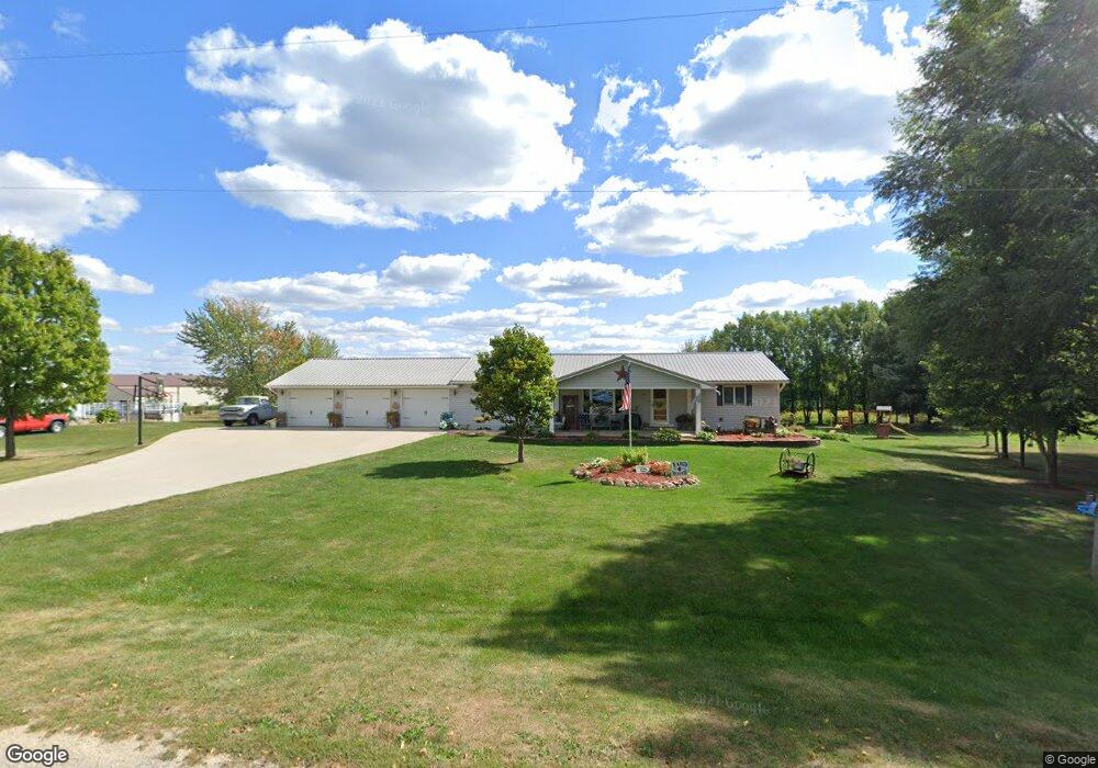
309 Maple St Center Point, IA 52213
Estimated Value: $328,000 - $502,000
5
Beds
3
Baths
3,210
Sq Ft
$123/Sq Ft
Est. Value
About This Home
This home is located at 309 Maple St, Center Point, IA 52213 and is currently estimated at $394,989, approximately $123 per square foot. 309 Maple St is a home located in Benton County with nearby schools including Center Point-Urbana Primary School, Center Point-Urbana Intermediate School, and Center Point-Urbana Middle School.
Ownership History
Date
Name
Owned For
Owner Type
Purchase Details
Closed on
May 31, 2009
Sold by
Tubbs Larry and Tubbs Amy
Bought by
Holven Nathaniel T and Holven Brooke M
Current Estimated Value
Home Financials for this Owner
Home Financials are based on the most recent Mortgage that was taken out on this home.
Original Mortgage
$164,000
Outstanding Balance
$105,772
Interest Rate
5.32%
Mortgage Type
New Conventional
Estimated Equity
$289,217
Create a Home Valuation Report for This Property
The Home Valuation Report is an in-depth analysis detailing your home's value as well as a comparison with similar homes in the area
Purchase History
| Date | Buyer | Sale Price | Title Company |
|---|---|---|---|
| Holven Nathaniel T | $205,000 | None Available |
Source: Public Records
Mortgage History
| Date | Status | Borrower | Loan Amount |
|---|---|---|---|
| Open | Holven Nathaniel T | $164,000 |
Source: Public Records
Tax History
| Year | Tax Paid | Tax Assessment Tax Assessment Total Assessment is a certain percentage of the fair market value that is determined by local assessors to be the total taxable value of land and additions on the property. | Land | Improvement |
|---|---|---|---|---|
| 2025 | $5,212 | $388,400 | $62,500 | $325,900 |
| 2024 | $5,212 | $362,500 | $55,600 | $306,900 |
| 2023 | $4,558 | $362,500 | $55,600 | $306,900 |
| 2022 | $4,516 | $278,300 | $44,500 | $233,800 |
| 2021 | $4,516 | $278,300 | $44,500 | $233,800 |
| 2020 | $3,914 | $252,300 | $31,100 | $221,200 |
| 2019 | $3,786 | $252,300 | $31,100 | $221,200 |
| 2018 | $3,674 | $238,400 | $28,400 | $210,000 |
| 2017 | $3,474 | $238,400 | $28,400 | $210,000 |
| 2016 | $3,338 | $220,200 | $25,800 | $194,400 |
| 2015 | $3,338 | $220,200 | $25,800 | $194,400 |
| 2014 | $3,618 | $237,900 | $0 | $0 |
Source: Public Records
Map
Nearby Homes
- 300 N Union Ave
- 103 North St
- 1 S Union Ave
- 207 W Main St
- 203 Center Ave
- 0 54th Street Trail
- 150 Towne Centre Dr
- 112 Shiloh Vista Ave
- 140 Towne Centre Dr
- 116 Shiloh Vista Ave
- 120 Shiloh Vista Ave
- 5358 Hutton Dr
- 0 31st Ave
- 3299 58th Street Dr
- 0 51st St Ln Unit 2600145
- 4505 Urbana Rd Unit East Parcel
- 4505 Urbana Rd
- 120 Green St
- 3090 59th Saint Trail
- 717 Pointer Cir
Your Personal Tour Guide
Ask me questions while you tour the home.