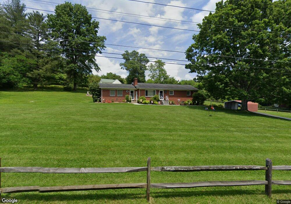
309 Raytheon Rd Bristol, TN 37620
Estimated Value: $281,942 - $346,000
4
Beds
3
Baths
2,247
Sq Ft
$140/Sq Ft
Est. Value
About This Home
This home is located at 309 Raytheon Rd, Bristol, TN 37620 and is currently estimated at $315,236, approximately $140 per square foot. 309 Raytheon Rd is a home located in Sullivan County with nearby schools including Haynesfield Elementary School, Vance Middle School, and Tennessee High School.
Ownership History
Date
Name
Owned For
Owner Type
Purchase Details
Closed on
Jul 16, 2019
Sold by
Livin Carter Wanda A
Bought by
Carter Wanda A
Current Estimated Value
Purchase Details
Closed on
Sep 13, 2005
Sold by
Carter Wanda A
Bought by
Baumgardner Campbell Ethel
Home Financials for this Owner
Home Financials are based on the most recent Mortgage that was taken out on this home.
Original Mortgage
$105,000
Outstanding Balance
$55,893
Interest Rate
5.77%
Estimated Equity
$259,343
Purchase Details
Closed on
Feb 3, 1997
Purchase Details
Closed on
Oct 9, 1995
Create a Home Valuation Report for This Property
The Home Valuation Report is an in-depth analysis detailing your home's value as well as a comparison with similar homes in the area
Home Values in the Area
Average Home Value in this Area
Purchase History
| Date | Buyer | Sale Price | Title Company |
|---|---|---|---|
| Carter Wanda A | -- | None Available | |
| Baumgardner Campbell Ethel | $140,000 | -- | |
| -- | $93,000 | -- | |
| -- | $94,000 | -- |
Source: Public Records
Mortgage History
| Date | Status | Borrower | Loan Amount |
|---|---|---|---|
| Open | -- | $105,000 |
Source: Public Records
Tax History Compared to Growth
Tax History
| Year | Tax Paid | Tax Assessment Tax Assessment Total Assessment is a certain percentage of the fair market value that is determined by local assessors to be the total taxable value of land and additions on the property. | Land | Improvement |
|---|---|---|---|---|
| 2024 | -- | $41,300 | $5,450 | $35,850 |
| 2023 | $1,814 | $41,300 | $5,450 | $35,850 |
| 2022 | $1,814 | $41,300 | $5,450 | $35,850 |
| 2021 | $1,814 | $41,300 | $5,450 | $35,850 |
| 2020 | $1,843 | $41,300 | $5,450 | $35,850 |
| 2019 | $1,843 | $38,950 | $5,450 | $33,500 |
| 2018 | $1,835 | $38,950 | $5,450 | $33,500 |
| 2017 | $1,835 | $38,950 | $5,450 | $33,500 |
| 2016 | $1,783 | $36,950 | $5,450 | $31,500 |
| 2014 | $1,683 | $36,939 | $0 | $0 |
Source: Public Records
Map
Nearby Homes
- 307 Tween Hills Rd
- 204 Johnston Ave
- 100 Martindale Rd
- 112 Holston View Dr
- 302 Martindale Rd
- 2118 King College Rd
- 403 Martindale Rd
- 201 East Rd
- 117 Carla St
- 210 Hemlock Rd
- 1837 Holston Dr
- 108 Quail Run
- 212 Hemlock Rd
- 205 Lavinder Ln
- 146 Cloudland Dr
- 305 Fieldcrest Rd
- 521 Hickory Rd
- 102 Hidden Valley Rd
- 103 Butler Dr
- 116 W Crown
- 312 Highland St
- 315 Raytheon Rd
- 311 Highland St
- 1101 Tween Hills Forest Trail
- 313 Highland St
- 310 Highland St
- 1020 Tween Hills Forest Trail
- 309 Highland St
- 1020 Tween Hills Forest Trail
- 307 Highland St
- 308 Highland St
- 1017 Tween Hills Forest Trail
- 305 Highland St
- 1021 Tween Hills Forest Trail
- 306 Highland St
- 303 Highland St
- 1015 Tween Hills Forest Trail
- 1005 Cedar Side Place
- 1013 Cedar Side Place
- 1009 Cedar Side Place