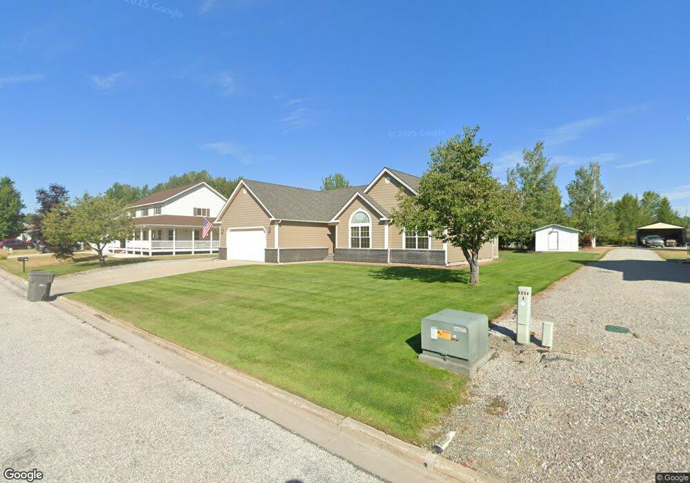
309 Upper Humbird Dr Sandpoint, ID 83864
Estimated Value: $698,000 - $793,000
3
Beds
2
Baths
1,738
Sq Ft
$419/Sq Ft
Est. Value
About This Home
This home is located at 309 Upper Humbird Dr, Sandpoint, ID 83864 and is currently estimated at $729,048, approximately $419 per square foot. 309 Upper Humbird Dr is a home located in Bonner County with nearby schools including Kootenai Elementary School, Sandpoint Middle School, and Sandpoint High School.
Ownership History
Date
Name
Owned For
Owner Type
Purchase Details
Closed on
Feb 23, 2017
Sold by
Ponsness Christina S and Wetzel Christina S
Bought by
Ponsness Samuel D and Ponsness Christina S
Current Estimated Value
Home Financials for this Owner
Home Financials are based on the most recent Mortgage that was taken out on this home.
Original Mortgage
$319,729
Outstanding Balance
$264,648
Interest Rate
4.19%
Mortgage Type
VA
Estimated Equity
$464,400
Purchase Details
Closed on
Feb 25, 2011
Sold by
Wetzel Curtis A
Bought by
Wetzel Christina S
Purchase Details
Closed on
Mar 13, 2009
Sold by
Schubarth Steve D and Schubarth Leslie F
Bought by
Wetzel Curtis A and Wetzel Christina S
Home Financials for this Owner
Home Financials are based on the most recent Mortgage that was taken out on this home.
Original Mortgage
$266,189
Interest Rate
5.03%
Mortgage Type
FHA
Create a Home Valuation Report for This Property
The Home Valuation Report is an in-depth analysis detailing your home's value as well as a comparison with similar homes in the area
Home Values in the Area
Average Home Value in this Area
Purchase History
| Date | Buyer | Sale Price | Title Company |
|---|---|---|---|
| Ponsness Samuel D | -- | First American Title Company | |
| Wetzel Christina S | -- | -- | |
| Wetzel Curtis A | -- | -- |
Source: Public Records
Mortgage History
| Date | Status | Borrower | Loan Amount |
|---|---|---|---|
| Open | Ponsness Samuel D | $319,729 | |
| Closed | Wetzel Curtis A | $266,189 |
Source: Public Records
Tax History
| Year | Tax Paid | Tax Assessment Tax Assessment Total Assessment is a certain percentage of the fair market value that is determined by local assessors to be the total taxable value of land and additions on the property. | Land | Improvement |
|---|---|---|---|---|
| 2025 | $2,091 | $697,686 | $254,176 | $443,510 |
| 2024 | $2,485 | $644,751 | $211,141 | $433,610 |
| 2023 | $2,069 | $705,342 | $211,141 | $494,201 |
| 2022 | $2,294 | $618,067 | $204,268 | $413,799 |
| 2021 | $1,951 | $404,102 | $108,634 | $295,468 |
| 2020 | $2,226 | $402,175 | $99,940 | $302,235 |
| 2019 | $1,361 | $365,192 | $85,450 | $279,742 |
| 2018 | $1,114 | $270,201 | $76,000 | $194,201 |
| 2017 | $1,114 | $231,370 | $0 | $0 |
| 2016 | $1,195 | $232,890 | $0 | $0 |
| 2015 | -- | $232,890 | $0 | $0 |
| 2014 | -- | $236,830 | $0 | $0 |
Source: Public Records
Map
Nearby Homes
- 128 Spur Dr
- 32056 Idaho 200
- 0 Idaho 200
- 540 Ponder Point Dr
- 61 Whiskey Jack Rd
- 71 Schissler Ln
- 200 Brittany Loop
- 127 Backtrack
- 105 Backtrack
- 147 Backtrack Rd
- 125 Crooked Ear Dr
- 159 Backtrack
- 1 Crooked Ear Dr
- 655 Oak Ave
- 95 Nancy Rd
- NNA Providence Rd
- 279 Birch
- 230 Ash St
- 201 Osprey Ln
- Lot 12 Dustarr Ln
- 329 Upper Humbird Dr
- NNA Upper Humbird Dr
- Lot 10 Upper Humbird Dr
- Lot 8 Upper Humbird Dr
- Lot 7 Upper Humbird Dr
- 281 Upper Humbird Dr
- 347 Upper Humbird Dr
- 294 Upper Humbird Dr
- 271 Upper Humbird Dr
- 318 Upper Humbird Dr
- 0 Upper Humbird Dr
- 1345 Upper Humbird Dr
- 115 Spur Dr
- 367 Upper Humbird Dr
- 340 Upper Humbird Dr
- 252 Upper Humbird Dr
- 245 Upper Humbird Dr
- 89 Spur Dr
- 67 Spur Dr
- 329 Up Humbird Dr
Your Personal Tour Guide
Ask me questions while you tour the home.