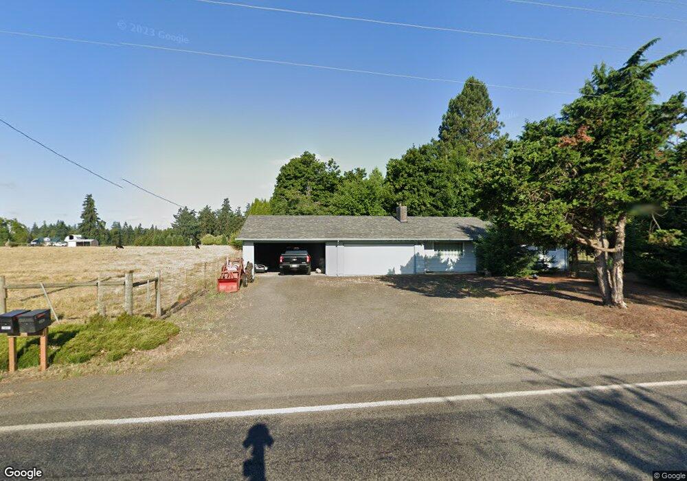
30903 Barlow Rd Hubbard, OR 97032
Estimated Value: $664,864 - $742,000
3
Beds
2
Baths
1,348
Sq Ft
$522/Sq Ft
Est. Value
About This Home
This home is located at 30903 Barlow Rd, Hubbard, OR 97032 and is currently estimated at $703,466, approximately $521 per square foot. 30903 Barlow Rd is a home located in Clackamas County with nearby schools including Josefa L. Sambrano Elementary School, Philander Lee Elementary School, and Baker Prairie Middle School.
Ownership History
Date
Name
Owned For
Owner Type
Purchase Details
Closed on
Aug 3, 2023
Sold by
Christner Dick L
Bought by
Dick Christner Revocable Living Trust and Christner
Current Estimated Value
Purchase Details
Closed on
Mar 8, 2007
Sold by
Christner Tamula G
Bought by
Christner Dick
Home Financials for this Owner
Home Financials are based on the most recent Mortgage that was taken out on this home.
Original Mortgage
$205,000
Interest Rate
7.78%
Mortgage Type
Negative Amortization
Create a Home Valuation Report for This Property
The Home Valuation Report is an in-depth analysis detailing your home's value as well as a comparison with similar homes in the area
Home Values in the Area
Average Home Value in this Area
Purchase History
| Date | Buyer | Sale Price | Title Company |
|---|---|---|---|
| Dick Christner Revocable Living Trust | -- | None Listed On Document | |
| Christner Dick | -- | Accommodation |
Source: Public Records
Mortgage History
| Date | Status | Borrower | Loan Amount |
|---|---|---|---|
| Previous Owner | Christner Dick | $205,000 |
Source: Public Records
Tax History Compared to Growth
Tax History
| Year | Tax Paid | Tax Assessment Tax Assessment Total Assessment is a certain percentage of the fair market value that is determined by local assessors to be the total taxable value of land and additions on the property. | Land | Improvement |
|---|---|---|---|---|
| 2025 | $3,912 | $309,507 | -- | -- |
| 2024 | $3,803 | $300,493 | -- | -- |
| 2023 | $3,803 | $291,741 | $0 | $0 |
| 2022 | $3,460 | $283,244 | $0 | $0 |
| 2021 | $3,319 | $274,995 | $0 | $0 |
| 2020 | $3,274 | $266,986 | $0 | $0 |
| 2019 | $3,091 | $259,210 | $0 | $0 |
| 2018 | $3,091 | $251,660 | $0 | $0 |
| 2017 | $3,018 | $244,330 | $0 | $0 |
| 2016 | $2,912 | $237,214 | $0 | $0 |
| 2015 | $2,831 | $230,305 | $0 | $0 |
| 2014 | $2,750 | $223,597 | $0 | $0 |
Source: Public Records
Map
Nearby Homes
- 30413 S Stuwe Rd
- 6150 S Miller Rd
- 29497 S Meridian Rd
- 30700 S Highway 170
- 6939 S Zimmerman Rd
- 29474 S Highway 170
- 17765 Monnier Rd NE
- 27200 S Barlow Rd
- 2995 Molalla Rd
- 30593 S Elisha Rd
- 12984 Elliott Prairie Rd NE
- 3197 Rainbow Loop Unit 10
- 8949 S Gribble Rd
- 3370 Maple St
- 3370 Maple St Unit 44
- 3472 Hoodview Dr
- 18767 Highway 99e
- 15145 Woodburn Monitor Rd NE
- 14604 Woodburn Monitor Rd NE
- 18767 Oregon 99e
- 30882 Barlow Rd
- 30882 S Barlow Rd
- 6877 Sconce Rd
- 6962 Sconce Rd
- 30751 S Barlow Rd
- 30742 Barlow Rd
- 30725 S Barlow Rd
- 7137 S Sconce Rd Unit 1
- 7137 S Sconce Rd
- 6743 Sconce Rd
- 31183 S Barlow Rd
- 6687 Sconce Rd
- 7320 S Sconce Rd
- 31237 Bond Rd
- 6846 S Miller Rd
- 30570 S Barlow Rd
- 6886 S Miller Rd
- 31250 Bond Rd
- 6806 S Miller Rd
- 30621 S Stuwe Rd