Estimated Value: $161,000 - $239,554
Studio
1
Bath
1,488
Sq Ft
$139/Sq Ft
Est. Value
About This Home
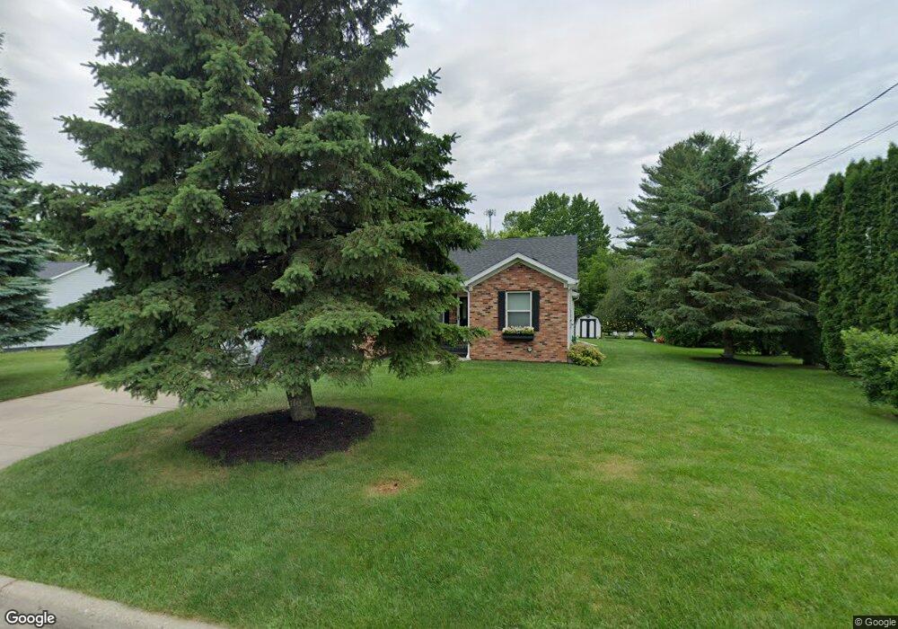
This home is located at 3093 Layman Dr, Flint, MI 48506 and is currently estimated at $206,389, approximately $138 per square foot. 3093 Layman Dr is a home located in Genesee County with nearby schools including Weston Elementary School, Kate Dowdall Elementary School, and Leota Fiedler Elementary School.
Ownership History
Date
Name
Owned For
Owner Type
Purchase Details
Closed on
Sep 3, 2015
Sold by
Poisson Tracy A and Bailey Daniel W
Bought by
Bailey Daniel W and Bailey Ellen M
Current Estimated Value
Home Financials for this Owner
Home Financials are based on the most recent Mortgage that was taken out on this home.
Original Mortgage
$68,325
Interest Rate
4.12%
Mortgage Type
FHA
Purchase Details
Closed on
May 5, 2009
Sold by
Poisson John J
Bought by
Poisson Tracy A
Home Financials for this Owner
Home Financials are based on the most recent Mortgage that was taken out on this home.
Original Mortgage
$74,000
Interest Rate
4.9%
Mortgage Type
New Conventional
Purchase Details
Closed on
Nov 12, 2008
Sold by
Poisson John J and Estate Of Maryann Poisson
Bought by
Poisson John J and Poisson Tracy A
Create a Home Valuation Report for This Property
The Home Valuation Report is an in-depth analysis detailing your home's value as well as a comparison with similar homes in the area
Home Values in the Area
Average Home Value in this Area
Purchase History
| Date | Buyer | Sale Price | Title Company |
|---|---|---|---|
| Bailey Daniel W | $83,000 | Attorney | |
| Poisson Tracy A | -- | None Available | |
| Poisson John J | -- | None Available |
Source: Public Records
Mortgage History
| Date | Status | Borrower | Loan Amount |
|---|---|---|---|
| Closed | Bailey Daniel W | $68,325 | |
| Closed | Poisson Tracy A | $74,000 |
Source: Public Records
Tax History
| Year | Tax Paid | Tax Assessment Tax Assessment Total Assessment is a certain percentage of the fair market value that is determined by local assessors to be the total taxable value of land and additions on the property. | Land | Improvement |
|---|---|---|---|---|
| 2025 | $2,264 | $140,100 | $0 | $0 |
| 2024 | $622 | $127,500 | $0 | $0 |
| 2023 | $594 | $115,300 | $0 | $0 |
| 2022 | $1,860 | $103,100 | $0 | $0 |
| 2021 | $1,842 | $92,200 | $0 | $0 |
| 2020 | $541 | $83,000 | $0 | $0 |
| 2019 | $532 | $72,600 | $0 | $0 |
| 2018 | $1,748 | $62,700 | $0 | $0 |
| 2017 | $1,682 | $60,800 | $0 | $0 |
| 2016 | $1,998 | $57,300 | $0 | $0 |
| 2015 | $1,471 | $53,500 | $0 | $0 |
| 2014 | $491 | $48,400 | $0 | $0 |
| 2012 | -- | $41,000 | $41,000 | $0 |
Source: Public Records
Map
Nearby Homes
- 4253 Potter Rd
- 4101 Sugar Maple Run Unit 1
- 4201 Sugar Maple Run Unit 2
- 4207 Sugar Maple Run
- 4213 Sugar Maple Run
- 4225 Sugar Maple Run Unit 6
- 4402 Maple Leaf Trail Unit 29
- 4231 Sugar Maple Run
- 4237 Sugar Maple Run Unit 8
- 4202 Sugar Maple Run Unit 30
- 4208 Sugar Maple Run Unit 31
- 4214 Sugar Maple Run Unit 32
- 4414 Maple Leaf Trail
- 4220 Sugar Maple Run Unit 33
- 4226 Sugar Maple Run Unit 34
- 4420 Maple Leaf Trail
- 4426 Maple Leaf Trail
- 4255 Sugar Maple Run Unit 11
- 2446 Lanning Dr
- 4258 Sugar Maple Run Unit 35
- 3083 Layman Dr
- 4080 Richfield Rd
- 4096 Richfield Rd
- 4090 Richfield Rd
- 4078 Richfield Rd
- 3100 Layman Dr
- 3073 Layman Dr
- 4068 Richfield Rd
- 3078 Layman Dr
- 4112 Richfield Rd
- 4097 Welcome Dr
- 4087 Welcome Dr
- 4077 Welcome Dr
- 3062 Layman Dr
- 4056 Richfield Rd
- 4067 Welcome Dr
- 4140 Richfield Rd
- 4083 Richfield Rd
- 3056 Layman Dr
- 4096 Welcome Dr
Your Personal Tour Guide
Ask me questions while you tour the home.