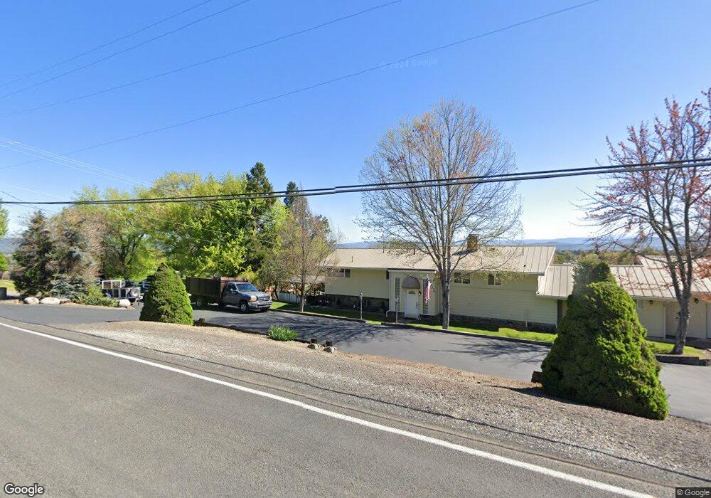
3094 Wells Fargo Rd Central Point, OR 97502
Estimated Value: $502,000 - $595,000
3
Beds
2
Baths
1,804
Sq Ft
$299/Sq Ft
Est. Value
About This Home
This home is located at 3094 Wells Fargo Rd, Central Point, OR 97502 and is currently estimated at $540,255, approximately $299 per square foot. 3094 Wells Fargo Rd is a home located in Jackson County with nearby schools including Richardson Elementary School, Scenic Middle School, and Crater High School.
Ownership History
Date
Name
Owned For
Owner Type
Purchase Details
Closed on
Dec 11, 2002
Sold by
Kosmatka Victor and Kosmatka Susan
Bought by
Kosmatka Victor D and Kosmatka Susan L
Current Estimated Value
Home Financials for this Owner
Home Financials are based on the most recent Mortgage that was taken out on this home.
Original Mortgage
$155,000
Interest Rate
6.06%
Create a Home Valuation Report for This Property
The Home Valuation Report is an in-depth analysis detailing your home's value as well as a comparison with similar homes in the area
Home Values in the Area
Average Home Value in this Area
Purchase History
| Date | Buyer | Sale Price | Title Company |
|---|---|---|---|
| Kosmatka Victor D | -- | Jackson County Title |
Source: Public Records
Mortgage History
| Date | Status | Borrower | Loan Amount |
|---|---|---|---|
| Closed | Kosmatka Victor D | $155,000 |
Source: Public Records
Tax History Compared to Growth
Tax History
| Year | Tax Paid | Tax Assessment Tax Assessment Total Assessment is a certain percentage of the fair market value that is determined by local assessors to be the total taxable value of land and additions on the property. | Land | Improvement |
|---|---|---|---|---|
| 2025 | $4,283 | $348,640 | $108,140 | $240,500 |
| 2024 | $4,283 | $338,490 | $131,170 | $207,320 |
| 2023 | $4,141 | $328,640 | $127,350 | $201,290 |
| 2022 | $4,053 | $328,640 | $127,350 | $201,290 |
| 2021 | $3,938 | $319,070 | $123,640 | $195,430 |
| 2020 | $3,823 | $309,780 | $120,040 | $189,740 |
| 2019 | $3,734 | $292,000 | $113,140 | $178,860 |
| 2018 | $3,619 | $283,500 | $109,840 | $173,660 |
| 2017 | $3,533 | $283,500 | $109,840 | $173,660 |
| 2016 | $3,430 | $267,240 | $103,530 | $163,710 |
| 2015 | $3,271 | $267,240 | $103,530 | $163,710 |
| 2014 | $3,192 | $251,910 | $97,590 | $154,320 |
Source: Public Records
Map
Nearby Homes
- 3307 Freeland Rd
- 3220 Freeland Rd
- 3506 New Ray Rd
- 3642 Oak Pine Way
- 429 Mayberry Ln
- 570 Bachand Cir
- 420 Mayberry Ln
- 2805 Old Military Rd
- 25 Donna Way
- 4228 Old Stage Rd
- 1134 Steamboat Dr
- 407 Silver Creek Dr
- 1135 Shake Dr
- 465 Creekside Cir
- 487 Creekside Cir
- 2555 Old Military Rd
- 21 Hickory Ln
- 659 Jackson Creek Dr
- 619 Palo Verde Way
- 626 Griffin Oaks Dr
- 3470 Old Stage Rd
- 3092 Wells Fargo St
- 3440 Old Stage Rd
- 3092 Wells Fargo Rd
- 3400 Old Stage Rd
- 3498 Old Stage Rd
- 3465 Old Stage Rd
- 3445 Old Stage Rd
- 3497 Old Stage Rd
- 3380 Old Stage Rd
- 3046 Wells Fargo Rd
- 3385 Old Stage Rd
- 3366 Old Stage Rd
- 3543 Old Stage Rd
- 2994 Wells Fargo Rd
- 3541 Old Stage Rd
- 2966 Wells Fargo Rd
- 3371 Old Stage Rd
- 3355 Old Stage Rd
- 3565 Old Stage Rd