Estimated Value: $463,000 - $490,428
4
Beds
2
Baths
2,148
Sq Ft
$223/Sq Ft
Est. Value
About This Home
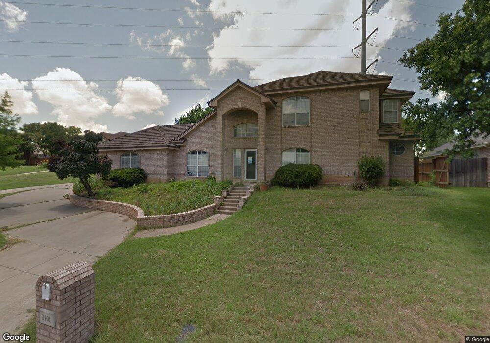
This home is located at 3097 Phillip Dr, Hurst, TX 76054 and is currently estimated at $478,357, approximately $222 per square foot. 3097 Phillip Dr is a home located in Tarrant County with nearby schools including W.A. Porter Elementary School, Smithfield Middle School, and Birdville High School.
Ownership History
Date
Name
Owned For
Owner Type
Purchase Details
Closed on
Jun 24, 2003
Sold by
Pannell Leslie Neal and Pannell Sonya
Bought by
Hall Daniel E and Hall Traci C
Current Estimated Value
Home Financials for this Owner
Home Financials are based on the most recent Mortgage that was taken out on this home.
Original Mortgage
$130,565
Outstanding Balance
$55,781
Interest Rate
5.44%
Mortgage Type
New Conventional
Estimated Equity
$422,576
Purchase Details
Closed on
Oct 15, 1996
Sold by
Pendley Timothy Edwin and Janay Pendley M
Bought by
Pannell Leslie Neal and Pannell Sonya
Home Financials for this Owner
Home Financials are based on the most recent Mortgage that was taken out on this home.
Original Mortgage
$110,650
Interest Rate
8.33%
Purchase Details
Closed on
Aug 2, 1993
Sold by
Tlg Inc
Bought by
Pendley Timothy Edwin and Janay Pendley M
Home Financials for this Owner
Home Financials are based on the most recent Mortgage that was taken out on this home.
Original Mortgage
$112,404
Interest Rate
7.18%
Mortgage Type
FHA
Create a Home Valuation Report for This Property
The Home Valuation Report is an in-depth analysis detailing your home's value as well as a comparison with similar homes in the area
Home Values in the Area
Average Home Value in this Area
Purchase History
| Date | Buyer | Sale Price | Title Company |
|---|---|---|---|
| Hall Daniel E | -- | American Title Co | |
| Pannell Leslie Neal | -- | American Title Company | |
| Pendley Timothy Edwin | -- | Commonwealth Land Title Co |
Source: Public Records
Mortgage History
| Date | Status | Borrower | Loan Amount |
|---|---|---|---|
| Open | Hall Daniel E | $130,565 | |
| Previous Owner | Pannell Leslie Neal | $110,650 | |
| Previous Owner | Pendley Timothy Edwin | $112,404 |
Source: Public Records
Tax History Compared to Growth
Tax History
| Year | Tax Paid | Tax Assessment Tax Assessment Total Assessment is a certain percentage of the fair market value that is determined by local assessors to be the total taxable value of land and additions on the property. | Land | Improvement |
|---|---|---|---|---|
| 2025 | $7,799 | $432,916 | $90,000 | $342,916 |
| 2024 | $7,799 | $432,916 | $90,000 | $342,916 |
| 2023 | $9,588 | $419,537 | $90,000 | $329,537 |
| 2022 | $9,531 | $385,762 | $55,000 | $330,762 |
| 2021 | $9,091 | $350,441 | $55,000 | $295,441 |
| 2020 | $8,188 | $318,636 | $55,000 | $263,636 |
| 2019 | $7,770 | $344,962 | $68,390 | $276,572 |
| 2018 | $6,388 | $268,729 | $68,390 | $200,339 |
| 2017 | $6,519 | $288,788 | $68,390 | $220,398 |
| 2016 | $5,926 | $373,677 | $175,410 | $198,267 |
| 2015 | $4,956 | $201,900 | $25,000 | $176,900 |
| 2014 | $4,956 | $201,900 | $25,000 | $176,900 |
Source: Public Records
Map
Nearby Homes
- 713 Paul Dr
- 717 Reese Ln
- 7020 Live Oak Dr
- 3229 David Dr
- 3233 David Dr
- 2829 Sandstone Dr
- 6708 Nob Hill Ct
- 3228 Oakdale Dr
- 3132 Hurstview Dr
- 6801 Woodland Hills Dr
- 6704 Nob Hill Ct
- 3317 S Riley Ct
- 2908 Steve Dr
- 2809 Sandstone Dr
- 2844 Hurstview Dr
- 3208 Glade Pointe Ct
- 8966 Hialeah Cir S
- 712 Springhill Dr
- 2804 Ridgewood Dr
- 7321 Fallen Oak Dr
- 3094 Phillip Dr
- 3101 Phillip Dr
- 3105 Phillip Dr
- 733 Herman Dr
- 3109 Phillip Dr
- 7032 Precinct Line Rd
- 728 Herman Dr
- 729 Paul Dr
- 3113 Phillip Dr
- 736 Evergreen Dr
- 732 Evergreen Dr
- 740 Evergreen Dr
- 729 Herman Dr
- 728 Evergreen Dr
- 724 Herman Dr
- 728 Paul Dr
- 725 Paul Dr
- 3121 Phillip Dr
- 725 Herman Dr
- 7040 Precinct Line Rd