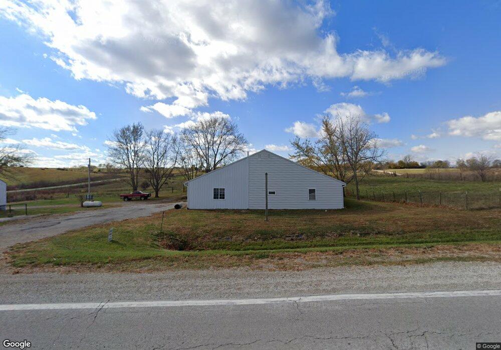
3097 Us Highway 169 Redding, IA 50860
Estimated Value: $50,000 - $157,000
2
Beds
1
Bath
832
Sq Ft
$145/Sq Ft
Est. Value
About This Home
This home is located at 3097 Us Highway 169, Redding, IA 50860 and is currently estimated at $120,384, approximately $144 per square foot. 3097 Us Highway 169 is a home located in Ringgold County with nearby schools including Mount Ayr Elementary School and Mount Ayr High School.
Ownership History
Date
Name
Owned For
Owner Type
Purchase Details
Closed on
Jun 19, 2017
Sold by
Mast John L and Mast Verna R
Bought by
Yoder Ananias and Yoder Mattie
Current Estimated Value
Home Financials for this Owner
Home Financials are based on the most recent Mortgage that was taken out on this home.
Original Mortgage
$97,000
Outstanding Balance
$80,684
Interest Rate
4.02%
Mortgage Type
New Conventional
Estimated Equity
$39,700
Create a Home Valuation Report for This Property
The Home Valuation Report is an in-depth analysis detailing your home's value as well as a comparison with similar homes in the area
Home Values in the Area
Average Home Value in this Area
Purchase History
| Date | Buyer | Sale Price | Title Company |
|---|---|---|---|
| Yoder Ananias | $100,000 | None Available |
Source: Public Records
Mortgage History
| Date | Status | Borrower | Loan Amount |
|---|---|---|---|
| Open | Yoder Ananias | $97,000 |
Source: Public Records
Tax History Compared to Growth
Tax History
| Year | Tax Paid | Tax Assessment Tax Assessment Total Assessment is a certain percentage of the fair market value that is determined by local assessors to be the total taxable value of land and additions on the property. | Land | Improvement |
|---|---|---|---|---|
| 2025 | $964 | $106,319 | $50,000 | $56,319 |
| 2024 | $964 | $81,850 | $32,500 | $49,350 |
| 2023 | $946 | $81,850 | $32,500 | $49,350 |
| 2022 | $846 | $64,252 | $27,500 | $36,752 |
| 2021 | $846 | $64,252 | $27,500 | $36,752 |
| 2020 | $850 | $61,224 | $24,075 | $37,149 |
| 2019 | $878 | $55,655 | $16,440 | $39,215 |
| 2018 | $854 | $55,655 | $16,440 | $39,215 |
| 2017 | $692 | $55,655 | $16,440 | $39,215 |
| 2016 | $680 | $45,420 | $0 | $0 |
| 2015 | $680 | $45,420 | $0 | $0 |
| 2014 | $676 | $45,420 | $0 | $0 |
Source: Public Records
Map
Nearby Homes
- 3084 Us Highway 169
- 3091 Us Highway 169
- 3078 Us Highway 169
- 1417 310th St
- 506 Central Ave
- 505 Central Ave
- 3132 Us Highway 169
- 100 4th St
- 103 4th St
- 101 Cemetery Rd
- 1400 310th St
- 103 Cemetery Rd
- 402 Washington St
- 307 4th St
- 105 Cemetery Rd
- 304 3rd St
- 308 3rd St
- 106 Jefferson St
- 109 Cemetery Rd
- 307 3rd St