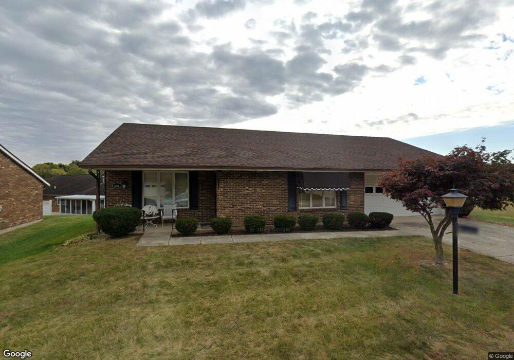
3098 Brixton Dr W Springfield, OH 45503
Estimated Value: $196,000 - $197,000
2
Beds
2
Baths
1,300
Sq Ft
$151/Sq Ft
Est. Value
About This Home
This home is located at 3098 Brixton Dr W, Springfield, OH 45503 and is currently estimated at $196,593, approximately $151 per square foot. 3098 Brixton Dr W is a home located in Clark County with nearby schools including Northridge Elementary School, Kenton Ridge Middle & High School, and Emmanuel Christian Academy.
Ownership History
Date
Name
Owned For
Owner Type
Purchase Details
Closed on
Apr 1, 2025
Sold by
Hawes Carol A
Bought by
Carol A Hawes Irrevocable Trust and Liptak
Current Estimated Value
Purchase Details
Closed on
Sep 9, 2011
Sold by
Silver John L
Bought by
Hawes Carol A
Purchase Details
Closed on
Jun 16, 1997
Sold by
West Josephine
Bought by
Asher Janet L
Purchase Details
Closed on
May 9, 1996
Sold by
Est Rita M Mccoy
Bought by
Gilmartin Ruth W
Create a Home Valuation Report for This Property
The Home Valuation Report is an in-depth analysis detailing your home's value as well as a comparison with similar homes in the area
Home Values in the Area
Average Home Value in this Area
Purchase History
| Date | Buyer | Sale Price | Title Company |
|---|---|---|---|
| Carol A Hawes Irrevocable Trust | -- | None Listed On Document | |
| Carol A Hawes Irrevocable Trust | -- | None Listed On Document | |
| Hawes Carol A | $83,000 | Attorney | |
| Asher Janet L | $94,000 | -- | |
| Gilmartin Ruth W | $85,000 | -- |
Source: Public Records
Tax History
| Year | Tax Paid | Tax Assessment Tax Assessment Total Assessment is a certain percentage of the fair market value that is determined by local assessors to be the total taxable value of land and additions on the property. | Land | Improvement |
|---|---|---|---|---|
| 2025 | $1,328 | $54,250 | $7,350 | $46,900 |
| 2024 | $1,309 | $41,070 | $6,300 | $34,770 |
| 2023 | $1,309 | $41,070 | $6,300 | $34,770 |
| 2022 | $0 | $41,070 | $6,300 | $34,770 |
| 2021 | $1,317 | $36,150 | $5,250 | $30,900 |
| 2020 | $1,319 | $36,150 | $5,250 | $30,900 |
| 2019 | $1,345 | $36,150 | $5,250 | $30,900 |
| 2018 | $1,192 | $32,250 | $5,570 | $26,680 |
| 2017 | $1,013 | $30,765 | $5,565 | $25,200 |
| 2016 | $1,005 | $30,765 | $5,565 | $25,200 |
| 2015 | $428 | $30,450 | $5,250 | $25,200 |
| 2014 | $856 | $30,450 | $5,250 | $25,200 |
| 2013 | $427 | $30,450 | $5,250 | $25,200 |
Source: Public Records
Map
Nearby Homes
- 1136 Foxboro Rd Unit 202
- 3052 Brixton Dr E
- 1013 Abington Place
- 1039 Bradford Dr Unit 42
- 1201 Kingsgate Rd
- 1031 Armsgate Rd Unit 11
- 3631 Kingsgate Ln
- 1500 Kingsgate Rd Unit 19430
- 1502 Kingsgate Rd Unit 19432
- 1500 Kingsgate Rd
- 1502 Kingsgate Rd
- 1503 Kingsgate Rd
- 1505 Kingsgate Rd
- 1507 Kingsgate Rd
- 615 Villa Rd Unit B
- 3124 El Camino Dr
- 3135 Imperial Blvd
- 1415 Montego Dr
- 3112 El Camino Dr
- 3211 Haverhill St
- 3098 Brixton Dr W Unit 244
- 3102 Brixton Dr W
- 1138 Derby Rd
- 3099 Brixton Dr W
- 3099 Brixton Dr W Unit 116
- 3103 Brixton Dr W Unit 115
- 3095 Brixton Dr W
- 1135 Derby Rd
- 3106 Brixton Dr W
- 3106 Brixton Dr W
- 1133 Derby Rd
- 3107 Brixton Dr W
- 3107 Brixton Dr W Unit 114
- 1137 Derby Rd
- 1140 Derby Rd
- 1140 Derby Rd Unit 246
- 3086 Brixton Dr W
- 3086 Brixton Dr W
- 3091 Brixton Dr W
- 1139 Derby Rd
Your Personal Tour Guide
Ask me questions while you tour the home.