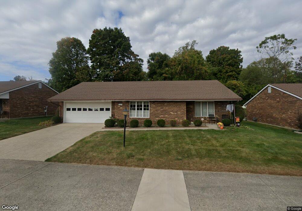
3099 Brixton Dr W Unit 116 Springfield, OH 45503
Estimated Value: $169,000 - $206,000
2
Beds
2
Baths
1,300
Sq Ft
$150/Sq Ft
Est. Value
About This Home
This home is located at 3099 Brixton Dr W Unit 116, Springfield, OH 45503 and is currently estimated at $194,543, approximately $149 per square foot. 3099 Brixton Dr W Unit 116 is a home located in Clark County with nearby schools including Rolling Hills Elementary School, Northridge Middle School, and Kenton Ridge Middle & High School.
Ownership History
Date
Name
Owned For
Owner Type
Purchase Details
Closed on
Aug 10, 2012
Sold by
Wiseman Debra S and Flannery Sharon G
Bought by
Weaver Faye E
Current Estimated Value
Purchase Details
Closed on
Aug 3, 2012
Sold by
Wiseman Debra S and Flannery Sharon G
Bought by
Weaver Faye E
Purchase Details
Closed on
Feb 4, 2011
Sold by
Wiseman Debra S and Flannery Sharon G
Bought by
Wiseman Debra S and Flannery Sharon G
Purchase Details
Closed on
Feb 6, 1998
Sold by
Ellinger Lillian B
Bought by
Ellinger Lillian B
Create a Home Valuation Report for This Property
The Home Valuation Report is an in-depth analysis detailing your home's value as well as a comparison with similar homes in the area
Home Values in the Area
Average Home Value in this Area
Purchase History
| Date | Buyer | Sale Price | Title Company |
|---|---|---|---|
| Weaver Faye E | $80,000 | None Available | |
| Weaver Faye E | $80,000 | None Available | |
| Wiseman Debra S | -- | Attorney | |
| Ellinger Lillian B | -- | -- |
Source: Public Records
Tax History Compared to Growth
Tax History
| Year | Tax Paid | Tax Assessment Tax Assessment Total Assessment is a certain percentage of the fair market value that is determined by local assessors to be the total taxable value of land and additions on the property. | Land | Improvement |
|---|---|---|---|---|
| 2024 | $1,292 | $40,670 | $6,300 | $34,370 |
| 2023 | $1,292 | $40,670 | $6,300 | $34,370 |
| 2022 | $1,314 | $40,670 | $6,300 | $34,370 |
| 2021 | $1,382 | $37,470 | $5,250 | $32,220 |
| 2020 | $1,383 | $37,470 | $5,250 | $32,220 |
| 2019 | $1,411 | $37,470 | $5,250 | $32,220 |
| 2018 | $1,125 | $30,970 | $5,570 | $25,400 |
| 2017 | $956 | $30,884 | $5,565 | $25,319 |
| 2016 | $949 | $30,884 | $5,565 | $25,319 |
| 2015 | $428 | $30,569 | $5,250 | $25,319 |
| 2014 | $856 | $30,569 | $5,250 | $25,319 |
| 2013 | $620 | $30,569 | $5,250 | $25,319 |
Source: Public Records
Map
Nearby Homes
- 1148 Foxboro Rd
- 3032 Armsgate Rd Unit 25
- 3029 Bradford Dr Unit 46
- 1162 Kingsgate Rd
- 3631 Kingsgate Ln
- 1509 Kingsgate Rd
- 1501 Kingsgate Rd
- 1503 Kingsgate Rd
- 1505 Kingsgate Rd
- 1732 Falmouth Ave
- 1507 Kingsgate Rd
- 1139 Greenoak Ct
- 647 Villa Rd Unit A
- 542 Villa Rd
- 1225 Vester Ave
- 4109 Derr Rd
- 1781 Pinehurst Dr
- 3229 Bristol Dr
- 3307 Tackett St
- 3129 Haverhill St
- 3099 Brixton Dr W
- 3103 Brixton Dr W Unit 115
- 3095 Brixton Dr W
- 3098 Brixton Dr W
- 3098 Brixton Dr W Unit 244
- 3107 Brixton Dr W
- 3107 Brixton Dr W Unit 114
- 3102 Brixton Dr W
- 3091 Brixton Dr W
- 3400 Derr Rd
- 3106 Brixton Dr W
- 3106 Brixton Dr W
- 1138 Derby Rd
- 3086 Brixton Dr W
- 3086 Brixton Dr W
- 3111 Brixton Dr W
- 3087 Brixton Dr W
- 1135 Derby Rd
- 3440 Derr Rd
- 1140 Derby Rd