Estimated Value: $594,000 - $1,250,411
About This Home
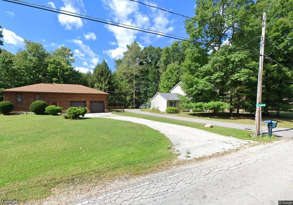
This home is located at 3099 N River Rd, Stow, OH 44224 and is currently estimated at $824,137, approximately $262 per square foot. 3099 N River Rd is a home located in Summit County with nearby schools including Stow-Munroe Falls High School and St Patrick Elementary School.
Ownership History
We collect this data history from publicly available records. To have your information removed, we recommend requesting removal directly through your county’s website.
Purchase Details
Home Financials for this Owner
Home Financials are based on the most recent Mortgage that was taken out on this home.Purchase Details
Purchase Details
Home Financials for this Owner
Home Financials are based on the most recent Mortgage that was taken out on this home.Purchase Details
Home Financials for this Owner
Home Financials are based on the most recent Mortgage that was taken out on this home.Purchase Details
Home Values in the Area
Average Home Value in this Area
Purchase History
We collect this data history from publicly available records. To have your information removed, we recommend requesting removal directly through your county’s website.
| Date | Buyer | Sale Price | Title Company |
|---|---|---|---|
| -- | Village Title | ||
| $215,000 | Village Title | ||
| $139,900 | Village Title Agency | ||
| $139,900 | Village Title Agency | ||
| -- | -- |
Mortgage History
We collect this data history from publicly available records. To have your information removed, we recommend requesting removal directly through your county’s website.
| Date | Status | Borrower | Loan Amount |
|---|---|---|---|
| Open | $250,000 | ||
| Previous Owner | $124,000 | ||
| Previous Owner | $139,900 |
Tax History
We collect this data history from publicly available records. To have your information removed, we recommend requesting removal directly through your county’s website.
| Year | Tax Paid | Tax Assessment Tax Assessment Total Assessment is a certain percentage of the fair market value that is determined by local assessors to be the total taxable value of land and additions on the property. | Land | Improvement |
|---|---|---|---|---|
| 2026 | $22,465 | $280,816 | $43,722 | $237,094 |
| 2025 | $15,752 | $280,816 | $43,722 | $237,094 |
| 2024 | $15,289 | $280,816 | $43,722 | $237,094 |
| 2023 | $15,289 | $280,816 | $43,722 | $237,094 |
| 2022 | $13,432 | $219,391 | $34,160 | $185,231 |
| 2021 | $12,024 | $219,391 | $34,160 | $185,231 |
| 2020 | $11,817 | $219,390 | $34,160 | $185,230 |
| 2019 | $12,772 | $221,710 | $40,430 | $181,280 |
| 2018 | $12,563 | $221,710 | $40,430 | $181,280 |
| 2017 | $12,068 | $221,710 | $40,430 | $181,280 |
| 2016 | $12,422 | $207,490 | $40,430 | $167,060 |
| 2015 | $12,068 | $207,490 | $40,430 | $167,060 |
| 2014 | $12,079 | $207,490 | $40,430 | $167,060 |
| 2013 | $13,119 | $212,030 | $44,970 | $167,060 |
Map
- 3338 Blessing Ln
- 1330 Chelton Dr
- 1327 Chelton Dr
- 525 Irma St
- 3069 Snowshoe Cir
- 3464 Hunters Crossing
- 391 Louise Ave
- 3591 Dayton Ave
- 1265 W Main St
- 3341 Roberta's Way
- 1314 Denise Dr
- 1074 Jessie Ave
- 511 Suzanne Dr
- 0 Middlebury Rd
- 1064 Munroe Falls Kent Rd
- 1262 Carol Dr
- 1271 Carol Dr
- 1566 Northeast Ave
- 2932 Heatherwood Ct
- 1312 Sunset Way Cir
- 3342 Blessing Ln
- 3354 Verner Rd
- 3362 Verner Rd Unit 3366
- 3344 Verner Rd
- 3334 Verner Rd
- 3380 Verner Rd Unit 3382
- 3390 Verner Rd
- 3324 Verner Rd
- 3096 Hillside Trail
- 3110 Hillside Trail
- 3353 Verner Rd
- 3394-3396 Verner Rd
- 3394 Verner Rd Unit 3396
- 3310 Verner Rd
- 3084 Hillside Trail
- 3379 Verner Rd
- 3093 Hillside Trail
- 3363 Verner Rd
- 3323 Verner Rd
- 3410 Verner Rd
Ask me questions while you tour the home.