30A Off Minnow Creek Rd Gordon Township, WI 54546
Estimated payment $361/month
Highlights
- 1,306,800 Sq Ft lot
- Wooded Lot
- Property is near a preserve or public land
- Private Lot
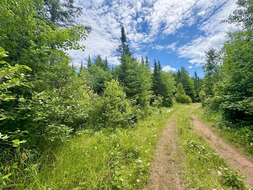
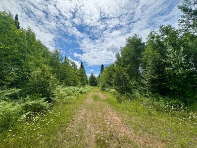
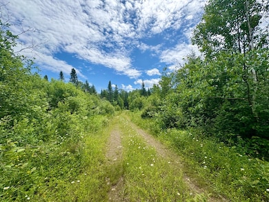
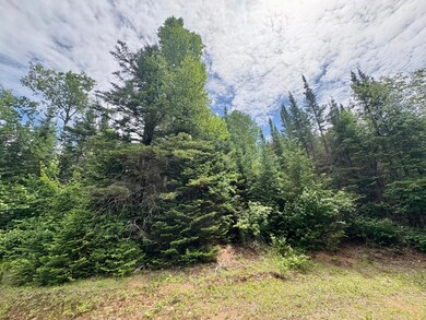
About This Lot
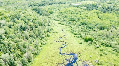
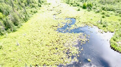
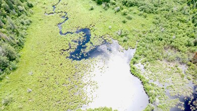
+/- 30 Acres of Prime Recreational Land located in the Township of Gordon near Mellen, WI. This vacant land parcel offers an ideal setting for hunting & outdoor recreation. The property features a mix of lowland terrain with scattered intermediate areas, creating a diverse landscape that supports local wildlife & makes for excellent opportunities. A meandering creek winds through the land, adding natural beauty & a water source for game. Tucked away & just a short drive to town, this parcel provides the perfect escape for those seeking peace, privacy, & access to endless outdoor adventure. Whether you're setting up a seasonal hunting base or looking for a quiet slive of the woods to explore, this property is worth a look! *Access to the parcel is on a Forest Road off on Minnow Creek Rd. Sellers are in the process of obtaining a permit & expected to received by late summer 2025*
Property Details
Property Type
- Land
Est. Annual Taxes
- $342
Lot Details
- 30 Acre Lot
- Rural Setting
- Private Lot
- Secluded Lot
- Wooded Lot
Community Details
- Property is near a preserve or public land
Listing and Financial Details
- Assessor Parcel Number 010-00003-0200
Map
Home Values in the Area
Average Home Value in this Area
Tax History
| Year | Tax Paid | Tax Assessment Tax Assessment Total Assessment is a certain percentage of the fair market value that is determined by local assessors to be the total taxable value of land and additions on the property. | Land | Improvement |
|---|---|---|---|---|
| 2024 | $350 | $26,800 | $26,800 | $0 |
| 2023 | $342 | $26,800 | $26,800 | $0 |
| 2022 | $470 | $23,600 | $23,600 | $0 |
| 2021 | $462 | $23,600 | $23,600 | $0 |
| 2020 | $409 | $23,600 | $23,600 | $0 |
| 2019 | $405 | $23,600 | $23,600 | $0 |
| 2018 | $401 | $23,600 | $23,600 | $0 |
| 2017 | $375 | $23,600 | $23,600 | $0 |
| 2016 | $361 | $23,600 | $23,600 | $0 |
| 2015 | $420 | $23,600 | $23,600 | $0 |
| 2014 | $475 | $30,100 | $30,100 | $0 |
| 2013 | $473 | $30,100 | $30,100 | $0 |
Property History
| Date | Event | Price | Change | Sq Ft Price |
|---|---|---|---|---|
| 10/01/2024 10/01/24 | For Sale | $59,900 | -- | -- |
Purchase History
| Date | Type | Sale Price | Title Company |
|---|---|---|---|
| Deed | $3,000 | Attorney Christina M. Writz | |
| Deed | $3,800 | Attorney Christina M. Writz | |
| Deed | $9,900 | Attorney Christina M. Writz | |
| Deed | $15,200 | Attorney Christina M. Writz | |
| Deed | $3,600 | Attorney Christina M. Writz |
Source: Greater Northwoods MLS
MLS Number: 209275
APN: 010-00003-0200
Disclaimer: Certain information contained herein is derived from information provided by parties other than Homes.com. All information provided is deemed reliable, but is not guaranteed to be accurate and should be independently verified.
![]() IDX information is provided exclusively for personal, non-commercial use, and may not be used for any purpose other than to identify prospective properties consumers may be interested in purchasing.
IDX information is provided exclusively for personal, non-commercial use, and may not be used for any purpose other than to identify prospective properties consumers may be interested in purchasing.
Information is deemed reliable but not guaranteed.
- ON Camp K Rd Unit 76.95 ac
- 73631 Long Lake Access Rd
- 73501 Long Lake Boat Landing Rd
- 25598 Hwy 13
- 0000 Meder Lake Boat Landing Rd
- 72033 Ponsegrau Rd Unit 4 Parcels
- 720XX Ponsegrau Rd Unit Bottom 2
- 72XXX Ponsegrau Rd Unit Top 2
- 23674 State Highway 13
- ON River Rd Unit 41.5+/- A
- 23165 Joy Villa Rd Unit 6
- 23165 Joy Villa Rd Unit 6
- 22936 Kubley Rd
- 79879 Hinz Rd
- 212 E 4th St
- 157 E 2nd St
- 23857 State Highway 13
- 155 Zach St
- 21463 Eder Rd
- 421 S Main St
