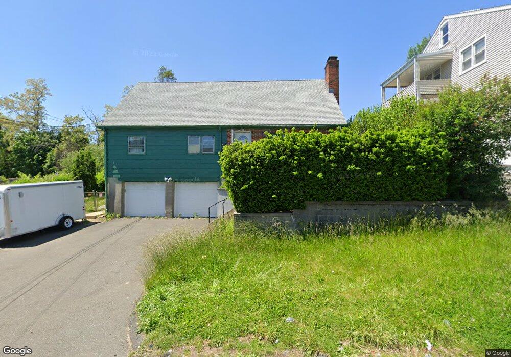
31--33 Sampson St Bridgeport, CT 06606
Brooklawn-Saint Vincent NeighborhoodEstimated Value: $487,000 - $639,000
5
Beds
3
Baths
1,940
Sq Ft
$279/Sq Ft
Est. Value
About This Home
This home is located at 31--33 Sampson St, Bridgeport, CT 06606 and is currently estimated at $540,942, approximately $278 per square foot. 31--33 Sampson St is a home located in Fairfield County with nearby schools including Blackham School, Central High School, and Catholic Academy of Bridgeport-St. Raphael Academy.
Ownership History
Date
Name
Owned For
Owner Type
Purchase Details
Closed on
Oct 25, 2021
Sold by
Robinson Gregory
Bought by
Chicayza Yupangui A and Loja Segundo M
Current Estimated Value
Purchase Details
Closed on
Dec 29, 2017
Sold by
Yoshida Ayako Est
Bought by
Robinson Gregory
Home Financials for this Owner
Home Financials are based on the most recent Mortgage that was taken out on this home.
Original Mortgage
$131,250
Interest Rate
3.95%
Mortgage Type
Unknown
Purchase Details
Closed on
Dec 5, 2003
Sold by
Yotsumoto Aiko
Bought by
Yoshida Ayako
Create a Home Valuation Report for This Property
The Home Valuation Report is an in-depth analysis detailing your home's value as well as a comparison with similar homes in the area
Home Values in the Area
Average Home Value in this Area
Purchase History
| Date | Buyer | Sale Price | Title Company |
|---|---|---|---|
| Chicayza Yupangui A | $320,000 | None Available | |
| Chicayza Yupangui A | $320,000 | None Available | |
| Robinson Gregory | $175,000 | -- | |
| Robinson Gregory | $175,000 | -- | |
| Yoshida Ayako | $140,000 | -- | |
| Yoshida Ayako | $140,000 | -- |
Source: Public Records
Mortgage History
| Date | Status | Borrower | Loan Amount |
|---|---|---|---|
| Previous Owner | Yoshida Ayako | $131,250 |
Source: Public Records
Tax History Compared to Growth
Tax History
| Year | Tax Paid | Tax Assessment Tax Assessment Total Assessment is a certain percentage of the fair market value that is determined by local assessors to be the total taxable value of land and additions on the property. | Land | Improvement |
|---|---|---|---|---|
| 2025 | $8,759 | $201,580 | $79,720 | $121,860 |
| 2024 | $8,759 | $201,580 | $79,720 | $121,860 |
| 2023 | $8,596 | $197,830 | $79,720 | $118,110 |
| 2022 | $8,596 | $197,830 | $79,720 | $118,110 |
| 2021 | $8,596 | $197,830 | $79,720 | $118,110 |
| 2020 | $7,475 | $138,460 | $41,640 | $96,820 |
| 2019 | $7,475 | $138,460 | $41,640 | $96,820 |
| 2018 | $7,528 | $138,460 | $41,640 | $96,820 |
| 2017 | $7,528 | $138,460 | $41,640 | $96,820 |
| 2016 | $7,528 | $138,460 | $41,640 | $96,820 |
| 2015 | $7,482 | $177,300 | $50,370 | $126,930 |
| 2014 | $7,482 | $177,300 | $50,370 | $126,930 |
Source: Public Records
Map
Nearby Homes
- 201 High Ridge Dr
- 125 Alexander Dr
- 150 Alexander Dr
- 11 Myron Ave
- 241 Sampson St
- 1275 Capitol Ave
- 119 Madison Terrace
- 2345 Park Ave
- 2445 Park Ave Unit 23
- 76 Suburban Ave
- 2625 Park Ave Unit 12L
- 2625 Park Ave Unit 5N
- 356 Taft Ave
- 724 Capitol Ave Unit 726
- 508 Hawley Ave
- 31 Taft Ave
- 390 Charles St Unit 106
- 2675 Park Ave Unit 3
- 2675 Park Ave Unit 22
- 203 Wayne St
- 31 Sampson St
- 33 Sampson St
- 5 Sampson St
- 41 Sampson St
- 39 Sampson St
- 28 Sampson St Unit 2
- 28 Sampson St Unit 3
- 28 Sampson St
- 256 Arlington St
- 67 Sampson St
- 202 Arlington St
- 50 Sampson St
- 159 High Ridge Dr Unit 161
- 278 Arlington St
- 278 Arlington St Unit 1sf
- 141 High Ridge Dr Unit 145
- 60 Sampson St
- 181 High Ridge Dr
- 194 Arlington St
- 175 High Ridge Dr